
| Darin McQuoid | Blog | Reviews | Tutorials | River Directory |
South
Fork of the
San Joaquin "Lower" V-V+
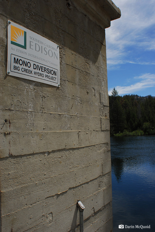
The South Fork San Joaquin runs freely from the headwaters to Florence Lake, yet once impounded in Florence Lake, it ss considered the “Hardest Working Water in the World”. Big Creek Hydroelectric Project is the largest in California, encompassing eight lakes, five forebays, nine powerhouses and three tunnels. Construction began in 1912 and the last powerhouse was finished in 1987 at Balsam Meadow. It's 1,000 feet underground and carved from solid granite. With a massive project using all the water, it’s no surprise this section river escaped descent for many years.
There are several gauges on the river, but Southern California Edison withholds all information from the public. Both times I had paddled the Middle Fork San Joaquin, the South Fork was already at fish flows. How can we run a river with no water?
"In the 24 years that have passed since Royal Robbins, Doug Tompkins, Newsome Holms, and Reg Lake's landmark first descent of the Middle San Joaquin, its sibling river the South Fork has been in the collective conscious of California's whitewater expedition elite. To further fuel the speculation over this run, it's upper reaches were included in the Holbek/Stanley guide as a spectacular run that only gets "harder and more fun" the further you go down stream to a point where either a Heli flight out or a massive hike out is necessary.” – Ben Stookesberry
Late August 2008; American Whitewater volunteer and Fresno local Paul Martzen catches wind of water being released into the South Fork San Joaquin via Mono Creek. For reasons we aren’t sure of, SCE needs to move more water downstream than can be put through powerhouses, and will be releasing 500cfs into Mono Creek, an un-run tributary of the river as far as we know.
The release will be on Labor Day weekend, with flows “expected but not guaranteed”. Once I hear the news I call Ben Stookesberry, leaving vague message about the release. The message is forgotten as we plan to enjoy a Fordyce release that is happening at the same time and a sure thing.
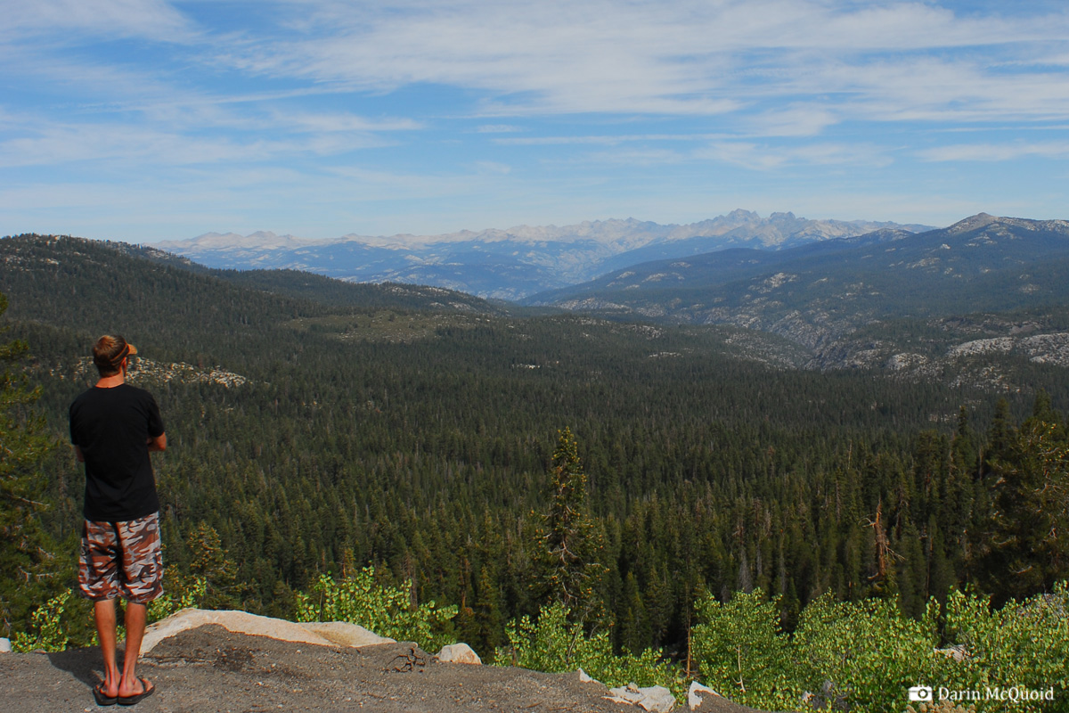
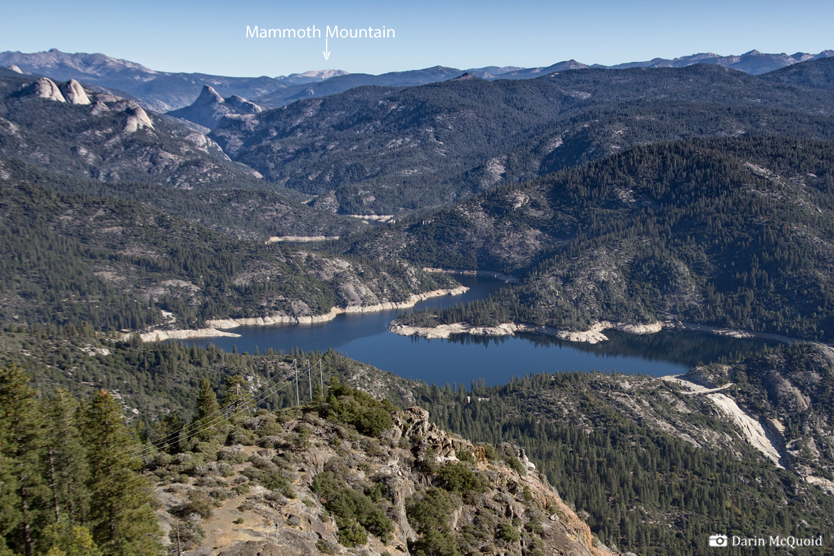
The
San Joaquin drainage, seen from above Mammoth Pool Reservoir. A
drainage where flows
are never a sure thing. The Middle Fork flows from below Mammoth
Mountain while the South Fork flows below the peaks on lookers right.
Mammoth resident Kevin Smith has the run on his radar too, and on Wednesday we chat about it, but I say we are out because I have not heard from anyone and we all have to work on Friday. While hiking into beautiful Heart Lake outside of Mt Shasta, I get a call and am suddenly talking to Ben again, who is dropping lines like “once in a lifetime” and “this is what we do”. Fueled by his motivation I call one of my favorite kayaking partners, Matt Thomas, who says he ccan get the day off work and is in. I follow up with a quick call to Kevin confirming that all systems are a go and there should “probably” be water for four days.
Matt was planning on Fordyce and will have to drive home and pack his gear before heading down from Southern Oregon. This puts our departure time at nine pm, a late start for a nine hour drive. Knowing it's going to be a slog, we pile into Ben’s Subaru and drive all night, stopping for two hours of sleep at four in the morning.
As we pulled into the Mammoth Pool boat ramp at 7am, we're all relived to see that Kevin has also made the big night drive and is already there. With no time to waste we pile into one car and embark on the four hour shuttle.
Wilderness
runs require wilderness
permits, so we make a quick stop to
get our permit as well as a better topo map at the ranger station.

Several
miles and no wrong turns
later, thanks to detailed work by map master
Kevin Smith, we are at the put-in for Mono Creek.
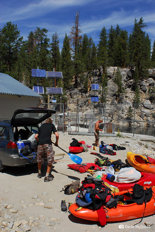
Mono Creek is a small tributary, and with 500cfs it is swollen over the bank. From the maps we know that in the first half mile the creek will drop away at four hundred feet per mile. We plan for one big portage until we are far enough down to switch to the right side and find the trail. Planning on three days, but packing for four is our motto. Most of my provisions are either left over from spring kayaking or were bought at a gas station last night.
We try
not to forget anything after
two
months off the water and two hours of sleep!
Initially a closed road is on the left and it follows Mono Creek, but after several hundred yards it continues to hold elevation and veers away from the creek, which is already out of sight. Ready to see some water, we drop straight down to the Mono Creek.
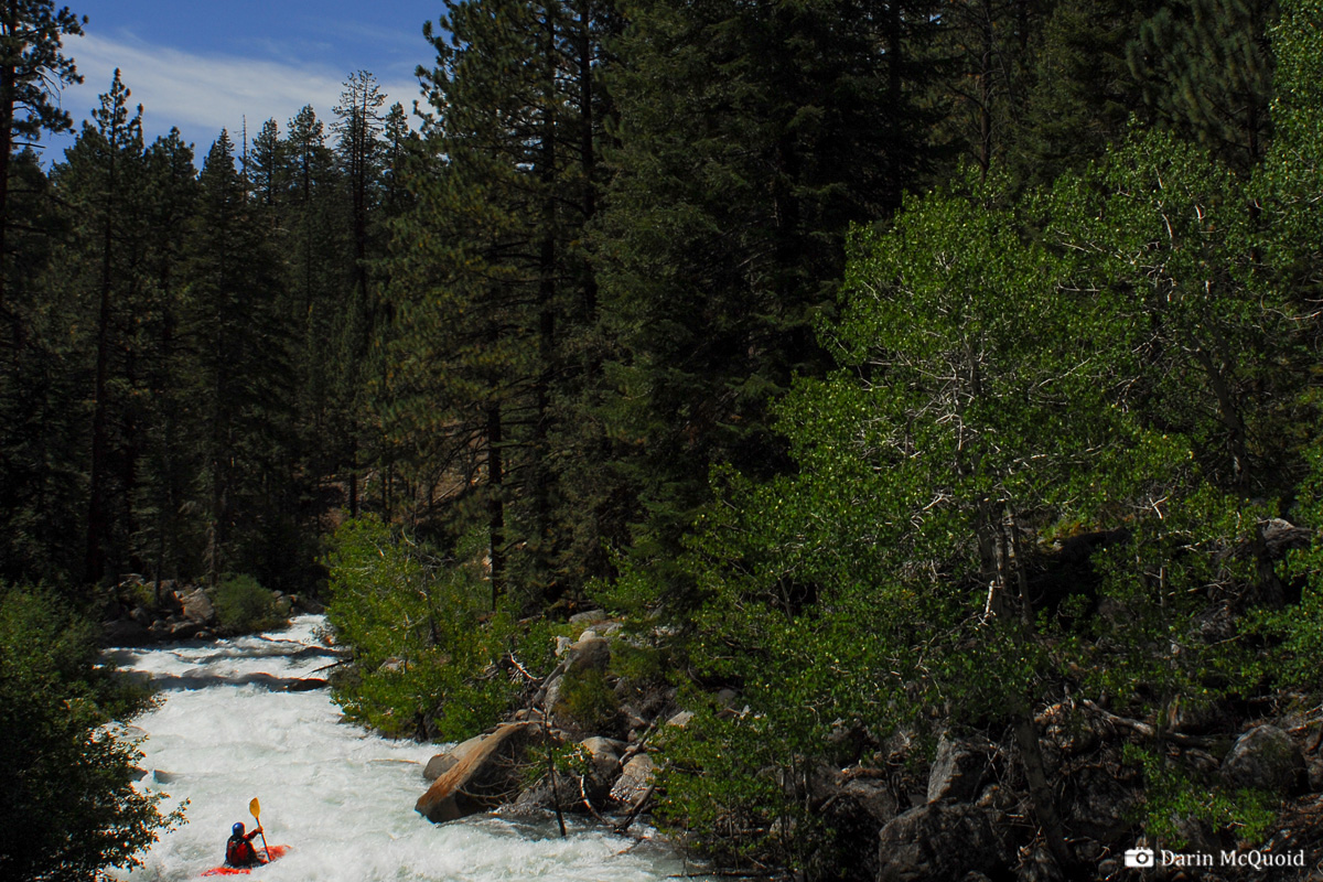
It is still steep, too steep for the high water level currently being release. We put in, run one rapid and start scrambling into available eddies, because the river doesn't stop and has lots of wood. We make one fast portage and it lookes possible to run a little ways further and catch an eddy far downstream on the right. Then we will hopefully find the trail and keep hiking.
Ben
Stookesberry on Mono Creek.
From far above it looks like Ben is right on line for the eddy, but as he makes the final move, a hidden hole type-writers him to the left side of the river, and far, far away from the destined eddy. As he disappears around the corner we try to rush down the banks, but the rugged terrain makes rushing impossible. Instead we are forced to climb up to get a higher vantage point, and see that Ben is on shore with his boat. Thankfully he found an eddy above more log jams. We spend a few minutes debating our options, but it is obvious the only safe thing to do is go up and around.
Matt
Thomas and the author going over
and around.
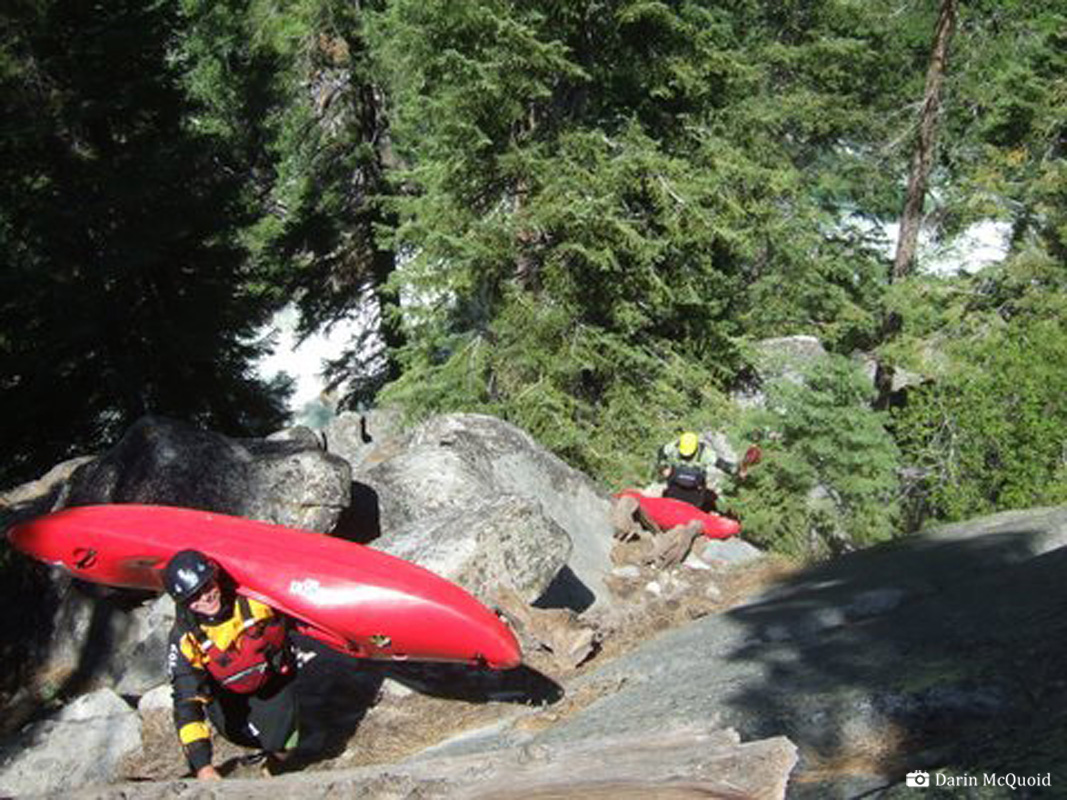
Photo: Kevin Smith, auto batched the watermarks ;)
Photo: Kevin Smith, auto batched the watermarks ;)
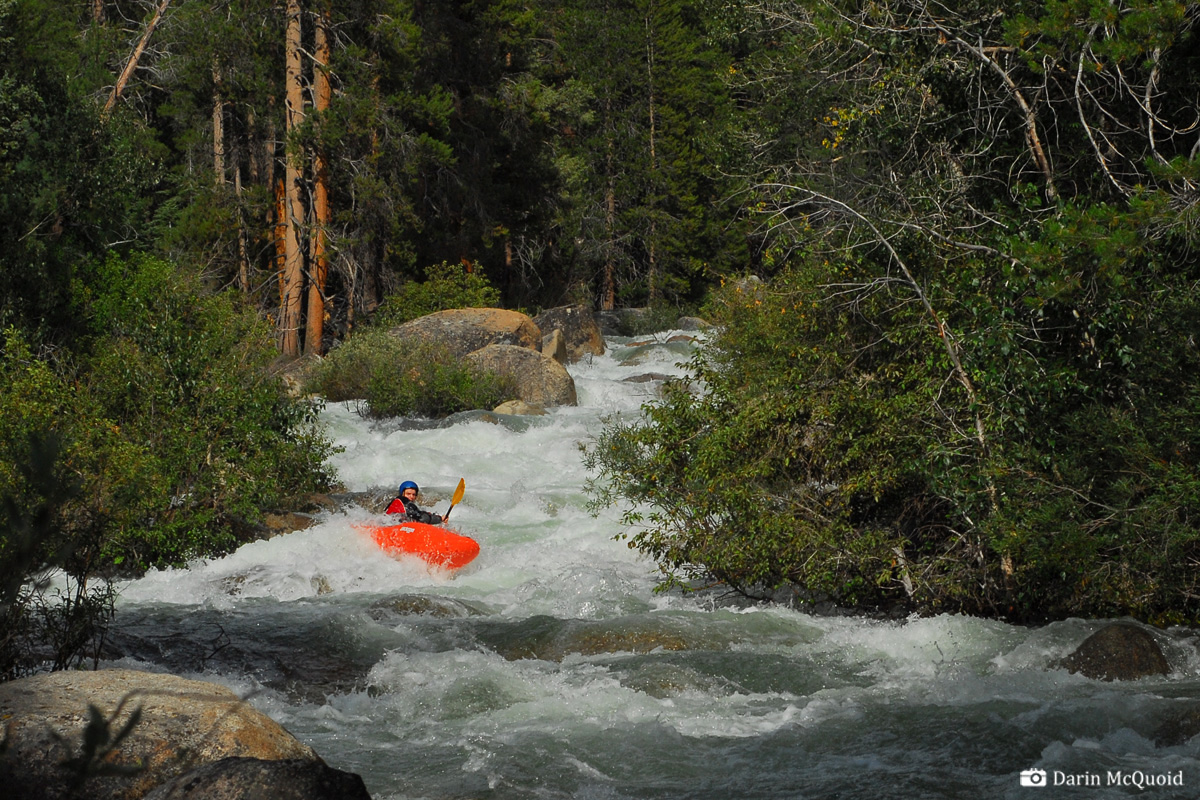
Every time we look at the river, the lack of eddies and abundance of wood keeps us high on the ridgeline, until the ridge eventually drops to the river near a cabin and footbridge. There are still a few portages around boulder piles, but we make quick work down most of the creek that Ben described as “a mini North Fork Payette”.
Ben
Stookesberry runs a rapid on the
mini NF Payette, Mono Creek.
Once at the confluence our attention is focused on assessing the flow. The guidebook recommends 1,200cfs for the section above this, and 500cfs is far cry from that, but the river holds the water well and we make quick work of the fun rapids, until after a few quick miles, and one or two portages, we pull into a camp on the right.
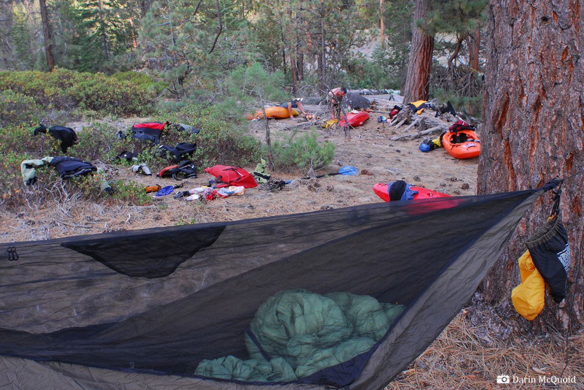
Sausage
time, Matt Thomas enjoying his
first night on the South Fork
San Joaquin.

Over the fire we discuss mileage we have made, and although we wish there was more river behind us, we've done well for putting in at 1pm and finding Mono Creek more demanding than expected. From camp it is obvious the next day will be full of action, and we head off to our sleeping bags to try and catch up on sleep.