
| Darin McQuoid | Blog | Reviews | Tutorials | River Directory |
Slate
Creek into the
North Fork Yuba River
V
V
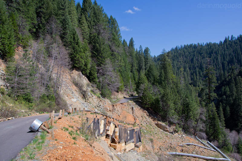
Slate Creek of the North Fork of the Yuba is an obscure run that will probably see more recreation in the future. I'd talked to one group who had done the run years before, and heard rumors of another running it before that. Slate Creek has rarely been done because it had no gauge, but it does have a diversion, which makes predicting water levels near impossible. In 2012, thanks to the South Fork Water Agency, there is a live online gauge for Slate Creek. The gauge helps tremendously, but doesn't make things easy. Getting to take-out is quite a task, as the road is not on any maps, and requires a good four wheel drive rig, or an inclination to bottom out a Subaru or other car based suv. The good news is that the rough road drops right down to river at the confluence and has ample parking and camping options. We heard the last group to do the run had taken two days, so we got an early start, planning to complete the section in one day.
The slow, arduous shuttle road ate up a good bit of time, but we reached put-in, or the closest thing to it, at ten in the morning.
Almost
there.
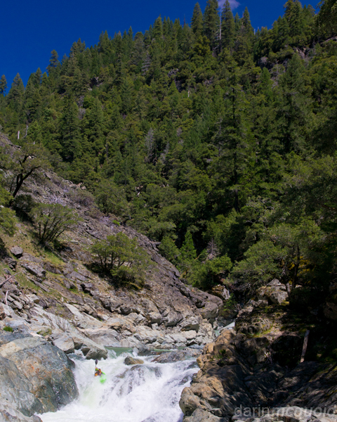
Ben Coleman lead is though a good bit of read and run before the river fell through sieves, making us walk about ten feet to seal launch back in.
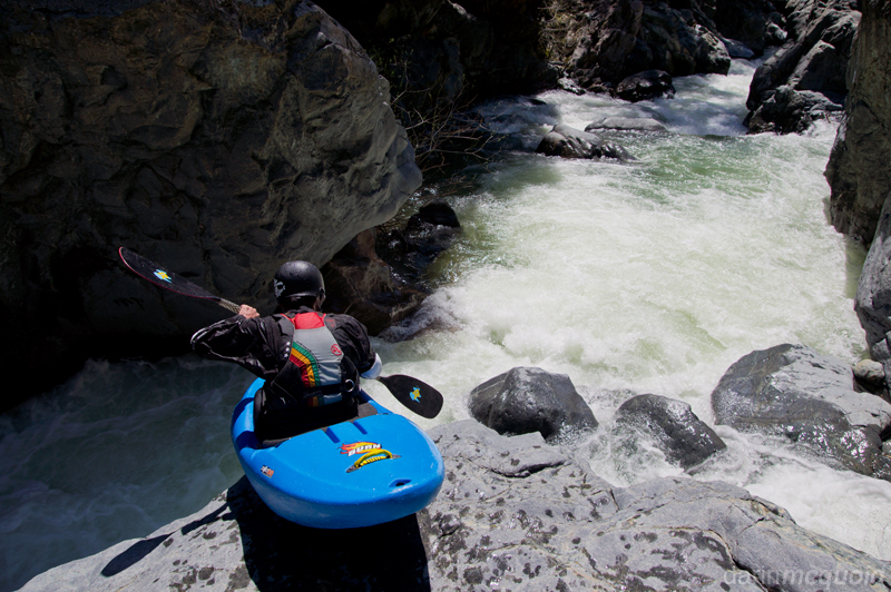
Read and run class V was interspersed with some dubious looking business. Not sure if you'd come out of this hole too easily.
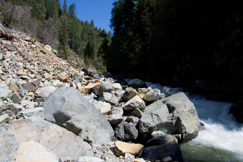
The
first time I attempted the run we were able to drive all the way to a
bridge, about a quarter mile upstream from where the road is washed out
(2012). This active
landslide looks like quite an issue for the road. We wasted no time and
decided it would be fastest to just head straight to the river.
Will
Pruett hikes down the slide to gain access.Ben Coleman lead is though a good bit of read and run before the river fell through sieves, making us walk about ten feet to seal launch back in.
Read and run class V was interspersed with some dubious looking business. Not sure if you'd come out of this hole too easily.
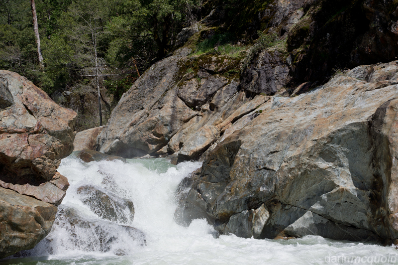
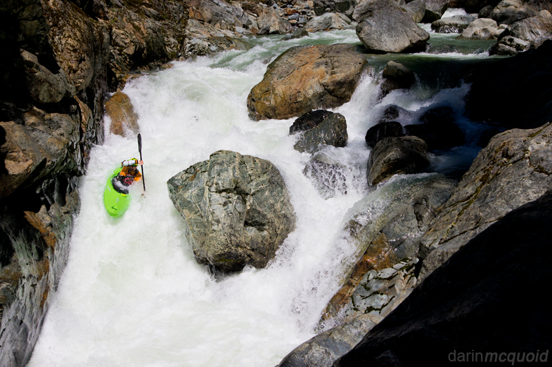
Legend had it that the run
was good class V with a few bigger drops that should be ok to run. Soon
enough we were at the lip of a long, low angle slide leading into a
~40' drop. The issue was the walls came in on both sides, and a rib of
rock down the center would want to reject a paddler into the wall. It
is the kind of drop that makes you think "hmm this may go higher...or
lower" but it probably has some sort issue at all flows.
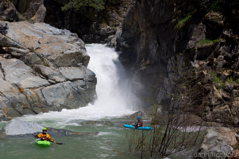
Will
Pruett and Thomas Moore below the
big guy.
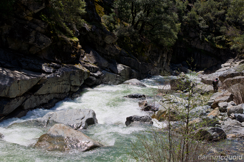
Looking
downstream, the river has less pool-drop character than is typical of
most California rivers.
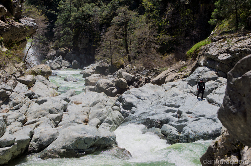
Ben Coleman scouts
a bedrock
section that has some big holes and undercuts.
Will Pruett runs the lead in.
Ben Coleman in the heart of Slate Creek.
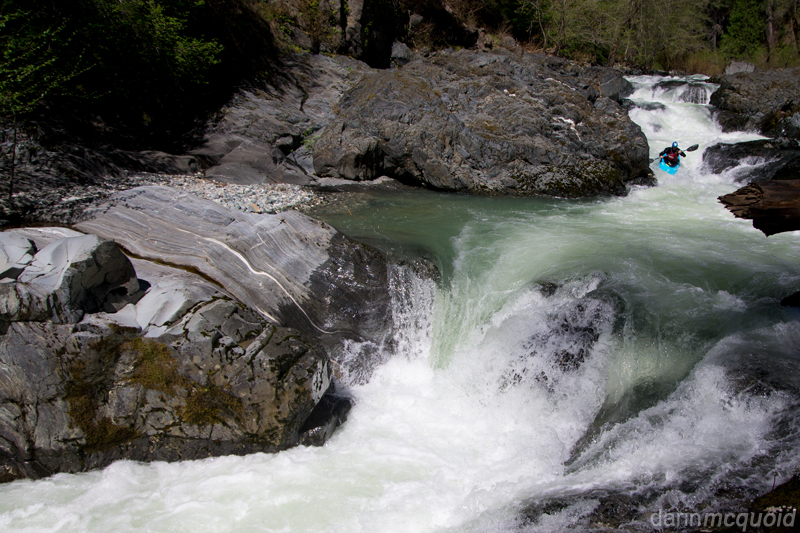
Downstream gradient easies up, and we enjoy one nice section of bedrock drops that proves a little tougher than it looks. Thomas Moore in the middle of it.
Looking downstream from the slides.
Will Pruett runs the lead in.
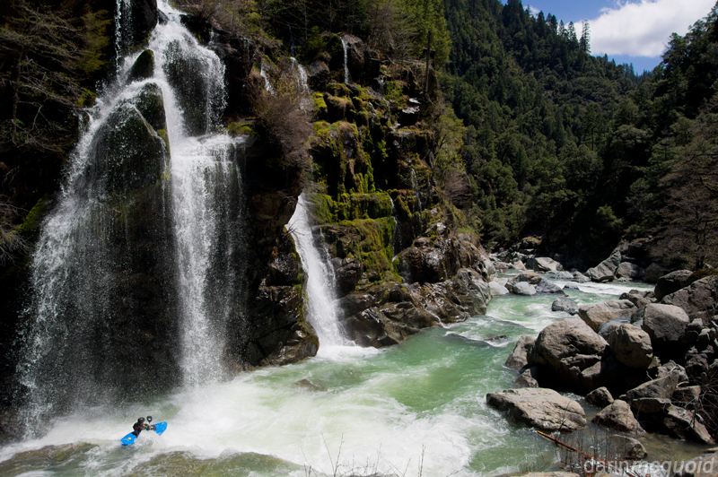
Looking at the slide,
and knowing we need to make downstream progress, we all opt to portage
because
it's faster than setting safety and running the slides. The good news
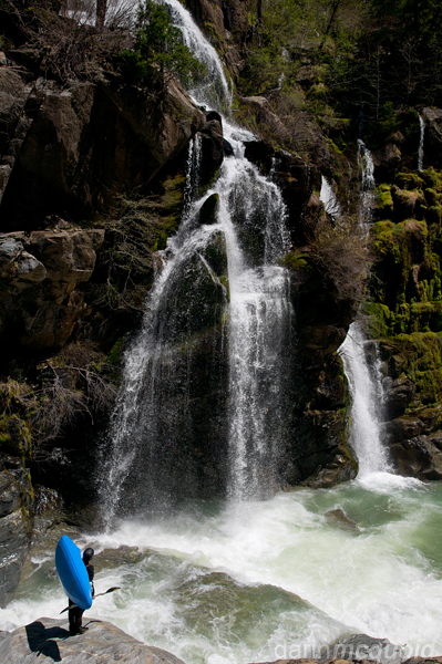
is the scenery is simply incredible. A hundred foot plus cascade
tumbles down the left canyon wall, and we're able to put in just above
it.
Ben Coleman in the heart of Slate Creek.
Coleman is phenomenal
kayaker who flys under
the radar. On our whole run he takes the lead, boat scouting into
eddies I wouldn't dare catch and enabling us to make quick time through
many class V boulder gardens. After a
mile or two of goods rapids, we're forced out to look at another big
drop that pinches down at the bottom with a significant hydraulic. Will
Pruett gives it a go as I make an easy portage on the right.
Downstream gradient easies up, and we enjoy one nice section of bedrock drops that proves a little tougher than it looks. Thomas Moore in the middle of it.
Looking downstream from the slides.
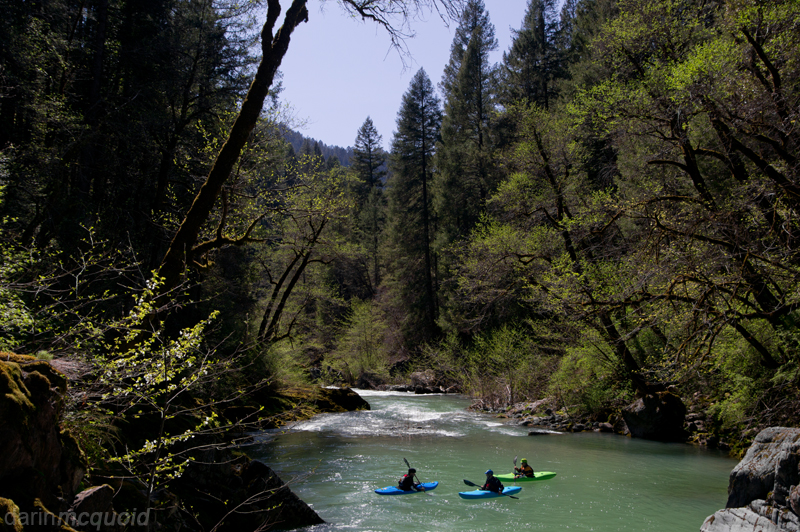
The far canyon wall looks like it should be the North Yuba, but that can't be, as we've only been on the water for four hours. Next beach for lunch? We paddle downstream to find out take-out around the corner, finishing the six mile run in exactly four hours, thanks to Ben's read and run ability. Without him I would have scouted more and can see a fairly fast day on Slate Creek still taking six to eight hours.
While not a complete classic, Slate Creek is worth doing at least once, and I won't be surprised if I'm tempted back in the future. The big drops at highly suspect, while the inbetween rapids are good but not classic. We had 350cfs on the Gauge and flows seemed ideal. It would get scary at higher water. Finding and getting to and from take-out is the largest logistical challenge. There is a road, but it's not on any maps, and is very rough. Google Maps marker for our take out. Google Maps Marker for put-in on Scales Road.
HTML
Comment Box is loading comments...