
| Darin McQuoid | Blog | Reviews | Tutorials | River Directory |
Sulanharas Creek II-III (P)
We
push off and the creek is a little low but no one is too concerned as
flow looks like it will double at the confluence downstream, and quick
time is made through two miles of class II and moving water down to the
bend where the streams join. There is no need to scout thanks to our
road side scouting, but it's photogenic and I was hoping to stack the
entrance slide up with the ledge, but we're there too early in the
day/year for the light to let this happen. Trevor and Dave cruise
through both rapids with no problem, although to second one does want
to throw you into a pocket on the right. I follow through with no
issues and we hop in our boats and continue on, enjoying the extra
water from the North Fork.
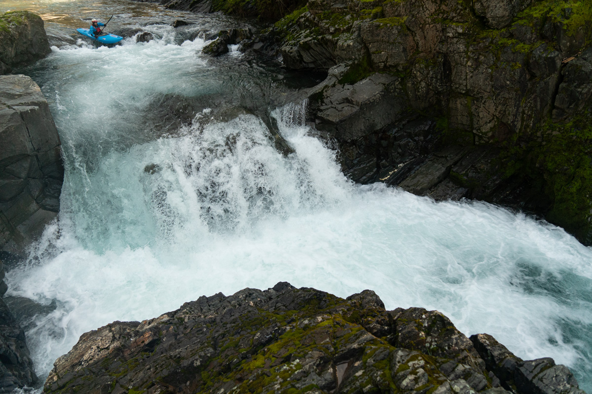
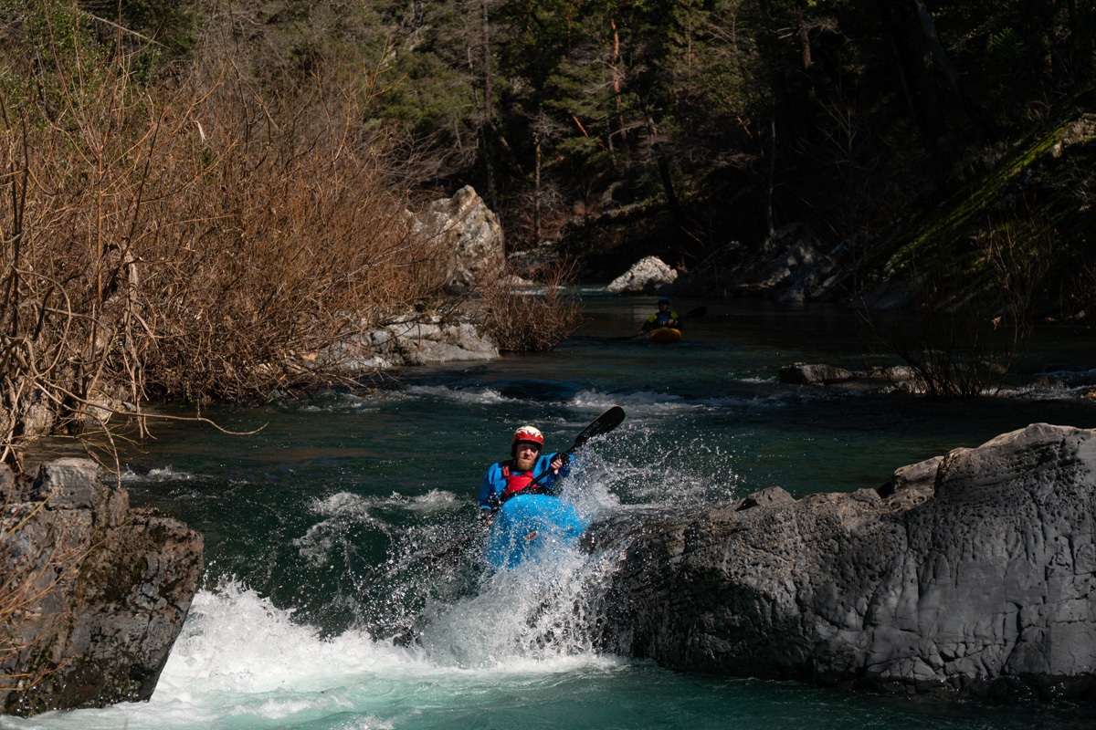
Trever Tanhoff entering the ledge drop.
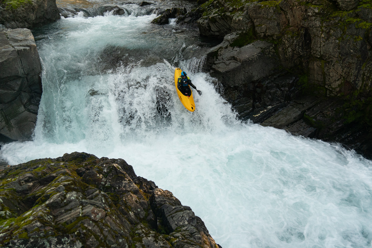
David Lew comes over the ledge.
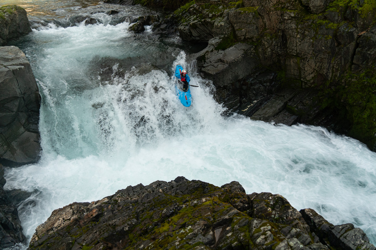
Trevor Tanhoff does the same.
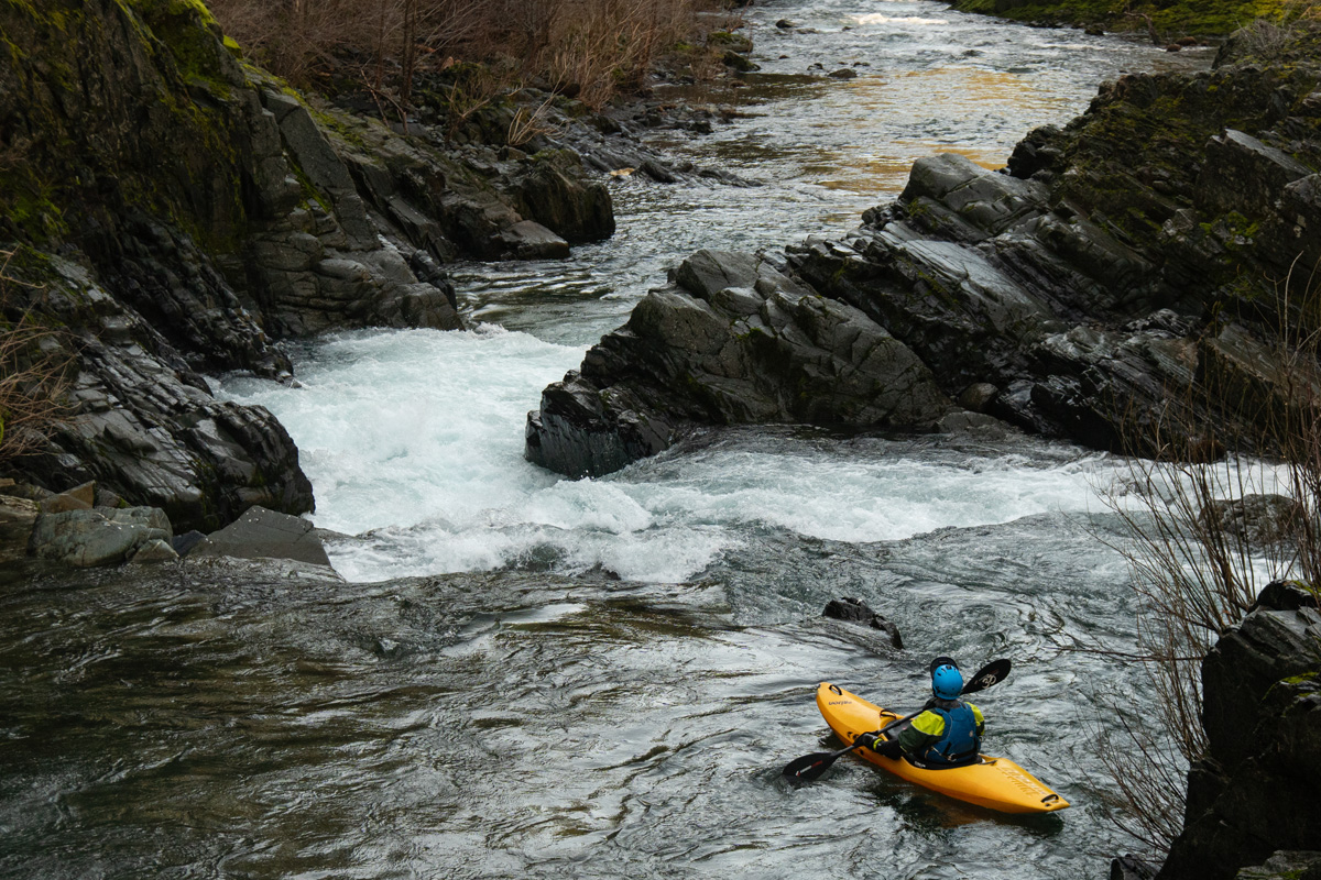
David Lew about to enter the confluence pinch. The flow is nearly doubled from river right here.
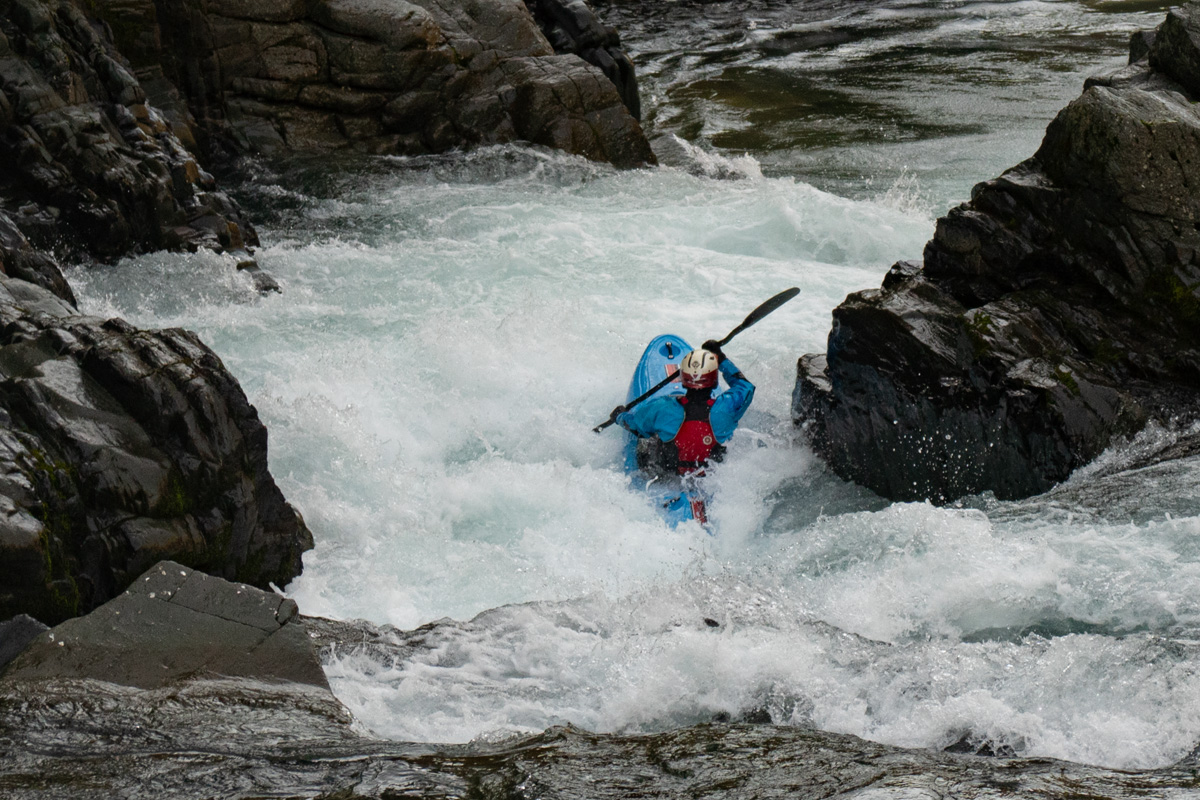
Trevor Tanhoff works past the pocket in the pinch.
What a wild spot, the author comes through the ledge as the North Fork joins on the viewers left - Trevor Tanhoff photograph.
The author comes through the pinch - Trevor Tanhoff photograph.
The confluence sequence thanks to David Lew.
https://youtu.be/GYVFtti9Gkc
About an hour and a half after putting on, we've made it five miles and change with all the rapids being class II outside the confluence set, and we pass under the bridge utilized during shuttle and enter the canyon zone, soon seeing the 1944-1966 gauge still in place on the left.
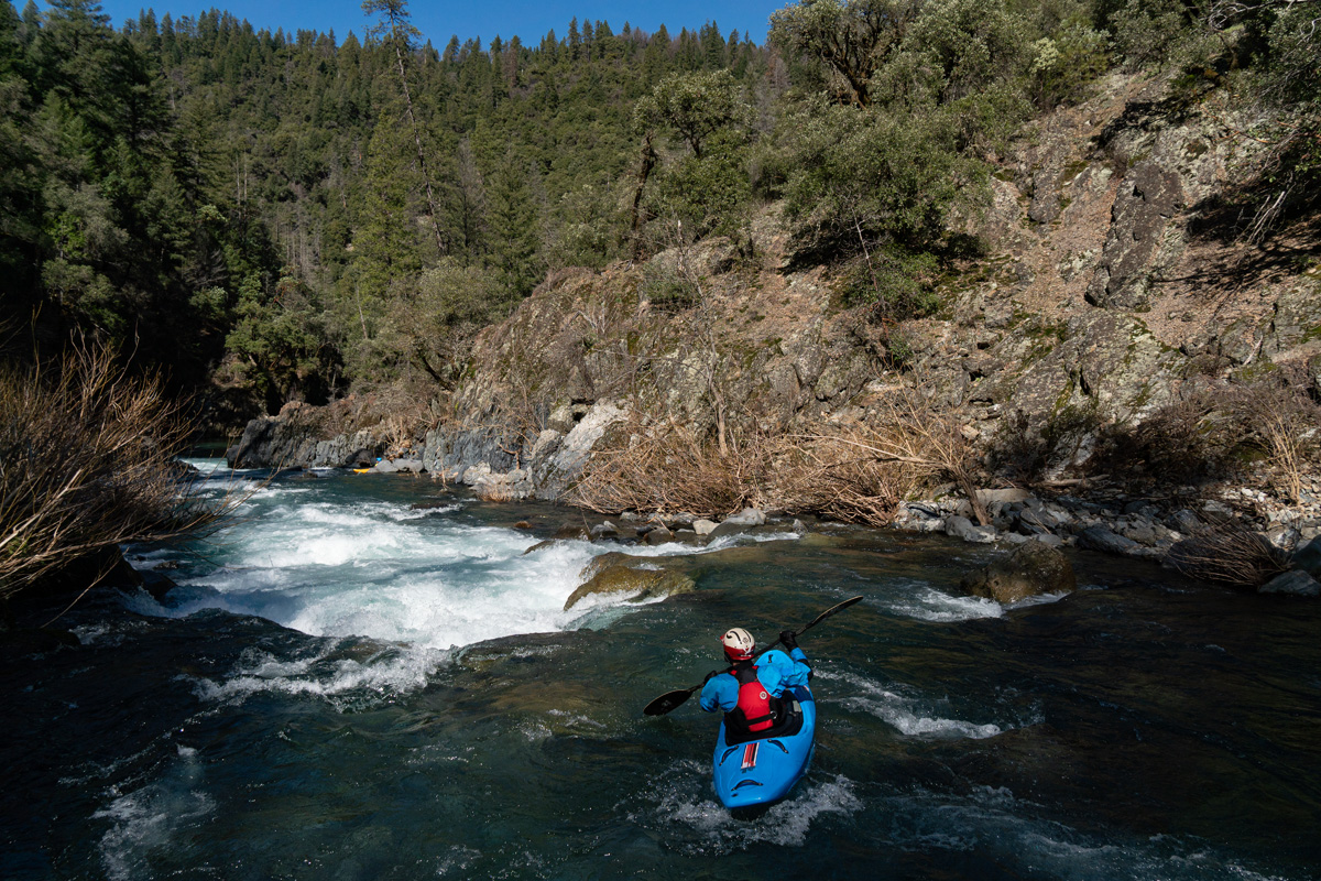
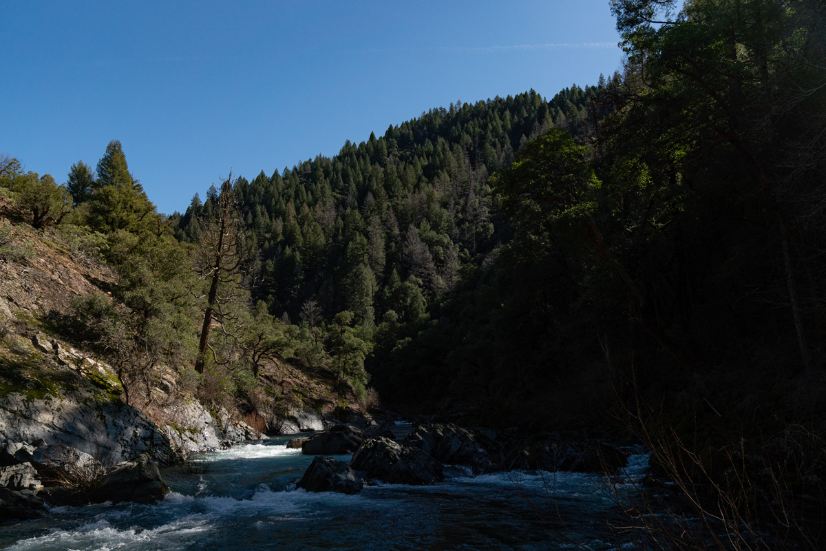
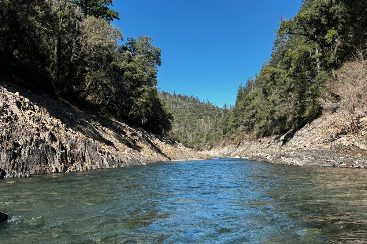
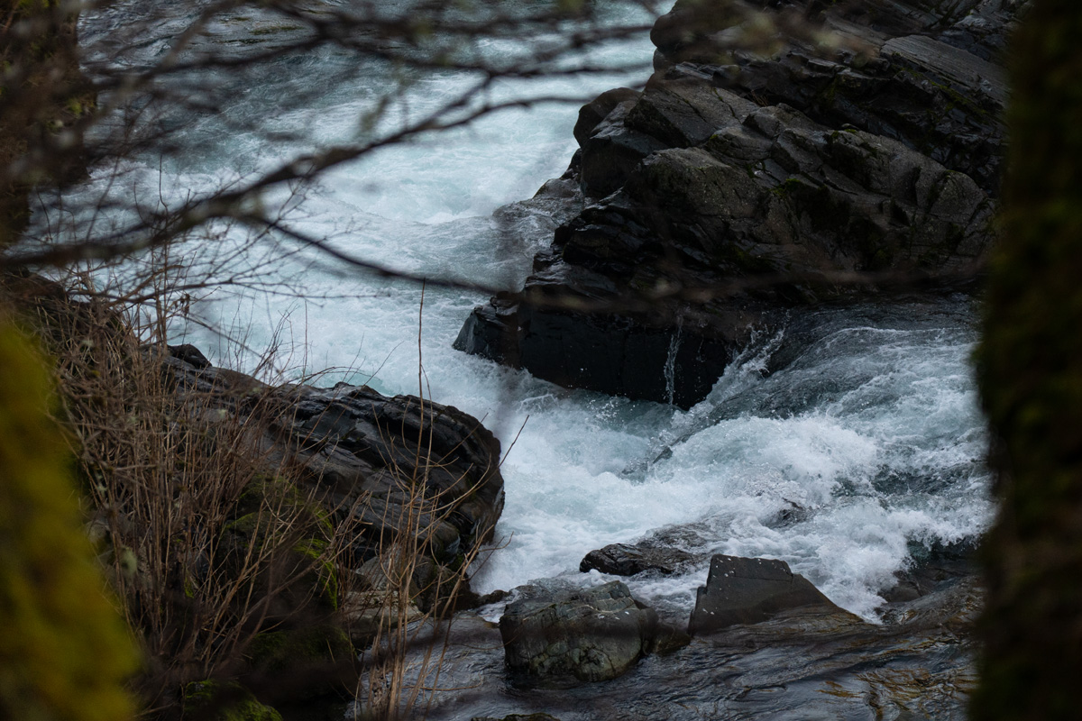
Now the character changes and the river bed narrows, and more rapids
appear. Soon it's many class II and III rapids, which would be
challenging for a class III boater as they are relatively blind in
nature.
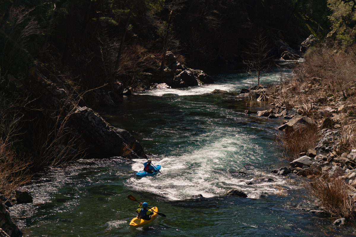
Trever Tanhoff enters a nice rapid as David Lew boat scouts.
Have we found a classic wilderness style class III run? It certainly feels like it as the scenery is superb and the rapids have nice spacing and big pools.
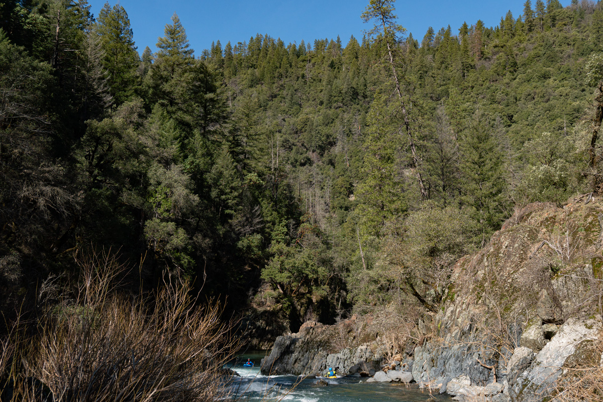
Looking upstream from the same location.
If this isn't nice, I don't know what is.
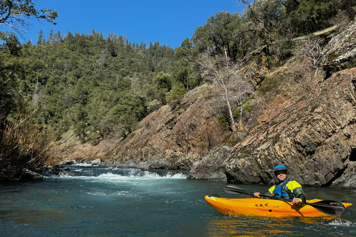
With big grins we continue downstream, the rapids are read and run, although we do catch the occasional eddy to make sure there is no wood, and I burden the group with waiting for a photograph here and there because it would be too easy to kayak through and not get out of our boats.
We can't argue with the lush vegetation and water quality on Sulanharas Creek.
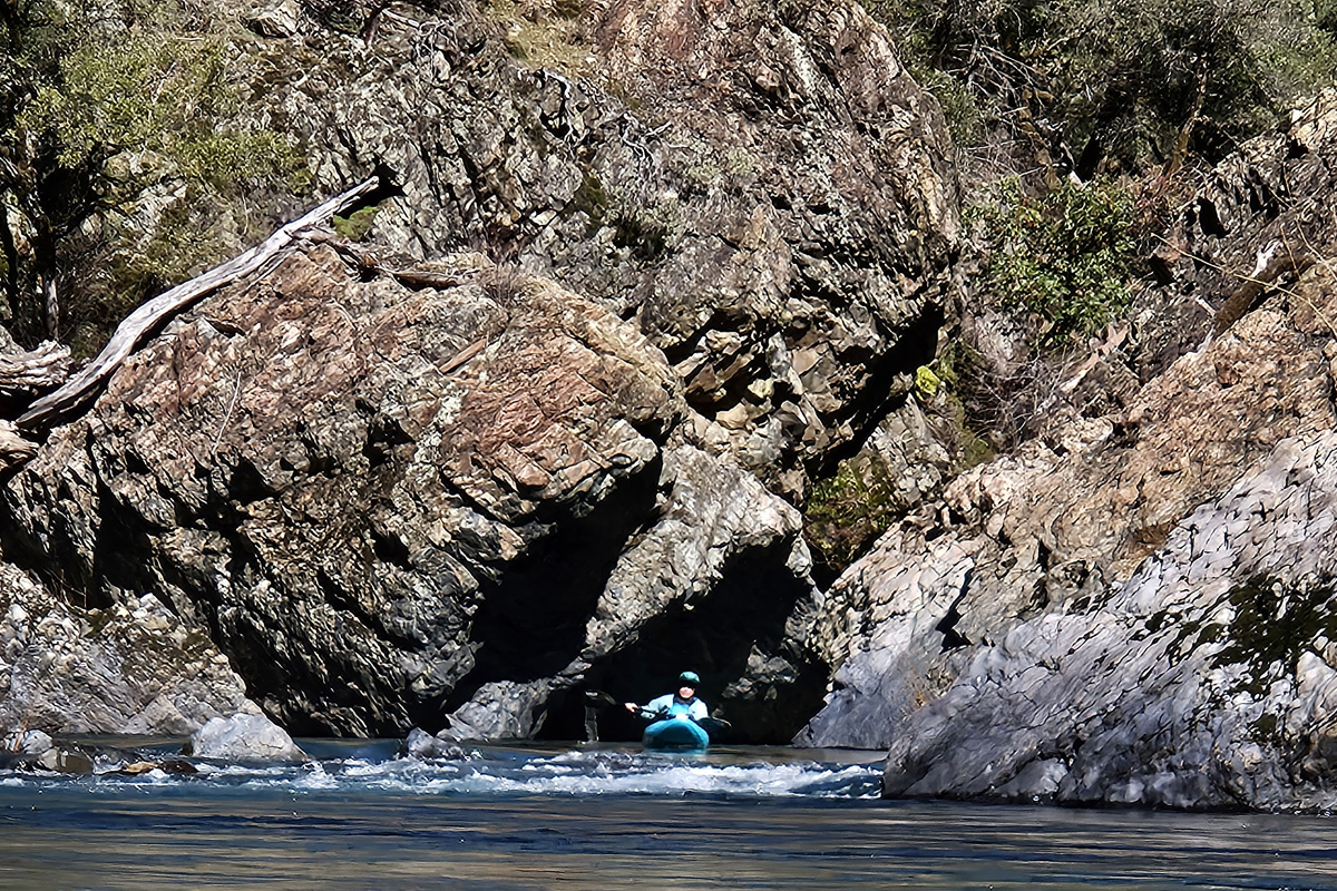
I ask people to wait on this exceptionaly blind rapid but unfortunately none do so there are no paddlers to photograph in this one.
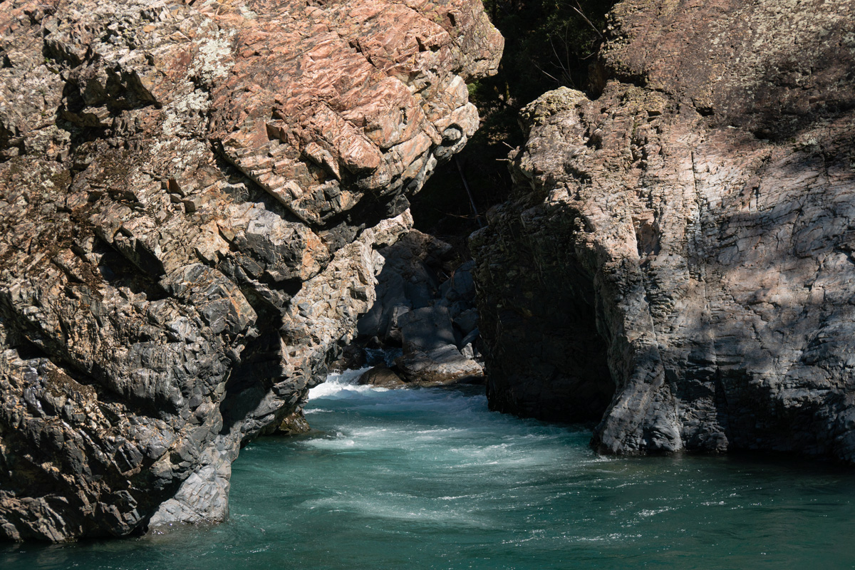
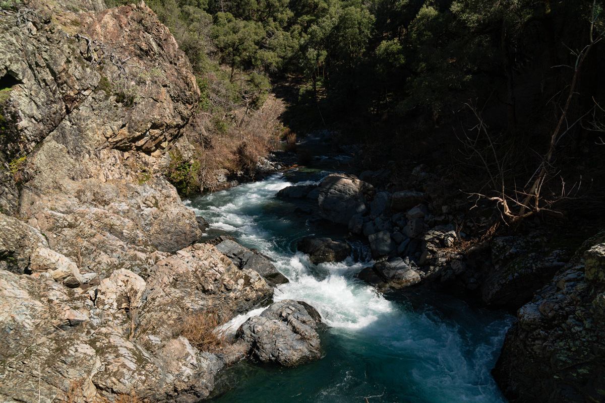
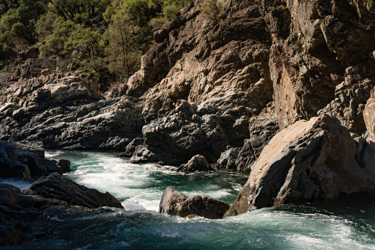
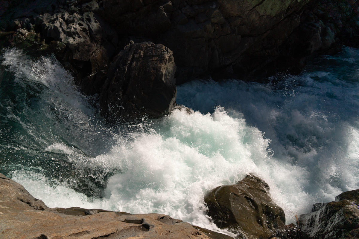
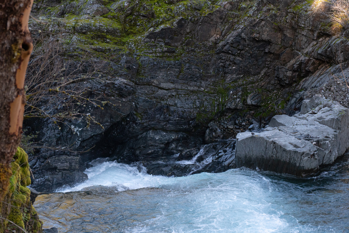
It ends in quite a pinch, the kind you just don't see on a regular basis.
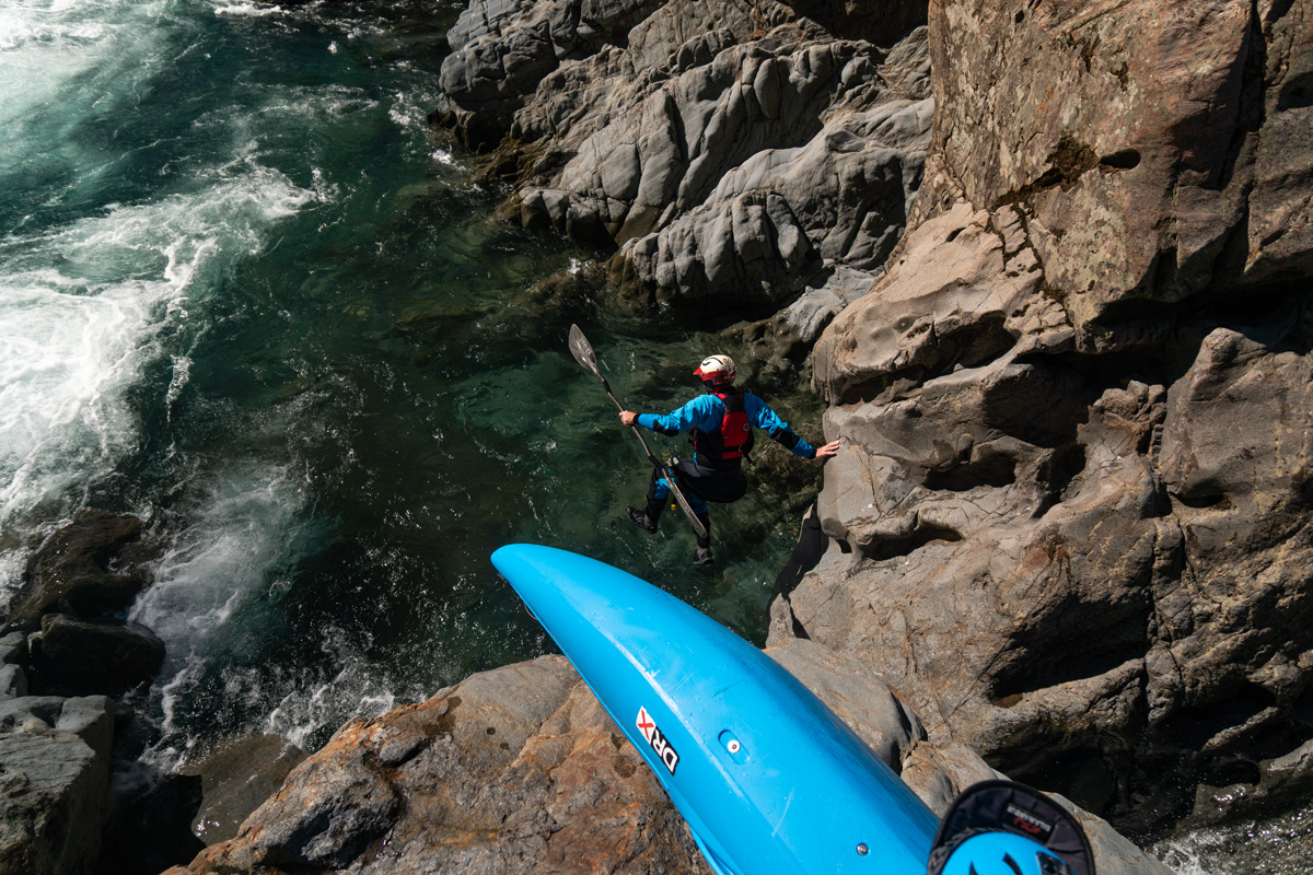
Author exits the pinch, photo thanks to Trevor Tanhoff
Trevor Tanhoff and David Lew make their way downstream.
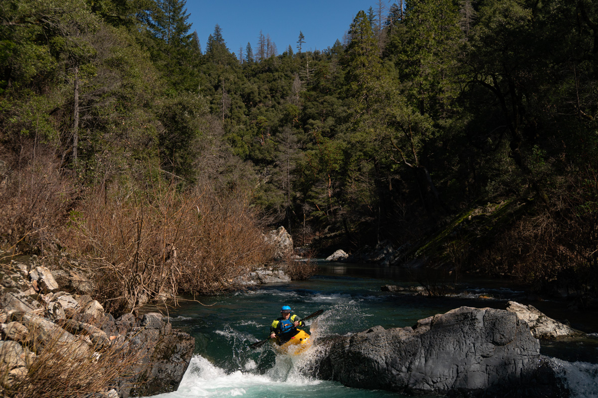
David Lew runs a nice ledge that was just around the corner.
Trevor Tanhoff does the same.
Salt Creek comes in from the right and makes a nice landmark and lunch spot. We stop here around one in the afternoon and enjoy the balmy weather and views. It's only a half a mile to the start of Lake Shasta, and it feels like this could be a true classic for those looking for a remote adventure delivering class V scenery and logistics but not the danger.
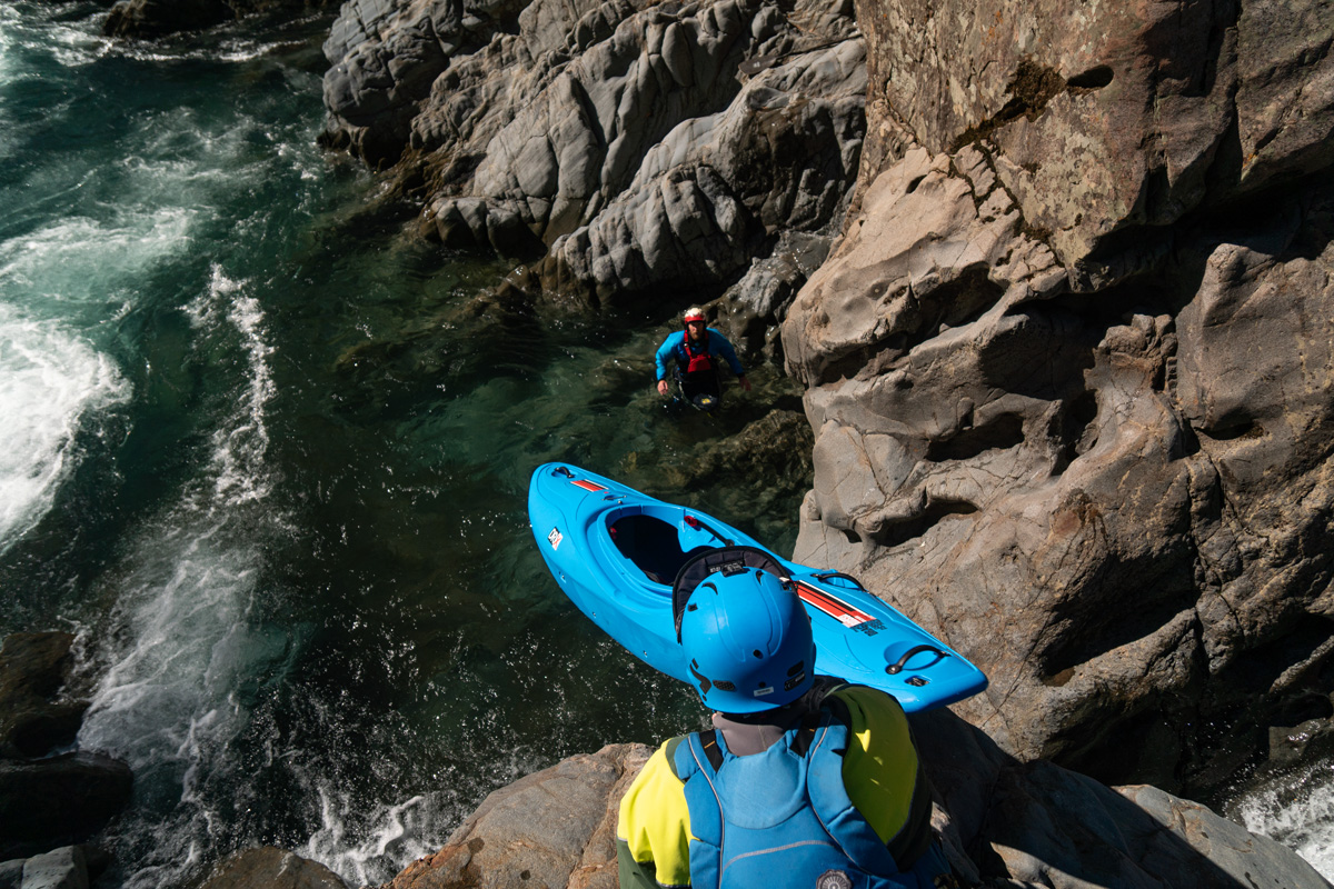
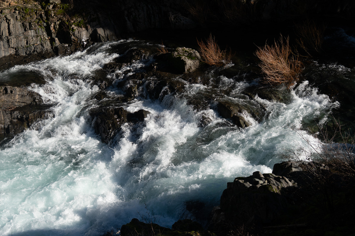
Satiated we head downstream making quick time through some easy rapids, then suddenly a class II entrance leads us to the lip of something larger that is clearly not class II or III just from the gradient. Maybe it's a perfect ten-foot drop into the lake?
Optimism and kayaking go hand in hand. We hop out and the lip and it's ugly. It does drop ten feet, but onto and through a pile of rocks. With double the water it would probably be fine, but at the current water level it looks terrible.

Portaging on the left isn't looking good, it would be a throw and go into water of questionable and then dealing with an undercut wall. We walk back upstream and ferry to river right. Here the throw and go doesn't look too bad, except the water is shallow so we downclimb as low as possible.
It's an interesting puzzle at the end of a straightforward day. Below our portage we run three more rapids below the bathtub ring of Lake Shasta and then float moving water for roughly a mile total from the initial high-water mark of the lake, then paddle about an hour on flat to reach our take out point.
We all agree it was a fun day on the water, a rather absurd amount of driving for what it is, and the portage is a shame because it changes the experience of the run, giving it a large barrier of intimidation for a class III/IV kayaker who may not have that much experience problem solving portages of that nature. On the drive out we see our relative McCloud River gauge had dropped to 125cfs, and one day I'd like to return with the McCloud around 2,500 so that all the rapids can be run, if it's possible to talk anyone into the adventure again.
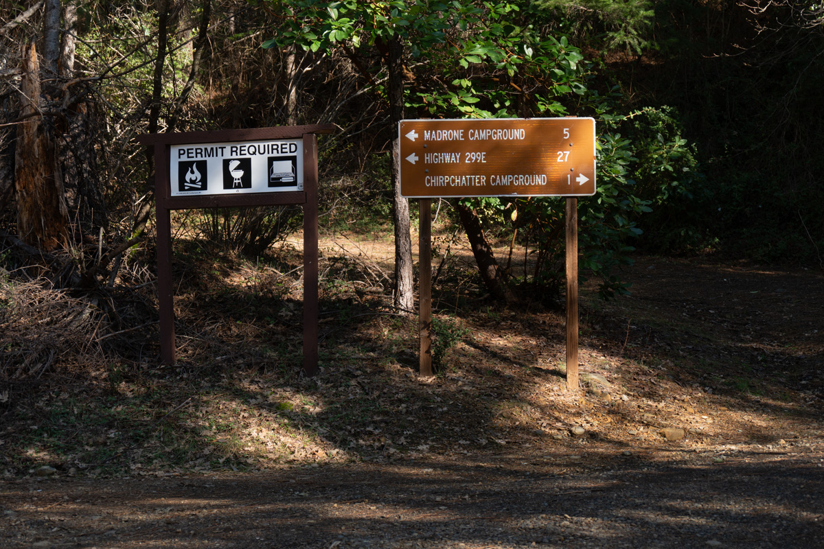
Put-in: Madrone Campground,Take Out: Lake Shasta just uplake of Didallas Creek. Overall feet per mile is just under 50.
Sandwiched
between the McCloud and Pit Rivers, Sulanharas Creek flows into Shasta
Lake from a remote pocket of Northern California. While the rivers
bordering it drain Mount Shasta, Sulanharas's headwaters are no more
than 5,000' in elevation. I have vague memory of reading of it having
been done by kayakers from the Redding area, yet today I can't find any
information about it being run. I made several logistical scouting
missions over the years, but come spring time it would fall off the
radar as other local classic runs were too fun and too easy to access
with a lot less driving.
Sulanharas Creek has no gauge, but watching the McCloud River gauge and getting eyes on the creek, it looks like 1000-2000cfs on the McCloud will correlate to optimal medium low flows for a first trip down. USGS has recorded data from 1944-1966, revealing that Sulanharas is an unusual watershed for this region; it's a riverbed where typical summer flows of 15cfs will see flows 2,000cfs most winters and 10,000cfs at least once every decade. As a result, this very season creek has a well-developed riverbed.
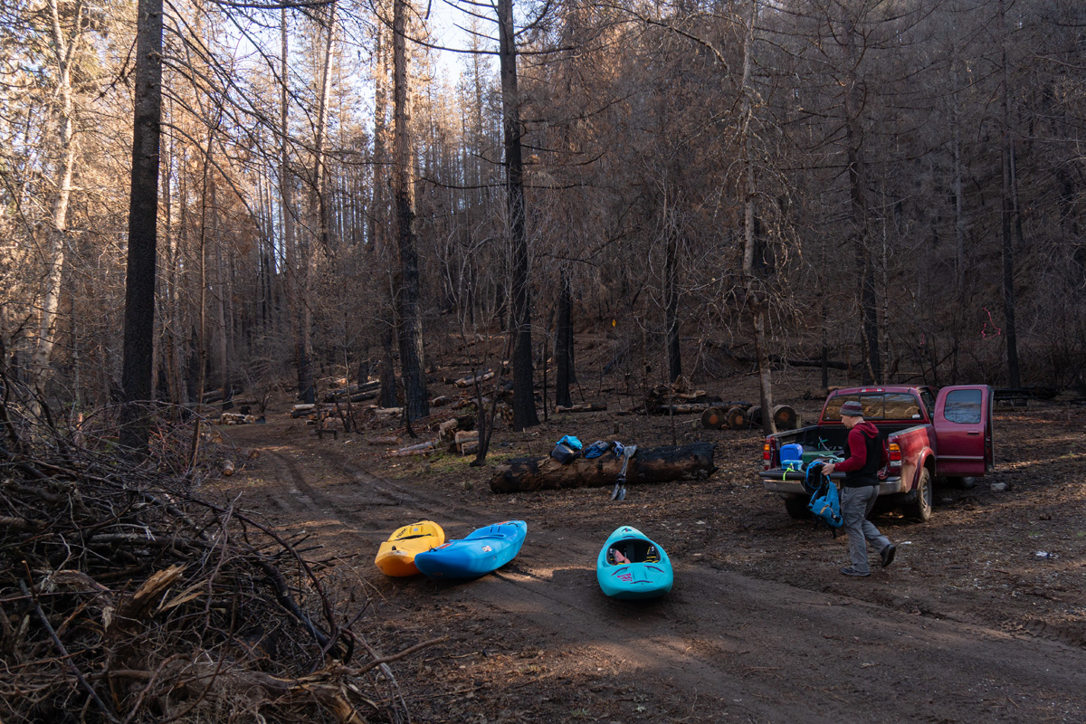
Not all paddlers love obscure runs with time consuming logistics, so I'm relieved when Trevor Tanhoff and David Lew are game to join my scheme of running ~10 miles of Sulanharas Creek on an unusually warm late February day. There is a lot of dirt road driving to get into the watershed, and even after three scouting trips, I'm still not sure of where the exact take out will be, just the general area on Shasta Lake where access is possible. We pack camping gear in the trucks and go out a day early to give ourselves plenty of breathing room. The McCloud River is at 1,450cfs.
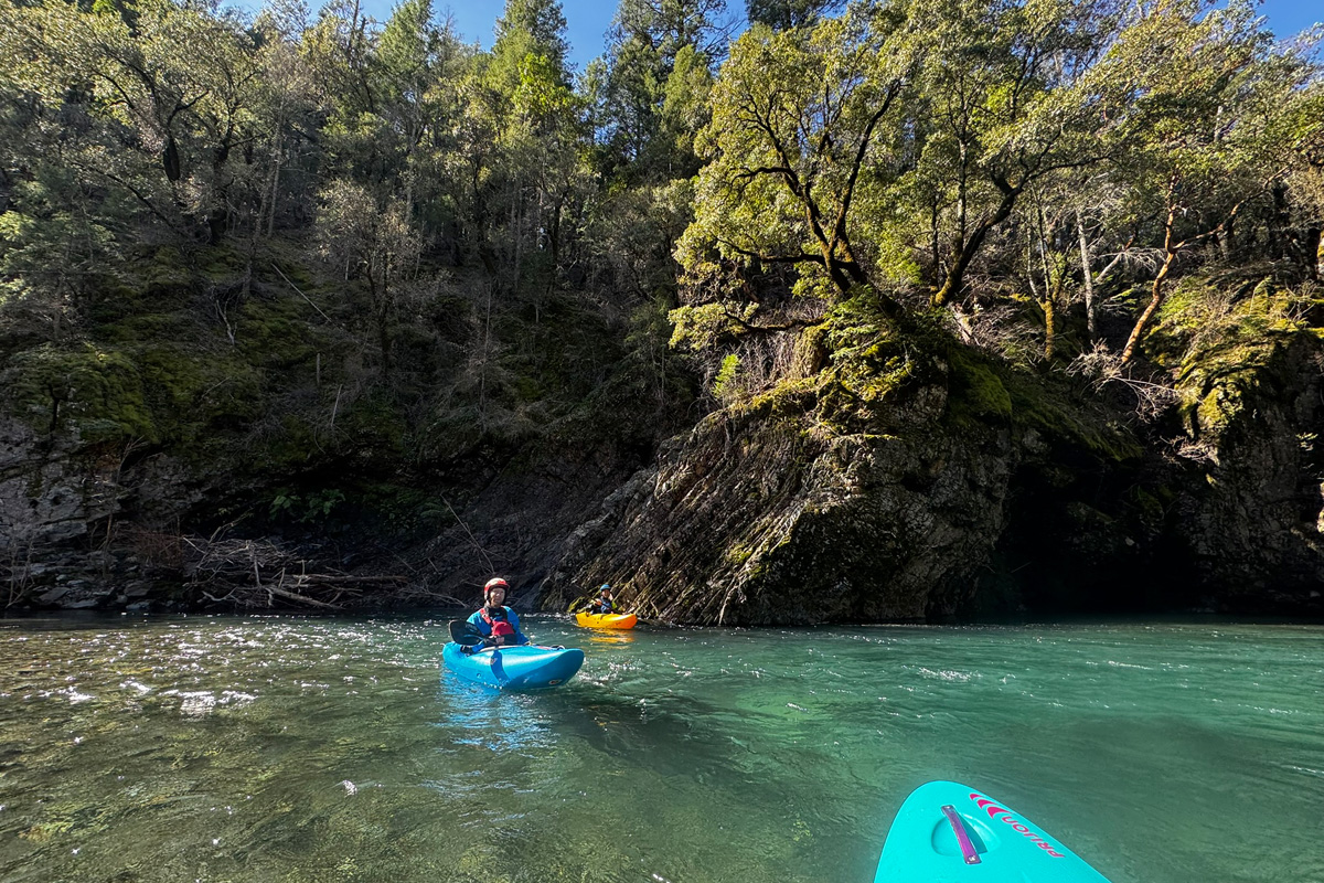
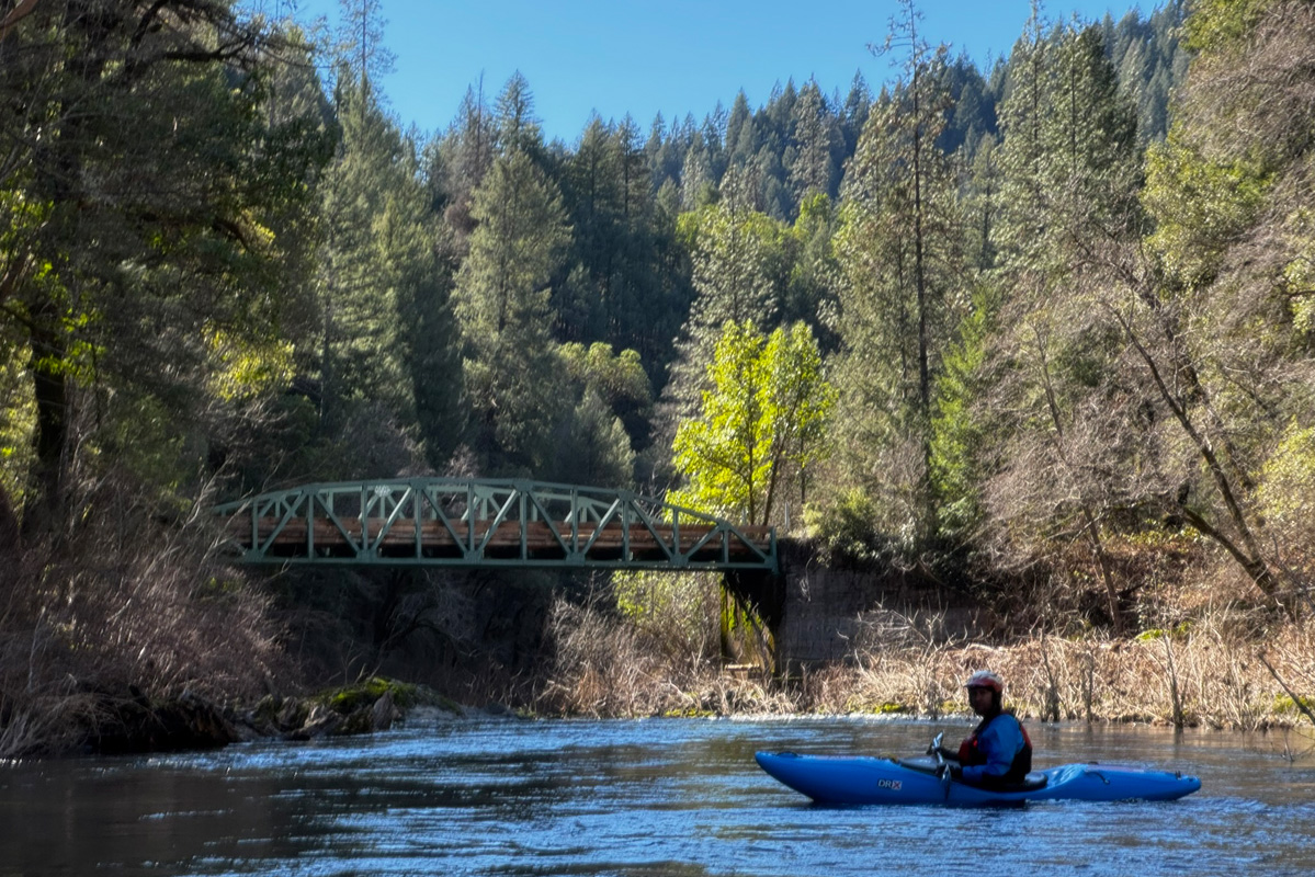
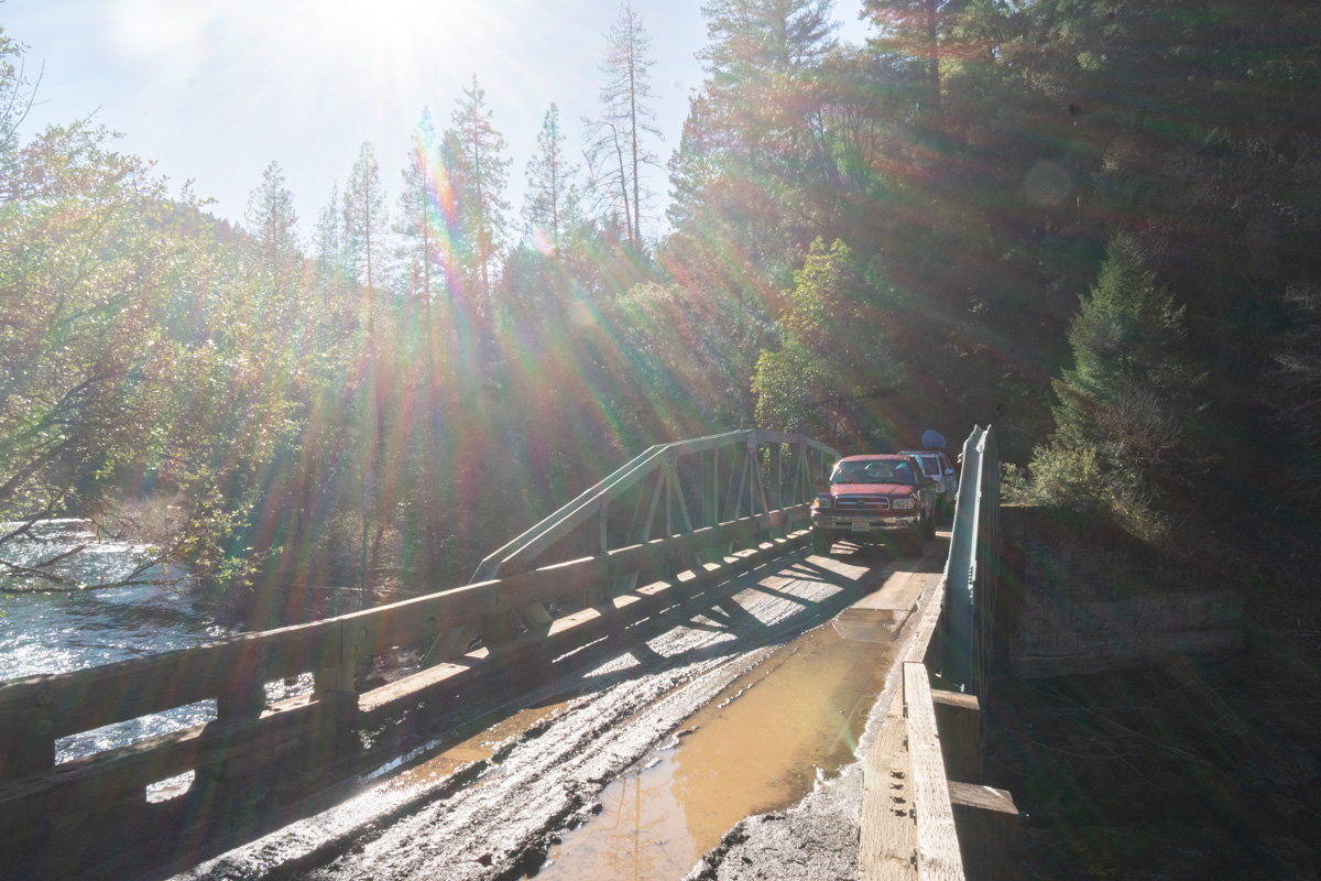
We meet off I5 at the Salt Creek/Gilman Exit and head east on Gilman Road which eventually turns to dirt and becomes Fender's Ferry Road as it crosses the McCloud River. Many bumpy miles later we're at a bridge over Sulanharas Creek, just over halfway through the section we'll be running. Previous scouting has shown the upstream section is rather flat with one interesting rapid at the confluence of the North Fork Sulanharas and Sulanharas, and good access at Madrone Campground about two miles above that. Below the bridge the creek drops into a canyon.
Arriving at the bridge over Sulanharas Creek.

Flows appear good, Trevor Tanhoff looking upstream, David Lew photo.
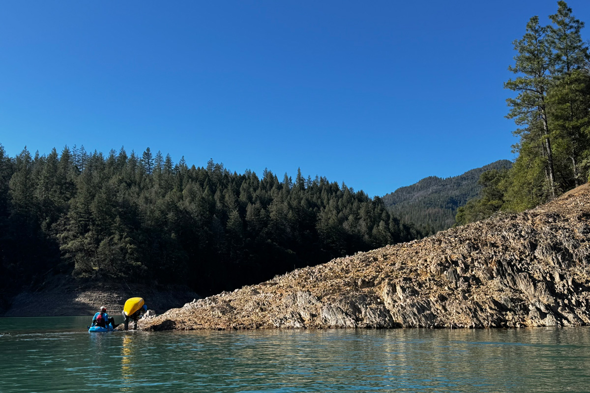
Flows look adequate so we backtrack to a left turn on Salt Creek road, and follow it until Lake Shasta is in view, and Salt Creek road crosses over Didallas Creek. If Shasta Lake is full, the reservoir comes all the way up to the bridge over Didallas Creek, but the lake is 24' down from full and access doesn't look too easy. Maps indicate a road just a little way back, and it should drop to the lake. A few years ago this road was full of downed trees, but now it's been somewhat cleared, mostly for side-by-side atvs we're guessing.
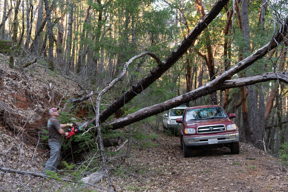
David Lew clears the way for team Tundra
Being early in the year it gets dark early, so we go to bed early and rise at dawn. Shuttle is slow on the rough roads, but we make our way to the bridge and turn left towards Madrone Campground.
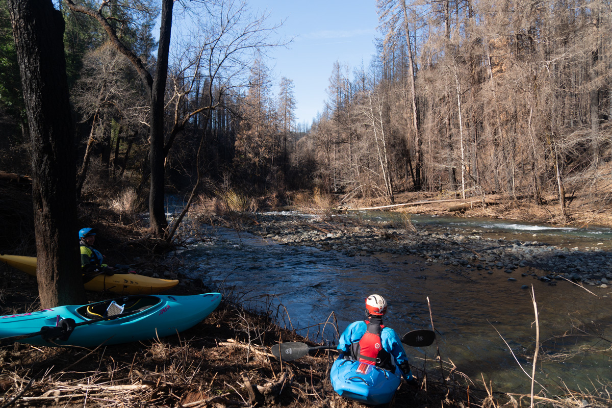
Approaching
the confluence of the main and North Fork we stop and scout. Last
spring there was no trail and lots of poison oak here, but a fire came
through in the fall and a fire crew put a trail all the way to the
creek, making for an easy scout of what looked like a potential portage
from the road. Thankfully the drop is wider than it had looked, and the
one above it is a nice surprise.
Exit drop from the scout.
Nice ledge!
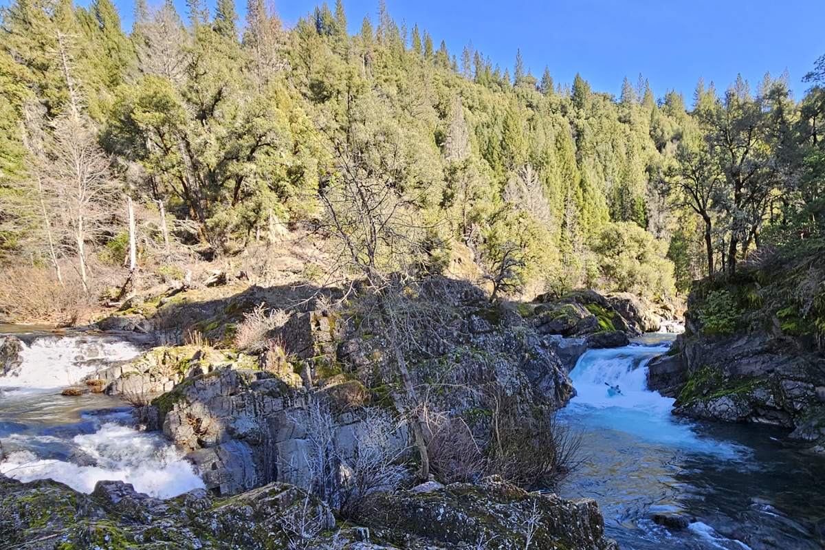
Entrance slide looking good, what would turn out to be the first significant whitewater of the run.
The next two miles upstream from the confluence the burn scar is considerable all the way into Madrone Campground and beyond. Thankfully the toilets survived and we make use of them as we gear up, frost on the ground, a surprise after our 40 plus degree night just 500 feet of elevation lower.
Sulanharas Creek has no gauge, but watching the McCloud River gauge and getting eyes on the creek, it looks like 1000-2000cfs on the McCloud will correlate to optimal medium low flows for a first trip down. USGS has recorded data from 1944-1966, revealing that Sulanharas is an unusual watershed for this region; it's a riverbed where typical summer flows of 15cfs will see flows 2,000cfs most winters and 10,000cfs at least once every decade. As a result, this very season creek has a well-developed riverbed.
Not all paddlers love obscure runs with time consuming logistics, so I'm relieved when Trevor Tanhoff and David Lew are game to join my scheme of running ~10 miles of Sulanharas Creek on an unusually warm late February day. There is a lot of dirt road driving to get into the watershed, and even after three scouting trips, I'm still not sure of where the exact take out will be, just the general area on Shasta Lake where access is possible. We pack camping gear in the trucks and go out a day early to give ourselves plenty of breathing room. The McCloud River is at 1,450cfs.
We meet off I5 at the Salt Creek/Gilman Exit and head east on Gilman Road which eventually turns to dirt and becomes Fender's Ferry Road as it crosses the McCloud River. Many bumpy miles later we're at a bridge over Sulanharas Creek, just over halfway through the section we'll be running. Previous scouting has shown the upstream section is rather flat with one interesting rapid at the confluence of the North Fork Sulanharas and Sulanharas, and good access at Madrone Campground about two miles above that. Below the bridge the creek drops into a canyon.
Arriving at the bridge over Sulanharas Creek.
Flows appear good, Trevor Tanhoff looking upstream, David Lew photo.
Flows look adequate so we backtrack to a left turn on Salt Creek road, and follow it until Lake Shasta is in view, and Salt Creek road crosses over Didallas Creek. If Shasta Lake is full, the reservoir comes all the way up to the bridge over Didallas Creek, but the lake is 24' down from full and access doesn't look too easy. Maps indicate a road just a little way back, and it should drop to the lake. A few years ago this road was full of downed trees, but now it's been somewhat cleared, mostly for side-by-side atvs we're guessing.
David Lew clears the way for team Tundra
A
little chainsaw work and we're able to squeeze our way down to a nice
flat spot above the lake and set up camp between Fowler Gulch and
Didallas Creek.
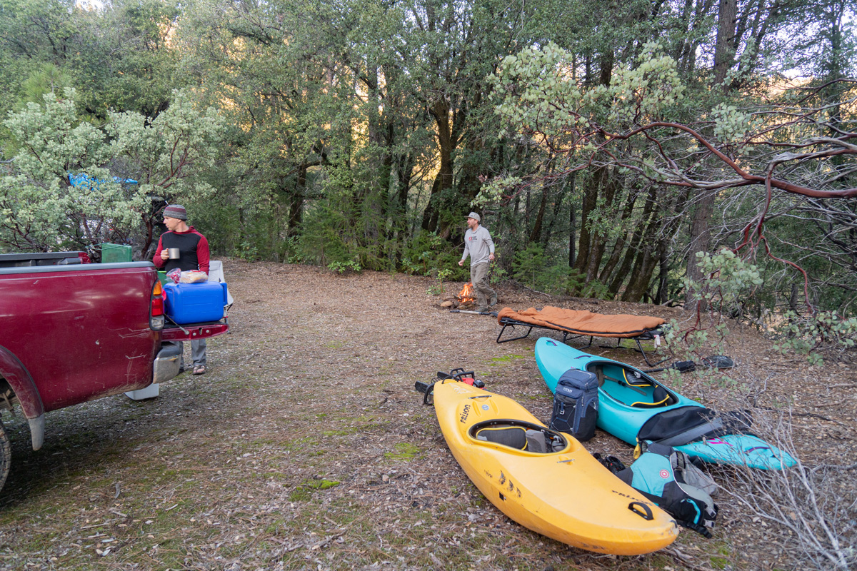
Being early in the year it gets dark early, so we go to bed early and rise at dawn. Shuttle is slow on the rough roads, but we make our way to the bridge and turn left towards Madrone Campground.
Exit drop from the scout.
Nice ledge!
Entrance slide looking good, what would turn out to be the first significant whitewater of the run.
The next two miles upstream from the confluence the burn scar is considerable all the way into Madrone Campground and beyond. Thankfully the toilets survived and we make use of them as we gear up, frost on the ground, a surprise after our 40 plus degree night just 500 feet of elevation lower.
Trever Tanhoff entering the ledge drop.
David Lew comes over the ledge.
Trevor Tanhoff does the same.
David Lew about to enter the confluence pinch. The flow is nearly doubled from river right here.
Trevor Tanhoff works past the pocket in the pinch.
What a wild spot, the author comes through the ledge as the North Fork joins on the viewers left - Trevor Tanhoff photograph.
The author comes through the pinch - Trevor Tanhoff photograph.
The confluence sequence thanks to David Lew.
https://youtu.be/GYVFtti9Gkc
About an hour and a half after putting on, we've made it five miles and change with all the rapids being class II outside the confluence set, and we pass under the bridge utilized during shuttle and enter the canyon zone, soon seeing the 1944-1966 gauge still in place on the left.
Trever Tanhoff enters a nice rapid as David Lew boat scouts.
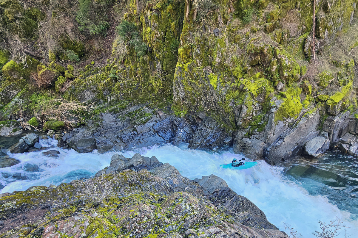
Have we found a classic wilderness style class III run? It certainly feels like it as the scenery is superb and the rapids have nice spacing and big pools.
Looking upstream from the same location.
If this isn't nice, I don't know what is.
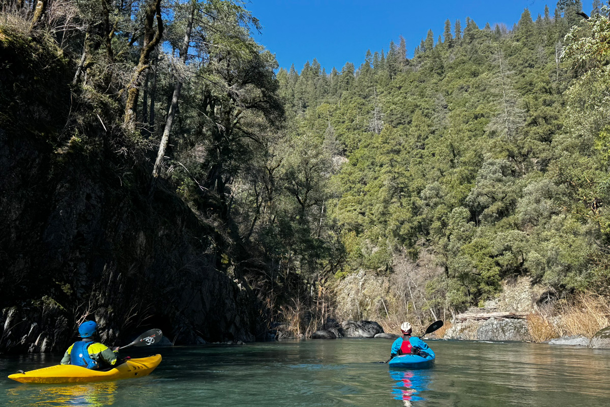
With big grins we continue downstream, the rapids are read and run, although we do catch the occasional eddy to make sure there is no wood, and I burden the group with waiting for a photograph here and there because it would be too easy to kayak through and not get out of our boats.
We can't argue with the lush vegetation and water quality on Sulanharas Creek.
I ask people to wait on this exceptionaly blind rapid but unfortunately none do so there are no paddlers to photograph in this one.
It ends in quite a pinch, the kind you just don't see on a regular basis.
Author exits the pinch, photo thanks to Trevor Tanhoff
Trevor Tanhoff and David Lew make their way downstream.
David Lew runs a nice ledge that was just around the corner.
Trevor Tanhoff does the same.
Salt Creek comes in from the right and makes a nice landmark and lunch spot. We stop here around one in the afternoon and enjoy the balmy weather and views. It's only a half a mile to the start of Lake Shasta, and it feels like this could be a true classic for those looking for a remote adventure delivering class V scenery and logistics but not the danger.
Satiated we head downstream making quick time through some easy rapids, then suddenly a class II entrance leads us to the lip of something larger that is clearly not class II or III just from the gradient. Maybe it's a perfect ten-foot drop into the lake?
Optimism and kayaking go hand in hand. We hop out and the lip and it's ugly. It does drop ten feet, but onto and through a pile of rocks. With double the water it would probably be fine, but at the current water level it looks terrible.
Portaging on the left isn't looking good, it would be a throw and go into water of questionable and then dealing with an undercut wall. We walk back upstream and ferry to river right. Here the throw and go doesn't look too bad, except the water is shallow so we downclimb as low as possible.
It's an interesting puzzle at the end of a straightforward day. Below our portage we run three more rapids below the bathtub ring of Lake Shasta and then float moving water for roughly a mile total from the initial high-water mark of the lake, then paddle about an hour on flat to reach our take out point.
We all agree it was a fun day on the water, a rather absurd amount of driving for what it is, and the portage is a shame because it changes the experience of the run, giving it a large barrier of intimidation for a class III/IV kayaker who may not have that much experience problem solving portages of that nature. On the drive out we see our relative McCloud River gauge had dropped to 125cfs, and one day I'd like to return with the McCloud around 2,500 so that all the rapids can be run, if it's possible to talk anyone into the adventure again.
Put-in: Madrone Campground,Take Out: Lake Shasta just uplake of Didallas Creek. Overall feet per mile is just under 50.