
| Darin McQuoid | Blog | Reviews | Tutorials | River Directory |
Devil's
Postpile of the Middle Fork San Joaquin.
The Beta
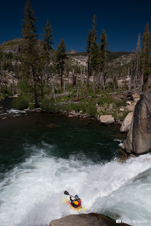
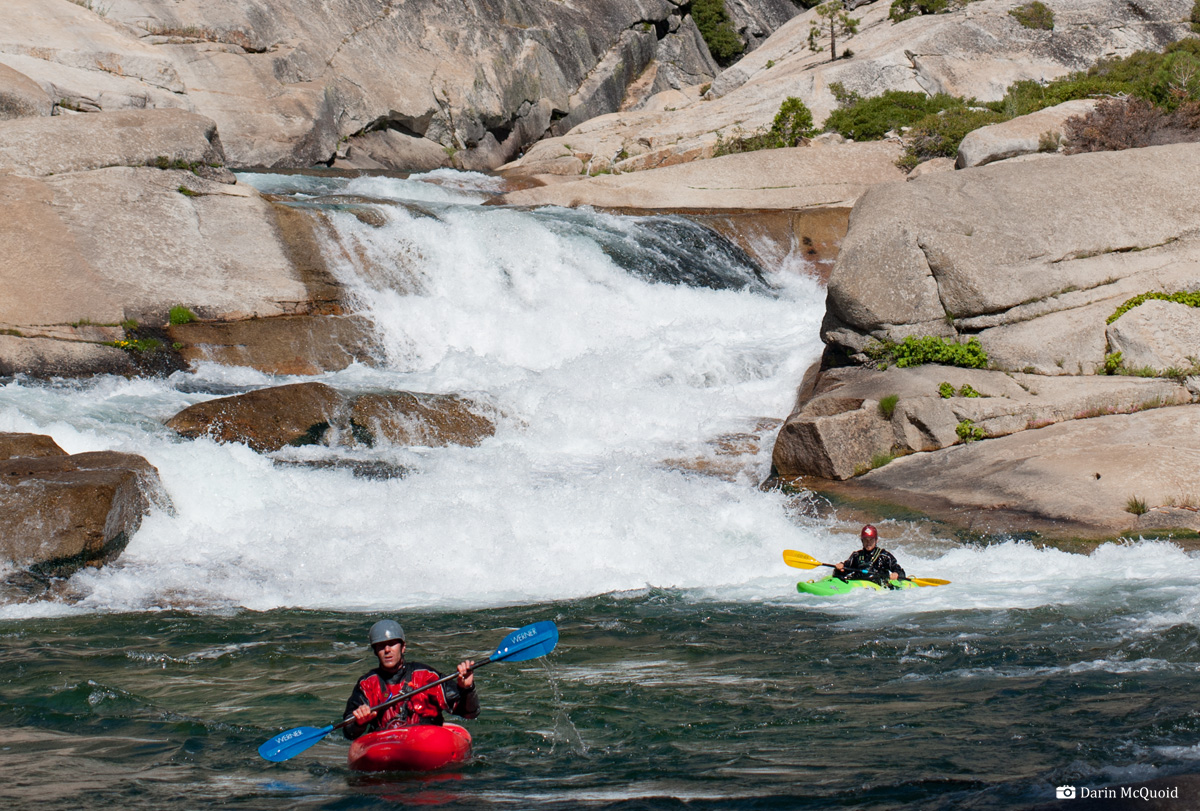
Shannon in the first rapid, 2011.
Nick Murphy, the next horizon with the pyramid rock in the center is Broken Arrow. 2014.
Ben Stookesberry on the final drop of The Crucible, 2008.

The Crucible at low water in November, 2014.
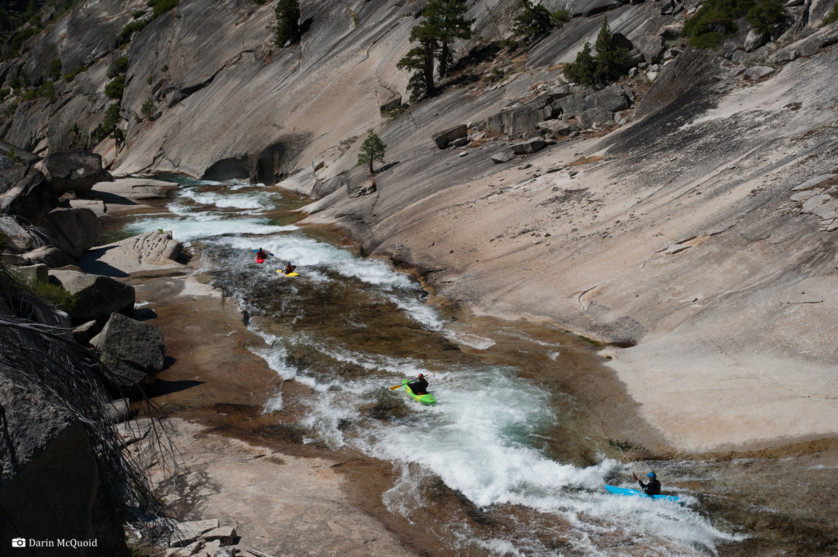
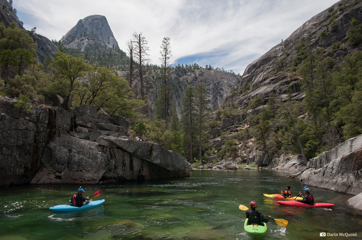
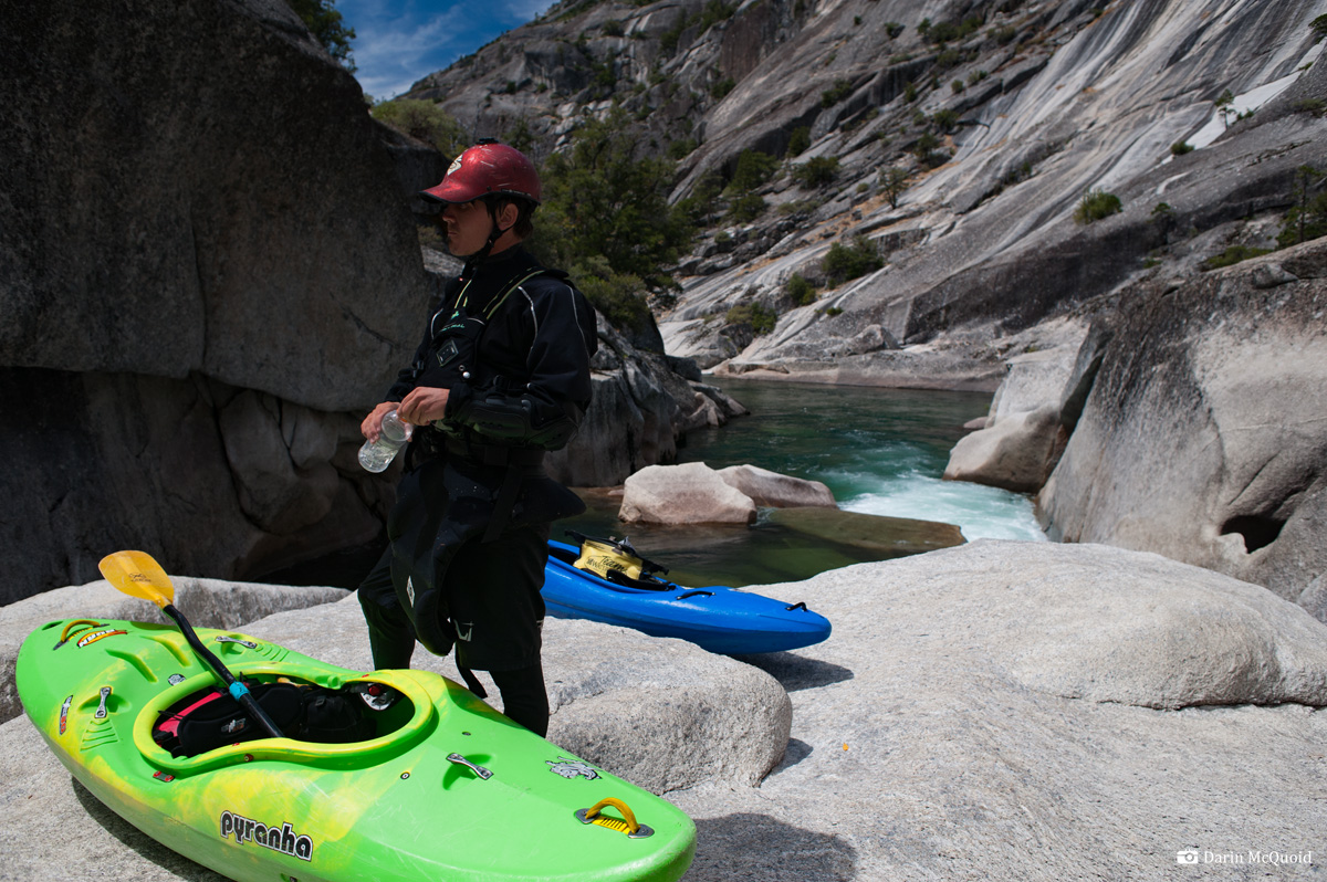
Nick Murphy, Thomas Moore and Middy Tilghman with Granite Creek in the background, 2012.

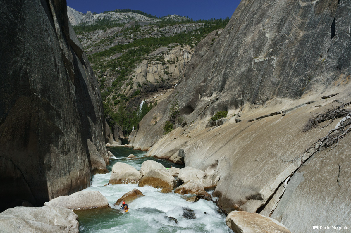
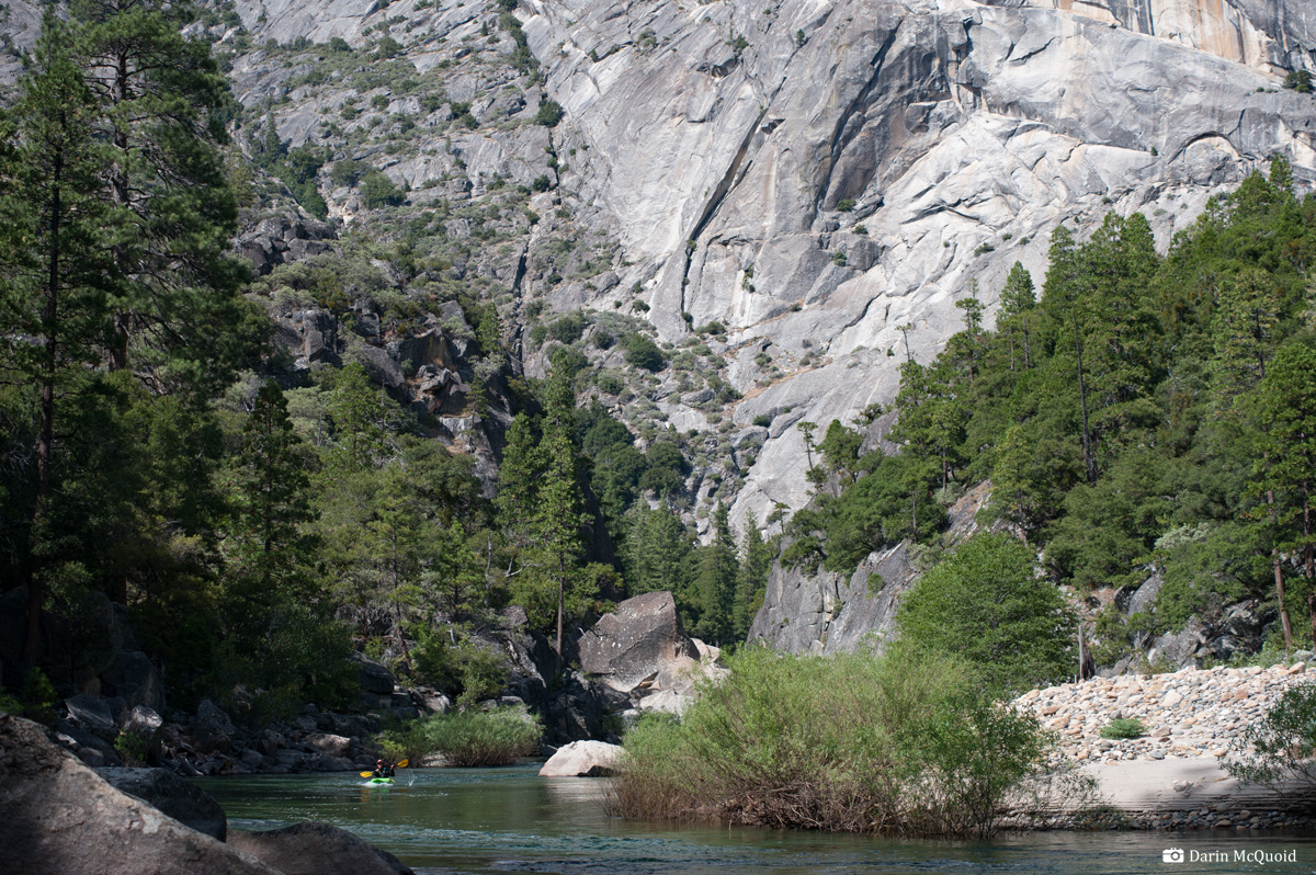
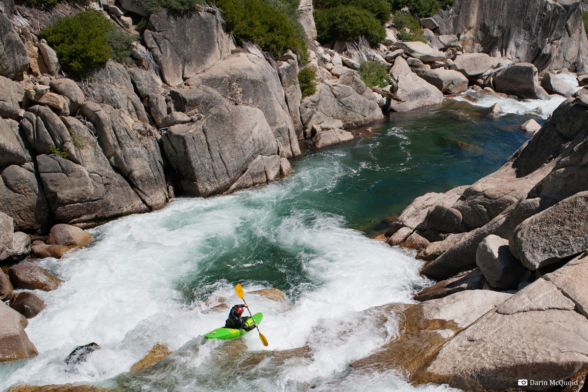
David Maurier enjoying a scenic section below the portage, 2011.
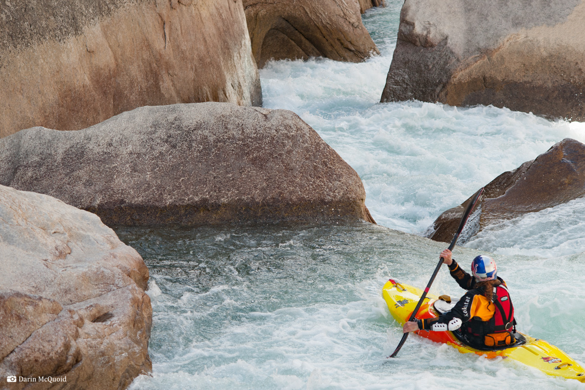
Kevin Smith enjoys a good morning boof.
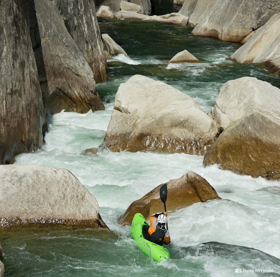
Kevin Smith riding the Bucking Bronco II.
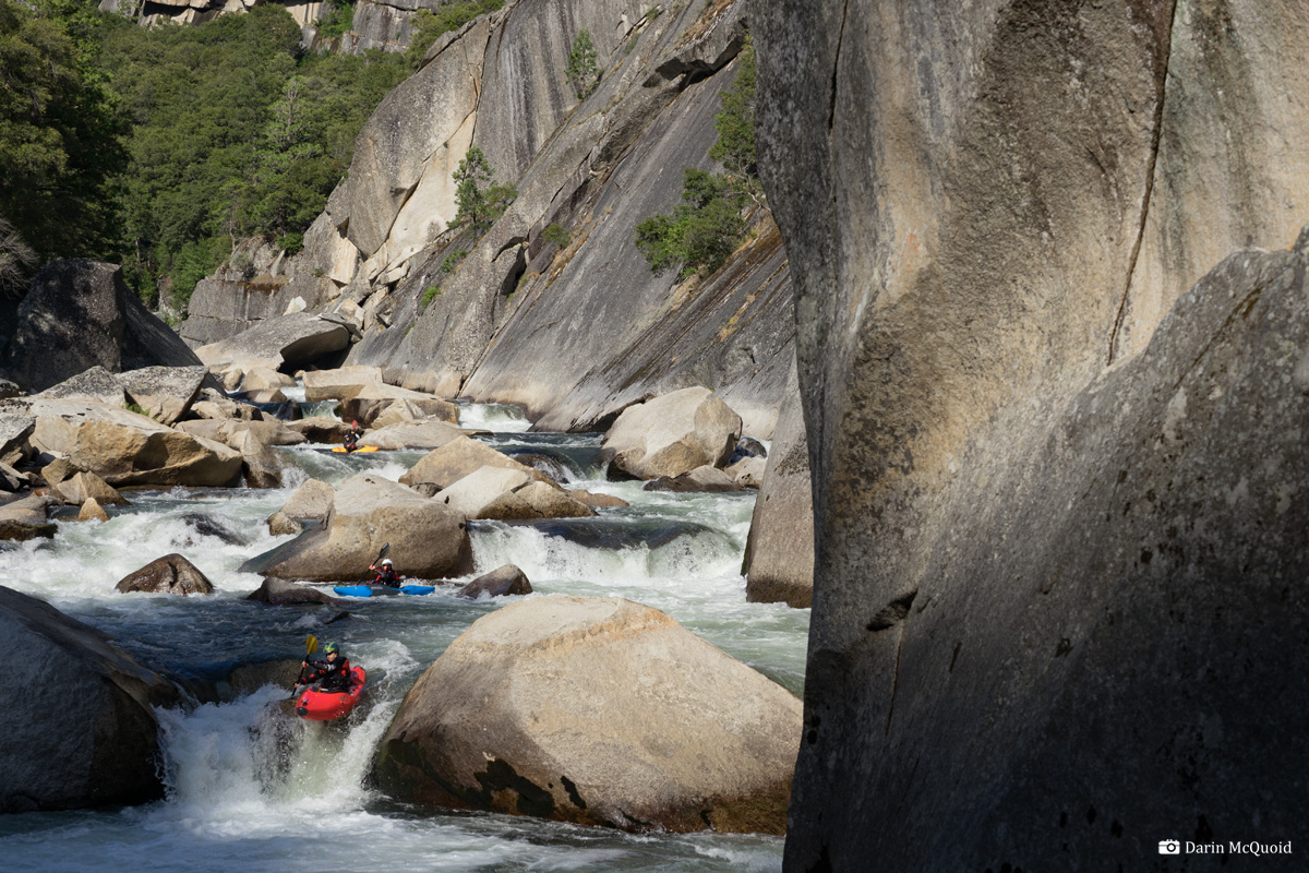
Chris Madden, Tom Janney, Jim Janney in 2014
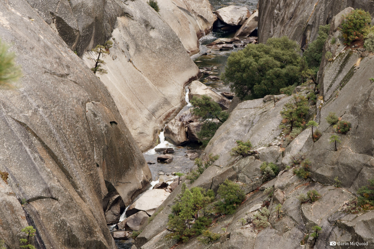
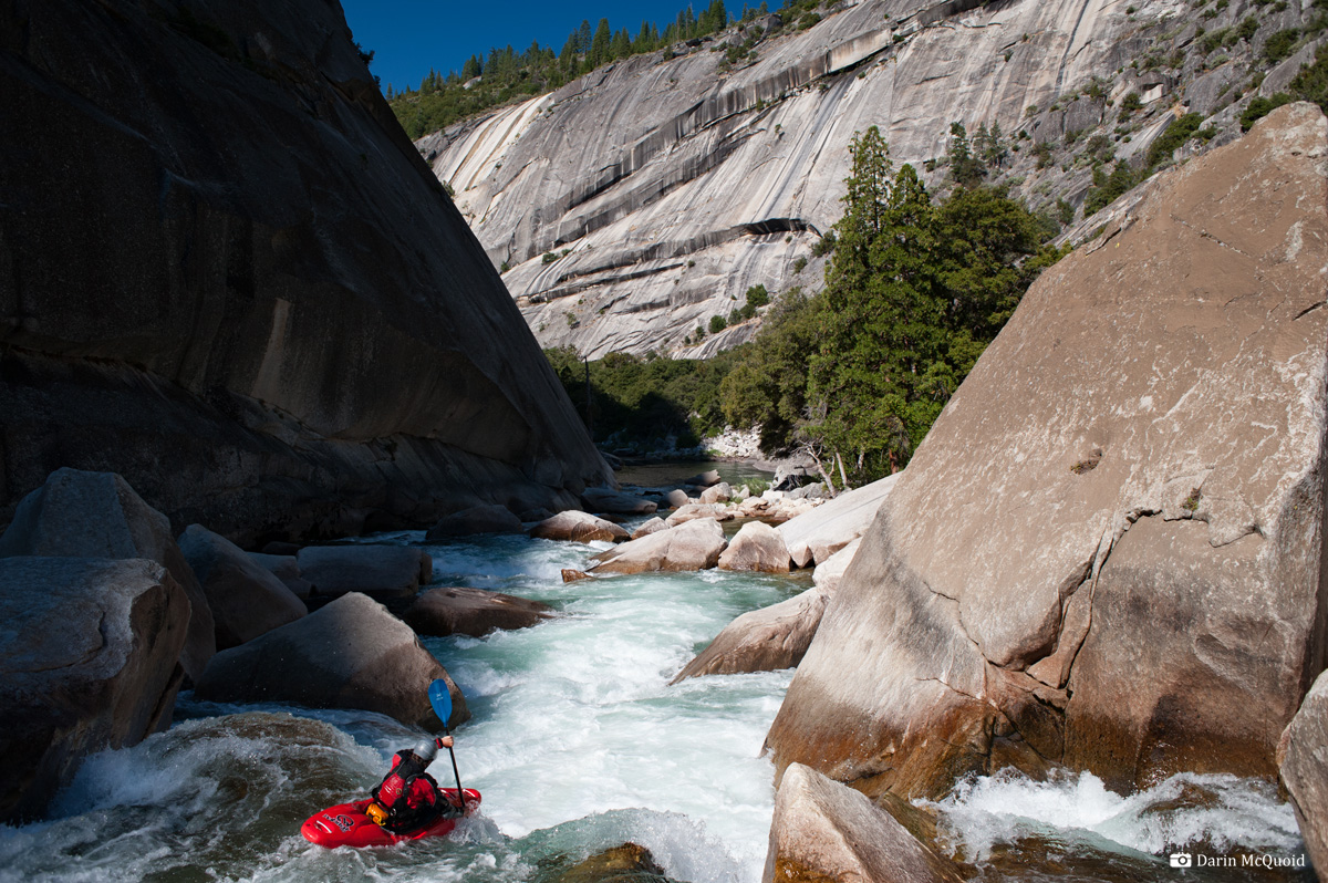
Unrelenting gorges, 2014.
Hope that the lake is full, if not the river contiues at an unrelenting pace. Tom Janney, 2014.
The Beta
The story of my
first trip down the Middle Fork of the San Joaquin is here.
This is going to be
more about the beta, and an excuse to share photographs from various
trips. There are many opinions about sharing beta for rivers
of this caliber. That short answer to me is that knowledge is power.
People will venture into these rivers sooner or later, and
knowing where & how to avoid specific hazards may just save a life
in the long run. Like all things in kayaking, use your own judgment.
Each river is a complex puzzle, this one especially so. These are just
tips for the puzzle, not a how to guide.
Personally I break the Middle Fork San Joaquin into three main sections; The steep, creek like section from put-in through boof-a-matic, the "easier" middle section which has some large rapids hidden in it, and then from Cassidy Crossing to take out.
The Devil's Postpile run on the Middle Fork San Joaquin is the most dangerous of the classic High Sierra rivers. It's also simply grueling because there are few "granite sidewalk" portages. Most are over massive rock piles and require repeated raising and lowering of boats. From top to bottom the river has an incredible amount of sieves and hazards. It has mandatory rapids with moves around or above sieves, sometimes several in a row. It's also the most remote, there is no riverside trail, and in only two places during the twenty six mile journey do trails cross the river. All that said, it's also one of the most rewarding journeys because of its remote, challenging and beautiful nature. This is not the river to go into if you think you might be up to it. If a paddler had a breakdown on the San Joaquin there are many places where the only option is to pull it together and run more rapids to exit a gorge.
It is also a river that can be made much safer by going with people who know it, but that's not always possible and is why I'm writing this. The hazards are still there, but sometimes just knowing where to walk can save some extreme exposure.
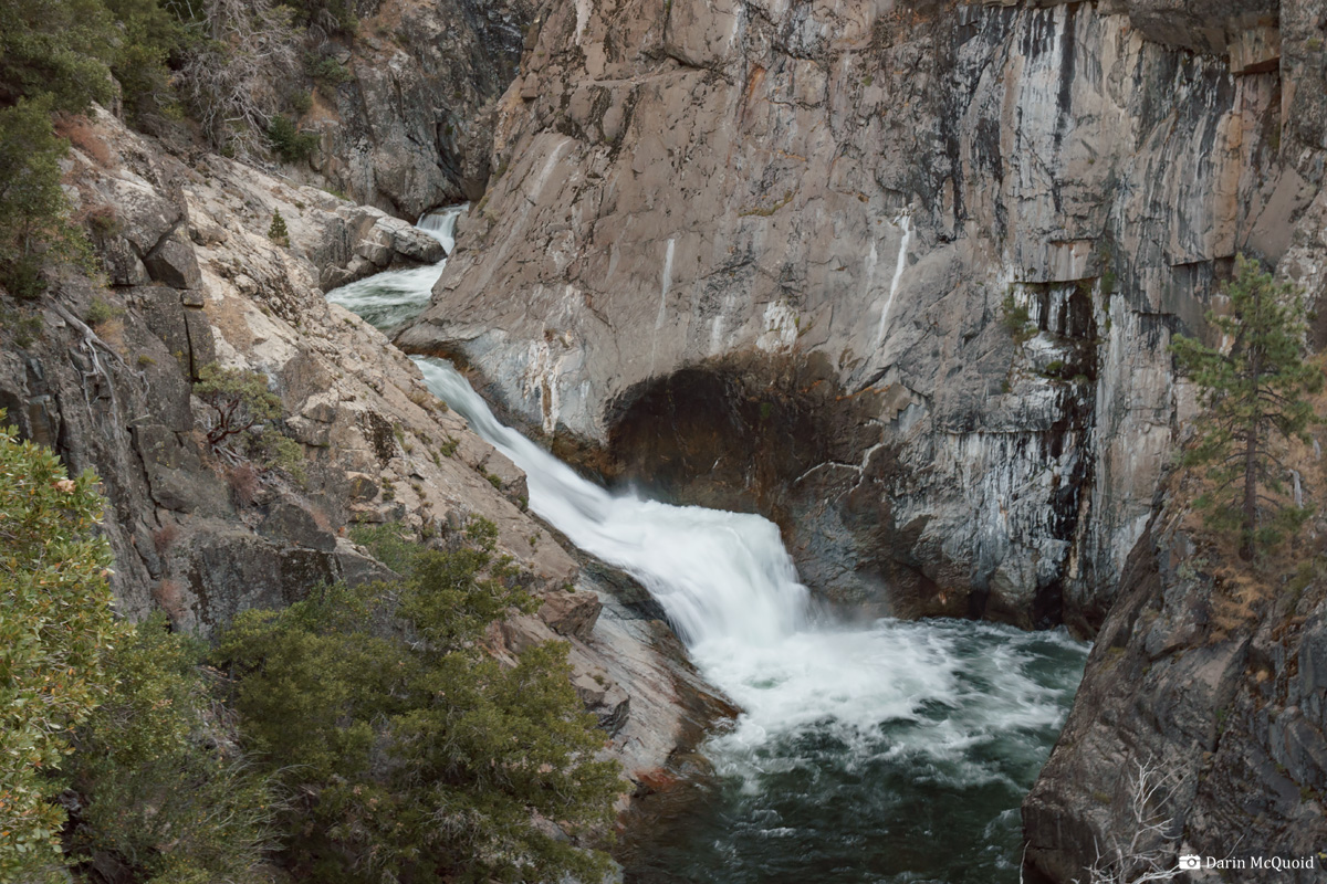
The run starts just below the Devil's Postpile National Monument. Park at the Reds Meadow trailhead and hike ~1 mile downstream to Rainbow Falls and put in below. Beware of at least one mandatory wood portage in the first mile. The first notable rapid is "Lower Falls". If the entrance looks good, flows are going to be high downstream. If it looks questionable because of a barely covered sieve in the entrance flows are a bit more medium. A quick partial portage is possible and the safest option.
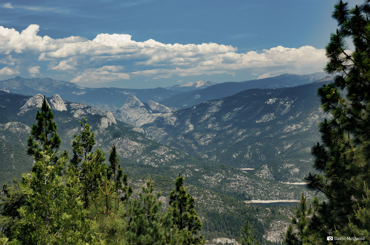
Middy Tilghman entering one of five.One can see from put in to take out; Mammoth Mountain to Mammoth Pool
Personally I break the Middle Fork San Joaquin into three main sections; The steep, creek like section from put-in through boof-a-matic, the "easier" middle section which has some large rapids hidden in it, and then from Cassidy Crossing to take out.
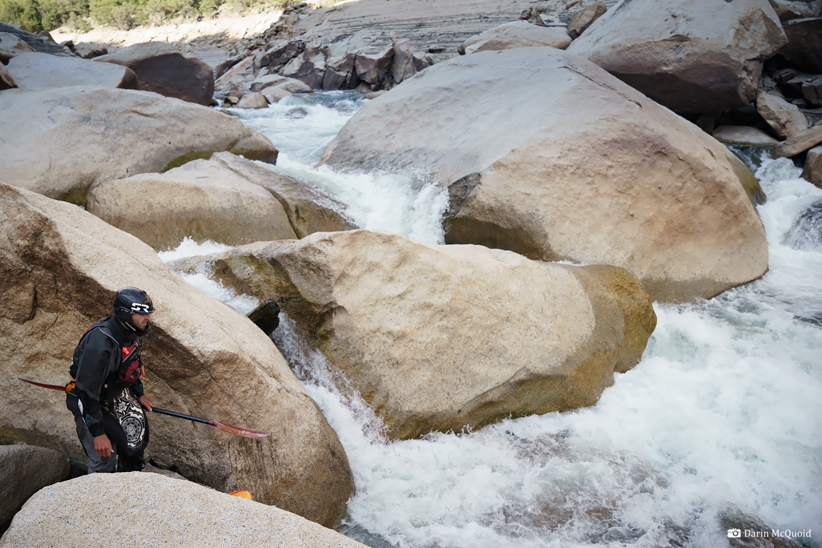
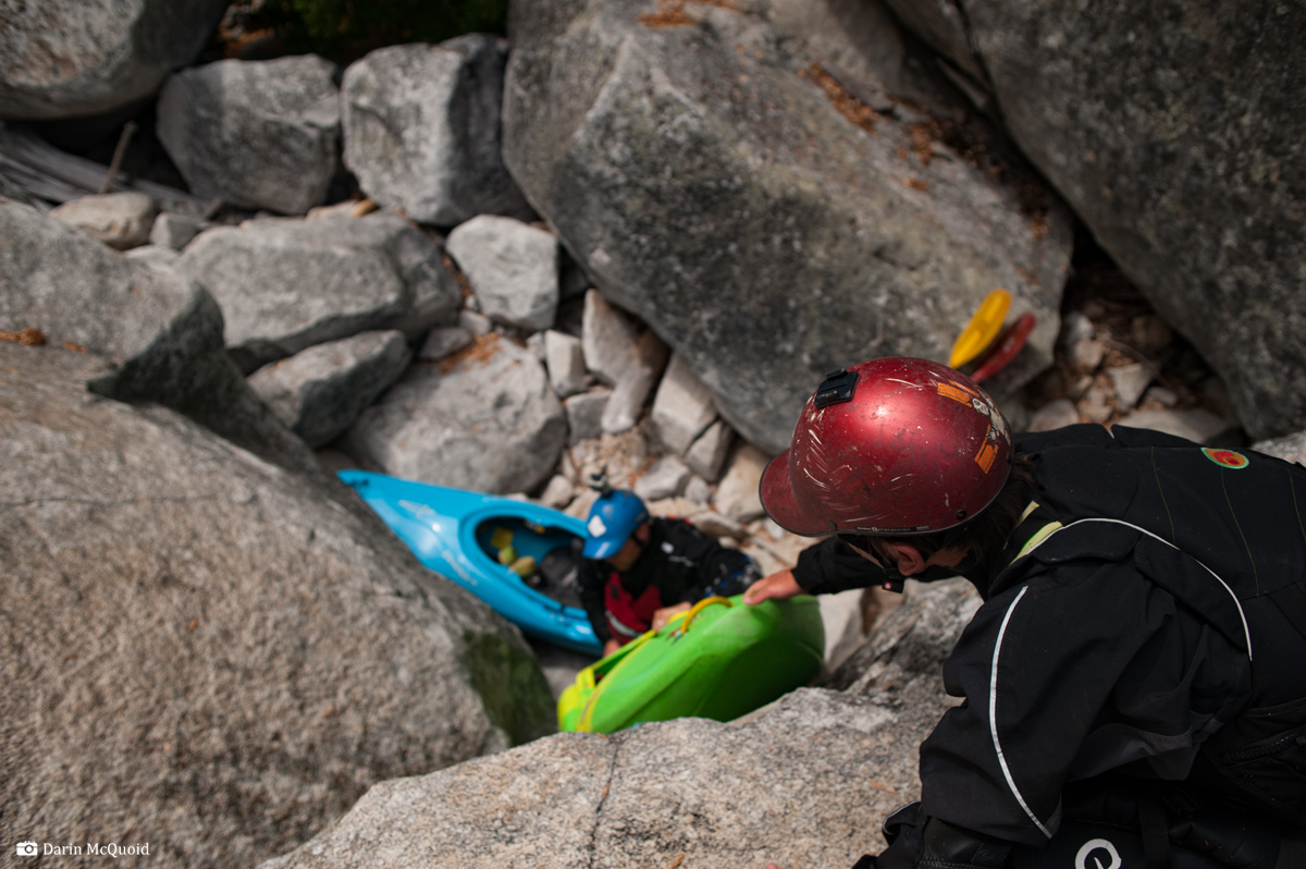
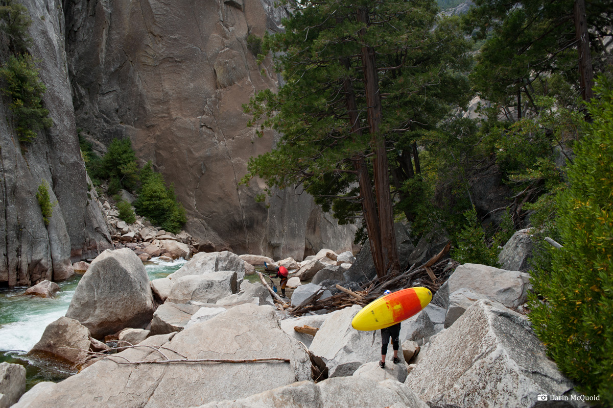
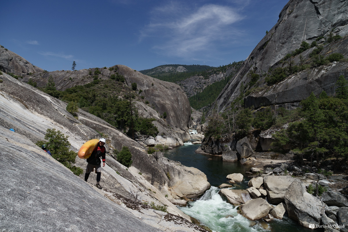
A typical portage on the San
Joaquin.
The Devil's Postpile run on the Middle Fork San Joaquin is the most dangerous of the classic High Sierra rivers. It's also simply grueling because there are few "granite sidewalk" portages. Most are over massive rock piles and require repeated raising and lowering of boats. From top to bottom the river has an incredible amount of sieves and hazards. It has mandatory rapids with moves around or above sieves, sometimes several in a row. It's also the most remote, there is no riverside trail, and in only two places during the twenty six mile journey do trails cross the river. All that said, it's also one of the most rewarding journeys because of its remote, challenging and beautiful nature. This is not the river to go into if you think you might be up to it. If a paddler had a breakdown on the San Joaquin there are many places where the only option is to pull it together and run more rapids to exit a gorge.
It is also a river that can be made much safer by going with people who know it, but that's not always possible and is why I'm writing this. The hazards are still there, but sometimes just knowing where to walk can save some extreme exposure.
The run starts just below the Devil's Postpile National Monument. Park at the Reds Meadow trailhead and hike ~1 mile downstream to Rainbow Falls and put in below. Beware of at least one mandatory wood portage in the first mile. The first notable rapid is "Lower Falls". If the entrance looks good, flows are going to be high downstream. If it looks questionable because of a barely covered sieve in the entrance flows are a bit more medium. A quick partial portage is possible and the safest option.
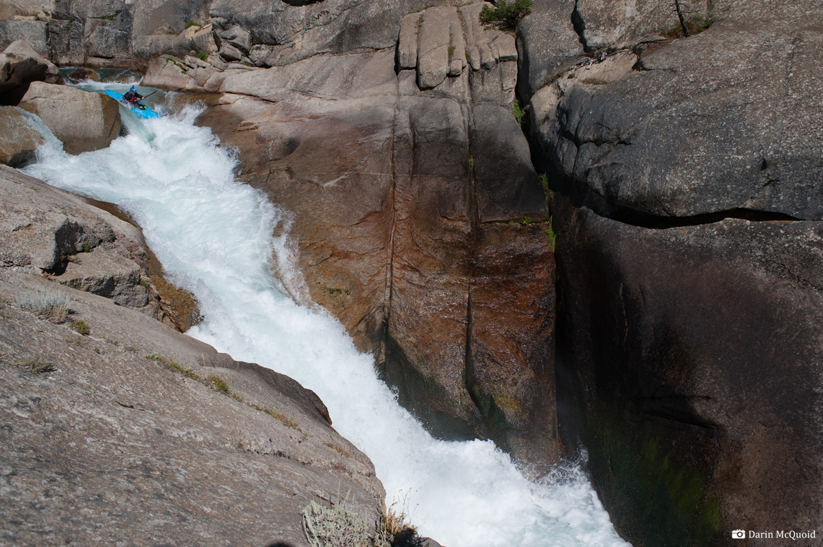
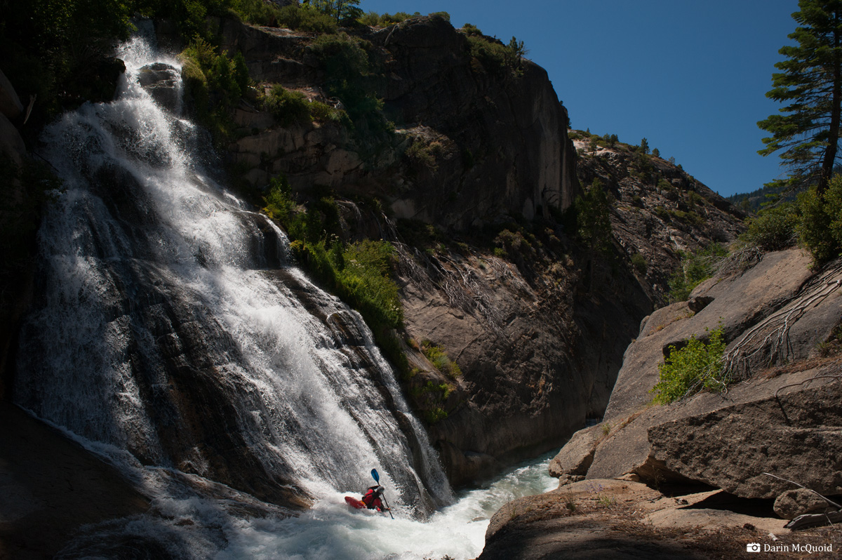
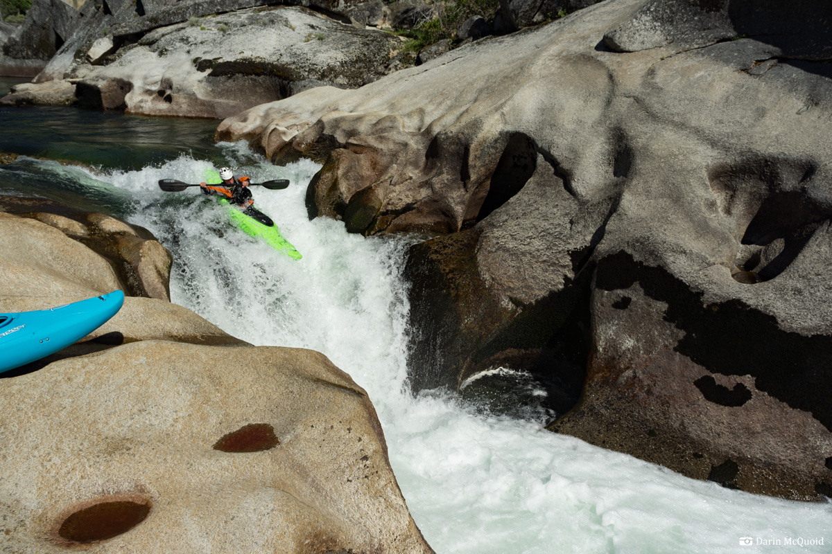
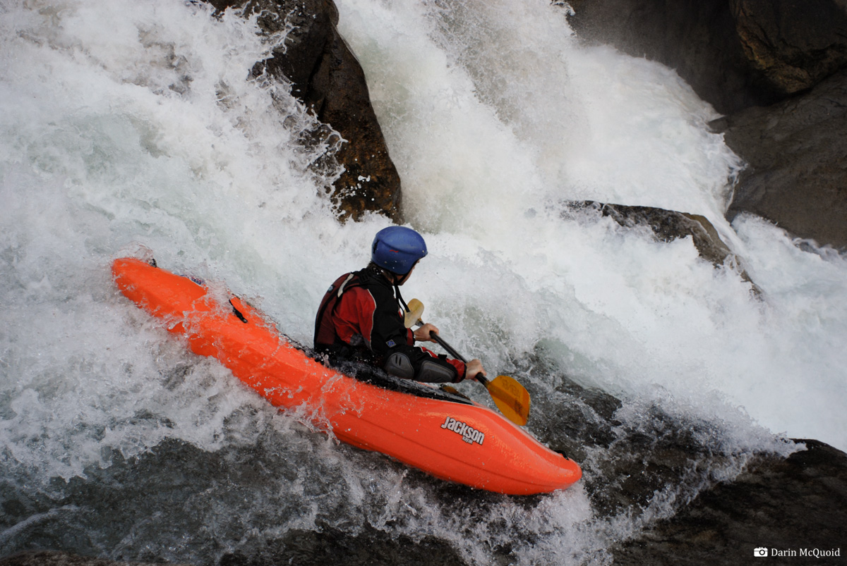
Shannon Carroll runs Lower
Falls at medium flows, 2011.
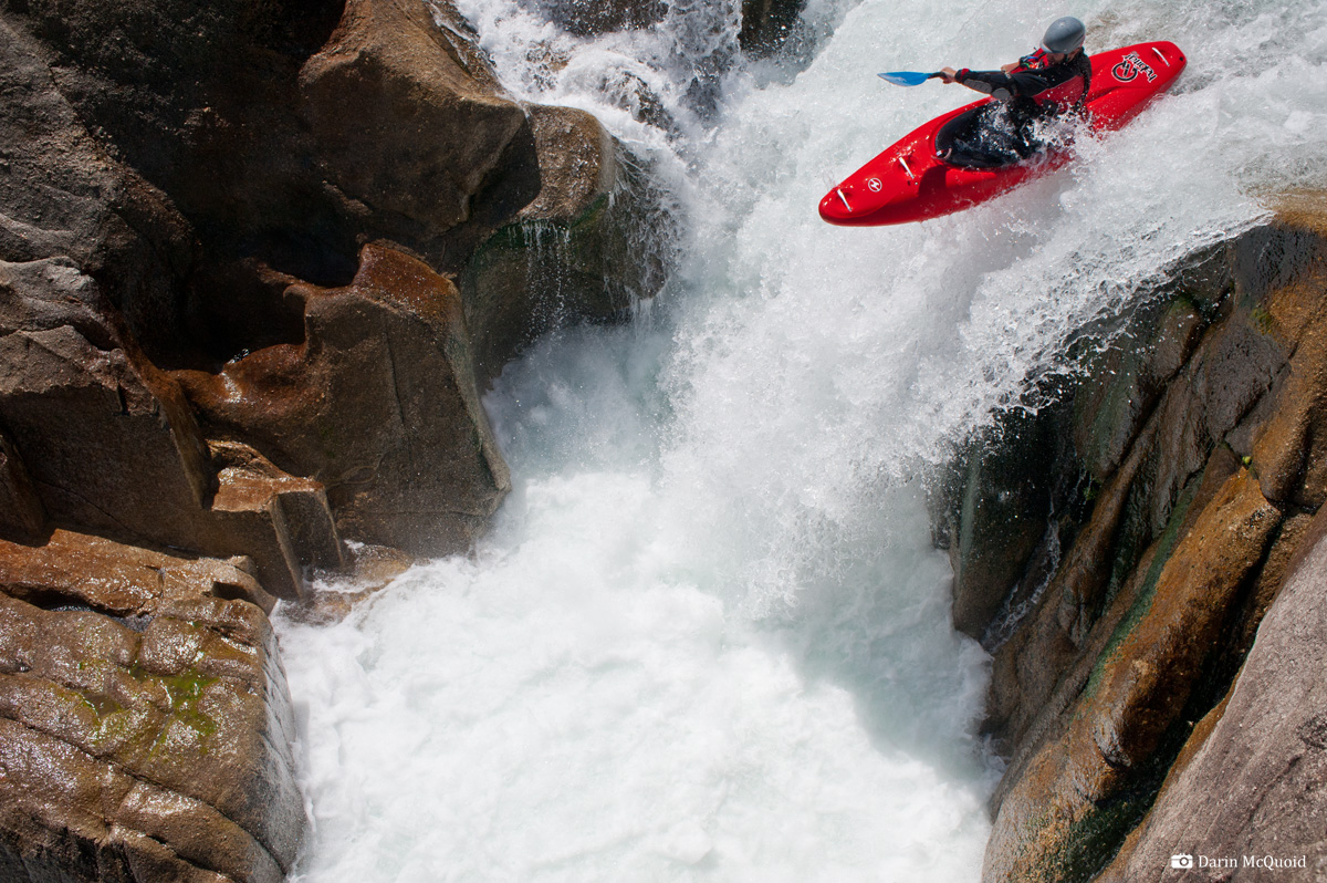
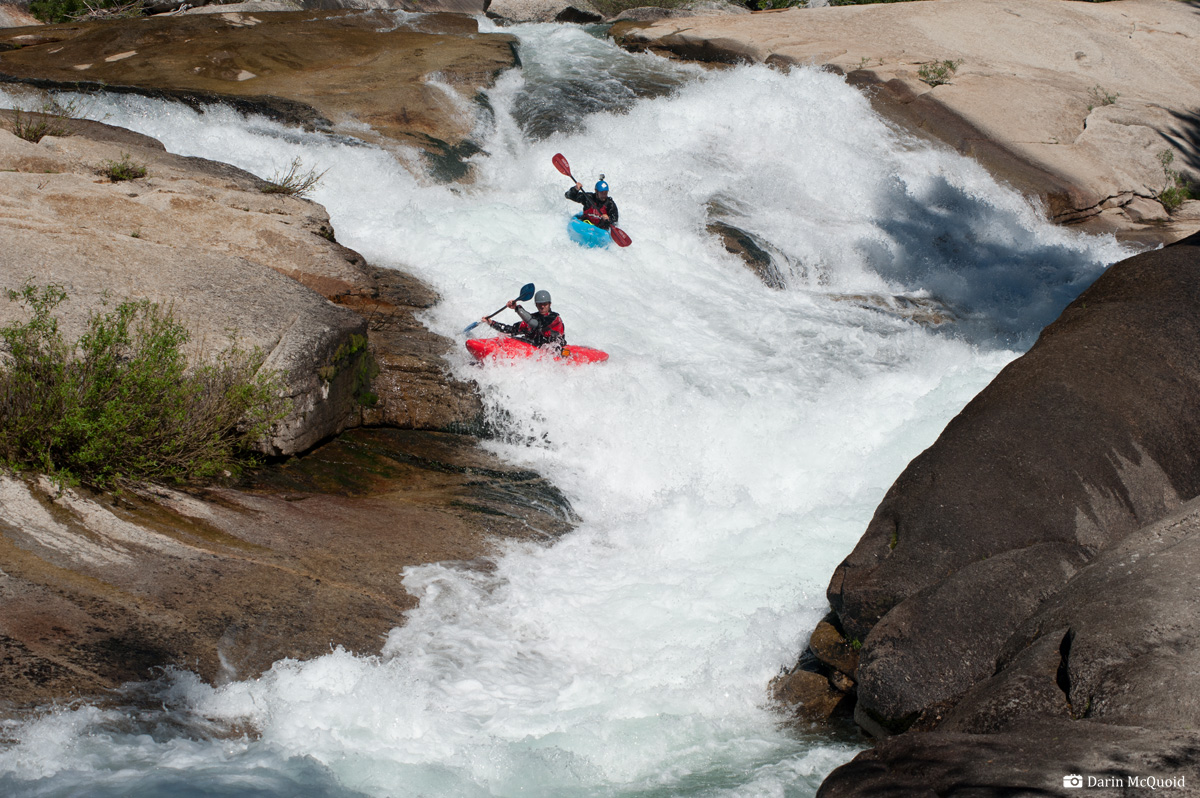
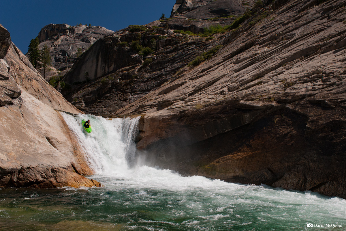
The first triple drop needs no explanation, it's unique and one of the best boofs in the world. Kevin Smith reaps the rewards. 2011
David Maurier exits the same, 2011.
Shannon Carroll exits, 2011.
We walked right since the drop after that one is a portage too. There is a bit of read and run with the occasional scout/portage before the next bedrock drop. This slide goes better at low flows, the bottom is very retentive at medium or higher water levels. It's possible to make a fairly quick portage on the right and run the next fun slide.
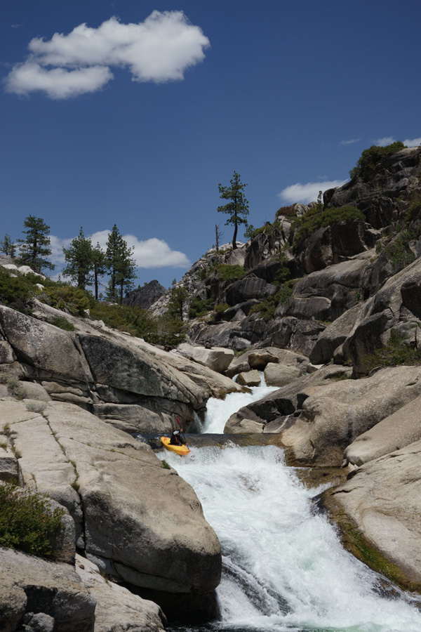
Thomas Moore drops in, 2011.
Tom Janney below the pothole slide in 2014.
Shannon Carroll getting busy, 2011.
The slide sequence, Phil Boyer 2017.
Just after Clay Wrights Drop is a nice slide, that ends in a possible camp site if you are having a slow first day. This site is not ideal because the next day will be quite long.
Kevin Smith and Dave Maurier below the slide, 2011.
This is the midst of one of the best sections of river, as there are several fun slides.
Kevin Smith and Thomas Moore, 2011.
One of the most memorable, a hundred yard long slide into a five to ten foot falls, 2011.
Shannon Carroll exits the final exit rapid of boof-a-matic gorge.
Camping just below boof-a-matic is a nice way to spend an evening.

There is a nice campsite on river right after the next rapid, it even has a little cell phone service.
Balloon Dome and the calm before the storm. There is a very nice campsite on the left below this.
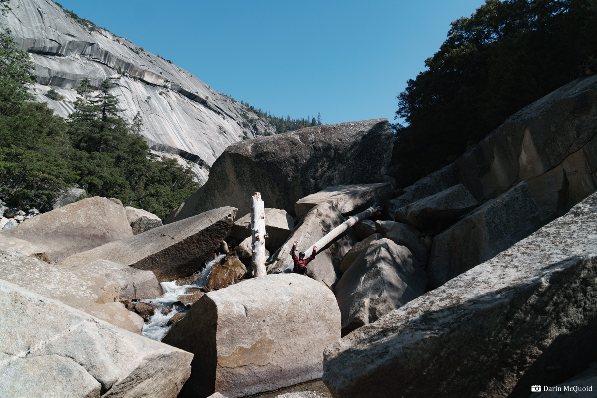
Making the last long portage into the Crucible. Start high on the right and finish at river level.
For quite some
time groups would put-on, run through Lower Falls and start portaging
on the right as the river sieved out. Our group did this on my first
trip and tried to run as much as possible. This is not the thing to do.
When you see the river drop into a gorge below Lower Falls, get out on
the left about 100 yards above the gorge and start portaging on the
left. In general you just try to stay on the ridge line closest to the
river. Doing this only requires a few spots of thick bushwhacking.
Eventually the ridge closest to the river will end in a ravine. If you
follow this ravine to the river you'll be at the first good drop. It
takes about an hour and a half to portage on the left, and three on the
right.
Google
Maps Marker for the Triple Drop Put-In.The first triple drop needs no explanation, it's unique and one of the best boofs in the world. Kevin Smith reaps the rewards. 2011
David Maurier exits the same, 2011.
Shannon Carroll exits, 2011.
Beware
of the next
rapid, in 2011 a boat was pinned in a sieve on the left, and another
the following year. It doesn't treat them well. Nick Murphey 2012.
We walked right since the drop after that one is a portage too. There is a bit of read and run with the occasional scout/portage before the next bedrock drop. This slide goes better at low flows, the bottom is very retentive at medium or higher water levels. It's possible to make a fairly quick portage on the right and run the next fun slide.
Thomas Moore drops in, 2011.
Tom Janney below the pothole slide in 2014.
Below the two
slides is a portage at medium or higher flows. Mr Hilikie's line in the
Seven Rivers dvd is very memorable as he barely escapes the pothole. To
run the next slide, seal launch in on either side. The right is a
little harder for everyone, while the left is easier except for the
last person who gets stuck with a rather tough seal launch at the lip
of the slide. Scout this whole gorge because the next three rapids are
walled in. We went left, and left. After the three distinct horizon
lines is "Clay Wrights Drop". It looks mellow but has a nasty sieve in
the middle. It's an easy portage on the left and worth doing.
Shannon Carroll getting busy, 2011.
The slide sequence, Phil Boyer 2017.
Just after Clay Wrights Drop is a nice slide, that ends in a possible camp site if you are having a slow first day. This site is not ideal because the next day will be quite long.
Kevin Smith and Dave Maurier below the slide, 2011.
This is the midst of one of the best sections of river, as there are several fun slides.
Kevin Smith and Thomas Moore, 2011.
One of the most memorable, a hundred yard long slide into a five to ten foot falls, 2011.
Below the long
slide get out on the left. It can be a little tricky to get out if
flows are high, but the next rapid falls ten to fifteen feet onto rock.
Make a quick portage on the left by passing boats, it's very slippery
to get down into the pothole. The horizon after the portage is blind,
go far right. Then scout far right for the twin falls. The twin falls
is one of the most amazing places I've ever been. Two tributaries come
in to join the river, each on their own waterfall, but at the top and
bottom of one rapid. I don't know if this one changed over the years,
but on my first trip we all walked it. It's a tough, brushy portage
high on the right. At medium flows most the group ran it, and one
wished they had. It goes a lot better than it looks.
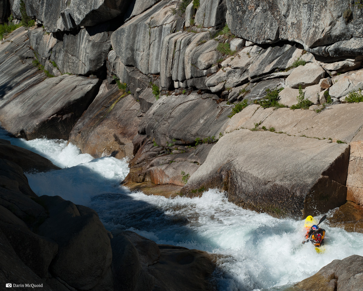
Kevin Smith makes final move of the twin falls rapid, 2011.
Below twin falls you are locked into running two significant but fun rapids. The first is a slide where it's possible eddy on the left above. Run the slide on the far left, then stay right for the final drop and end of the first gorge.
David Maurier exits the gorge, 2011.
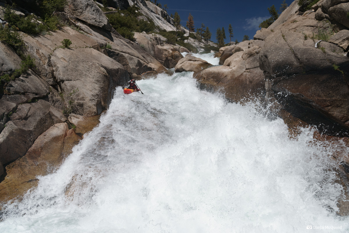
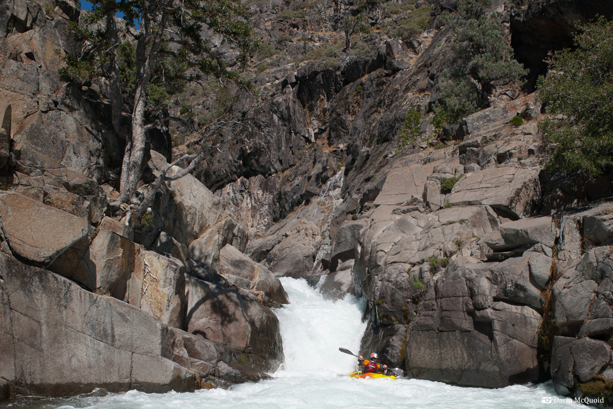
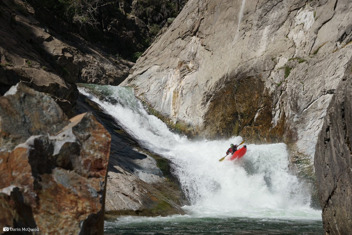
Boof-a-matic falls. Mandatory and very, very fun. Thomas Moore. 2011
Chris Madden, 2014.
Below twin falls you are locked into running two significant but fun rapids. The first is a slide where it's possible eddy on the left above. Run the slide on the far left, then stay right for the final drop and end of the first gorge.
David Maurier exits the gorge, 2011.
River character
changes below the twenty footer. The granite bedrock gives way to
boulder gardens, and most are not granite. The majority are read and
run, but stay on your toes as this is an unstable region and the rapids
can and do change yearly. The further you get into the boulder gardens, the
steeper the gorge walls get. Eventually comes a portage on the left,
which is followed by two mandatory rapids both run left of center,
before the highlight: boof-a-matic.
Boof-a-matic falls. Mandatory and very, very fun. Thomas Moore. 2011
Chris Madden, 2014.
There is a
large pool below boof-a-matic, then the river goes over a small slide.
The next two rapids after the slide are significant, tough to portage
and tough to scout. Go right on the first one, about four feet off the
wall. Boof hard and fast, the hole is sticky. If you get past the first
hole, go slightly left of center through another hole (try not to get
stuck in the eddy on the left) and go left for the final ledge. There
are eddies on both sides above the final drop, which has caused a
number of swims (the drop not the eddies :) The secret of the final
drop is running the first tier
on the far right, staying up on a pillow then boofing around a hole.
Follow this with another boof over the second larger ledge.
Shannon Carroll exits the final exit rapid of boof-a-matic gorge.
Camping just below boof-a-matic is a nice way to spend an evening.
There is a nice campsite on river right after the next rapid, it even has a little cell phone service.
Significant inflow is added with the addition of Fish Creek and the
North Fork San Joaquin, and the next
half day the river is more read and run, except for two portages, both
have been run but are very marginal. Both are portaged on the right.
Most of it is open to Cassidy Crossing with the exception of the "Class IV/Big Water Gorge" which is walled in and has a few mandatory rapids in it. The bridge at Cassidy Crossing is obvious and marks the start of the Crucible section. Although not particularly long, about two miles, this section can take most to all of a day. W̶a̶t̶c̶h̶ ̶o̶u̶t̶ ̶f̶o̶r̶ ̶a̶n̶ ̶u̶n̶d̶e̶r̶c̶u̶t̶ ̶o̶n̶ ̶t̶h̶e̶ ̶r̶i̶g̶h̶t̶ ̶w̶a̶l̶l̶ ̶o̶f̶ ̶t̶h̶e̶ ̶f̶i̶r̶s̶t̶ ̶r̶a̶p̶i̶d̶ ̶b̶e̶l̶o̶w̶ ̶t̶h̶e̶ ̶b̶r̶i̶d̶g̶e̶.̶ ̶T̶h̶e̶ ̶s̶e̶c̶o̶n̶d̶ ̶r̶a̶p̶i̶d̶ ̶i̶s̶ ̶p̶o̶r̶t̶a̶g̶e̶d̶ ̶o̶n̶ ̶t̶h̶e̶ ̶l̶e̶f̶t̶.̶ ̶I̶t̶'̶s̶ ̶t̶e̶c̶h̶n̶i̶c̶a̶l̶ ̶a̶n̶d̶ ̶r̶e̶q̶u̶i̶r̶e̶s̶ ̶c̶l̶i̶m̶b̶i̶n̶g̶ ̶o̶v̶e̶r̶ ̶a̶ ̶n̶a̶s̶t̶y̶ ̶e̶x̶p̶o̶s̶e̶d̶ ̶s̶i̶e̶v̶e̶.̶ Significant change as of 2017, it can no longer be portaged at river level, one must take out out at Cassidy Bridge, use the trail on river right to climb for five minutes and then find an obscure fishing trail to go through a notch and put below the first two rapids of the gorge, just a short ways above this rarely run rapid.
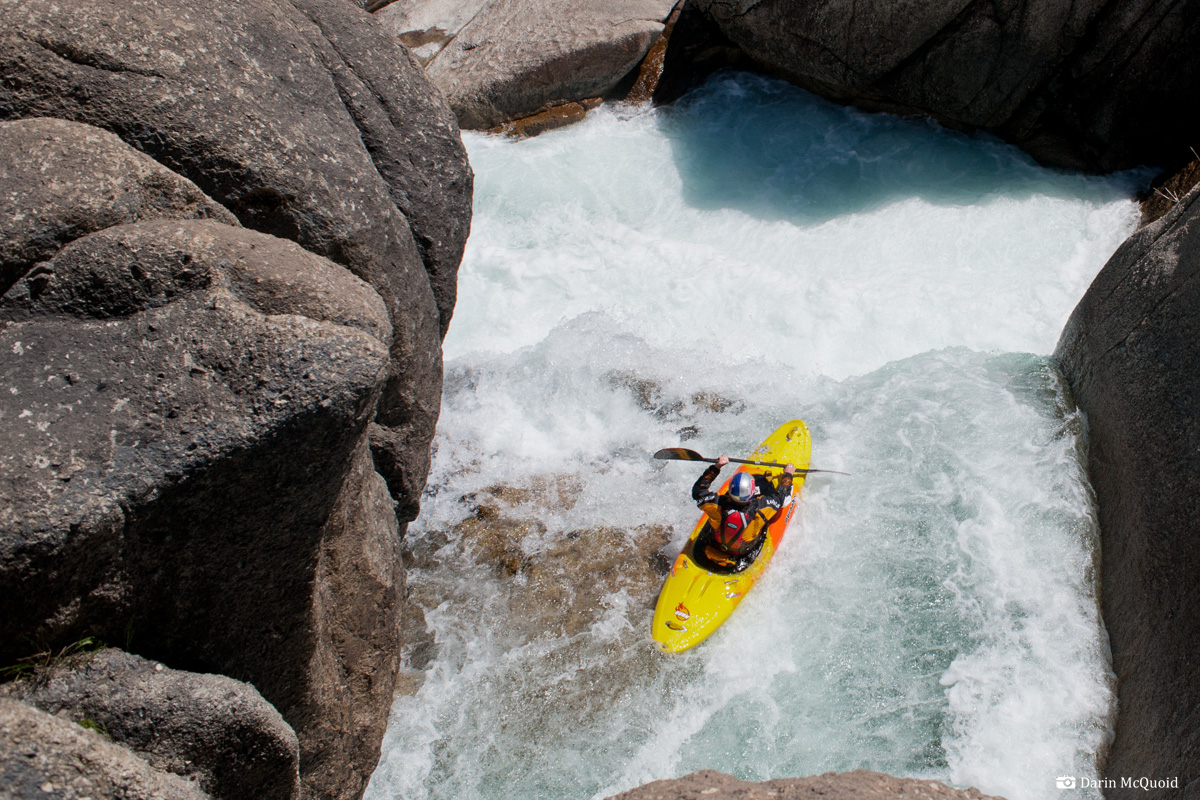
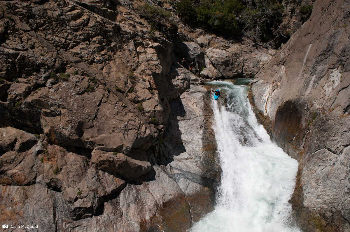
Nick Murphey, 2012.
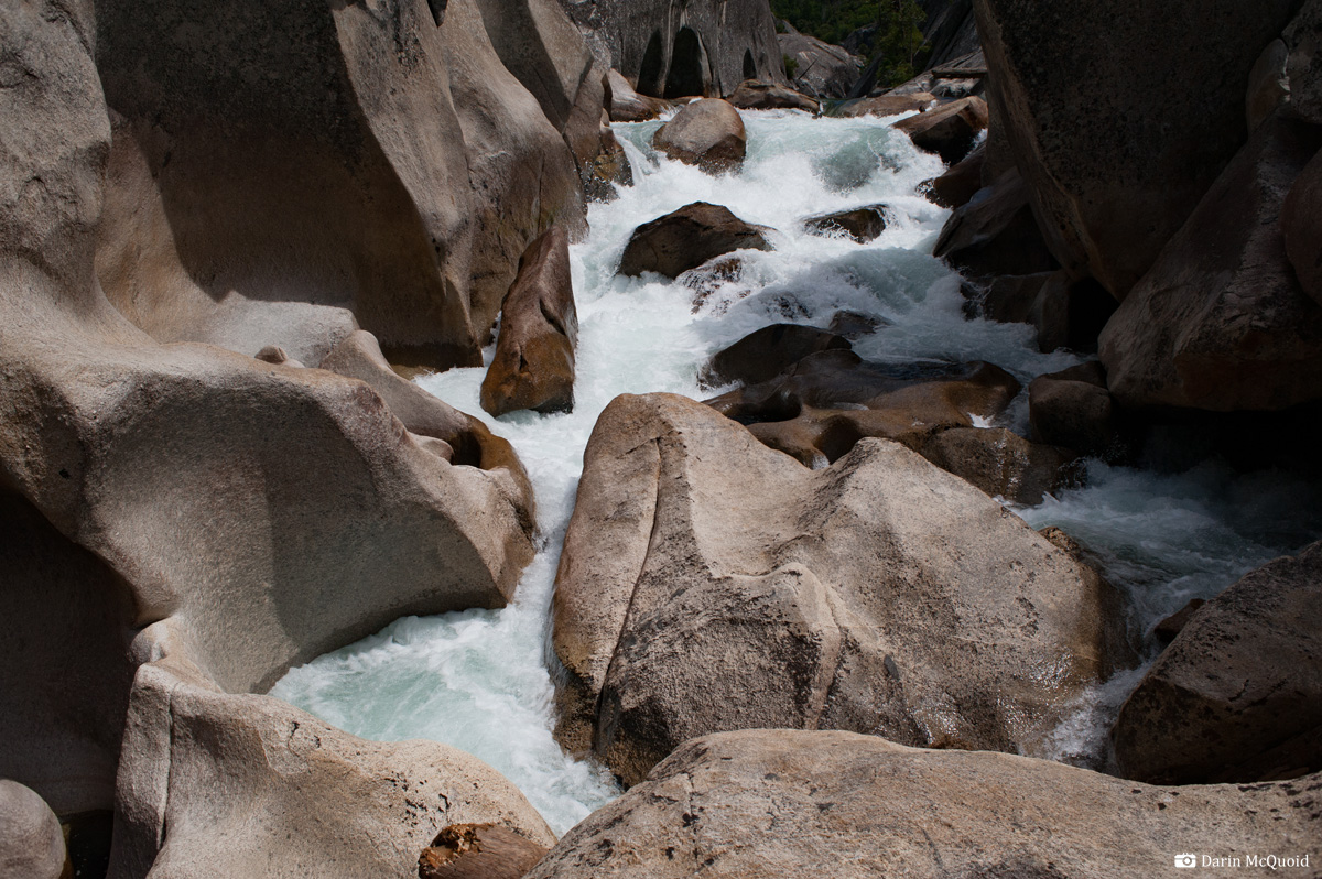
Continue into the Crucible, scouting & portaging when necessary. One of the good things about the San Joaquin is you won't have to debate about portages, because most of them just go underground. The one pictured below absorbs all the energy of the rapid, and ends in a flat green pool.
David Maurier at the base of the above portage.
This one has been run at very low flows and it still resulted in a swim.

Scout where appropriate as always,
there
are sieves and some large holes in this section.
Jim Janney somewhere in the middle, 2014.
Most of it is open to Cassidy Crossing with the exception of the "Class IV/Big Water Gorge" which is walled in and has a few mandatory rapids in it. The bridge at Cassidy Crossing is obvious and marks the start of the Crucible section. Although not particularly long, about two miles, this section can take most to all of a day. W̶a̶t̶c̶h̶ ̶o̶u̶t̶ ̶f̶o̶r̶ ̶a̶n̶ ̶u̶n̶d̶e̶r̶c̶u̶t̶ ̶o̶n̶ ̶t̶h̶e̶ ̶r̶i̶g̶h̶t̶ ̶w̶a̶l̶l̶ ̶o̶f̶ ̶t̶h̶e̶ ̶f̶i̶r̶s̶t̶ ̶r̶a̶p̶i̶d̶ ̶b̶e̶l̶o̶w̶ ̶t̶h̶e̶ ̶b̶r̶i̶d̶g̶e̶.̶ ̶T̶h̶e̶ ̶s̶e̶c̶o̶n̶d̶ ̶r̶a̶p̶i̶d̶ ̶i̶s̶ ̶p̶o̶r̶t̶a̶g̶e̶d̶ ̶o̶n̶ ̶t̶h̶e̶ ̶l̶e̶f̶t̶.̶ ̶I̶t̶'̶s̶ ̶t̶e̶c̶h̶n̶i̶c̶a̶l̶ ̶a̶n̶d̶ ̶r̶e̶q̶u̶i̶r̶e̶s̶ ̶c̶l̶i̶m̶b̶i̶n̶g̶ ̶o̶v̶e̶r̶ ̶a̶ ̶n̶a̶s̶t̶y̶ ̶e̶x̶p̶o̶s̶e̶d̶ ̶s̶i̶e̶v̶e̶.̶ Significant change as of 2017, it can no longer be portaged at river level, one must take out out at Cassidy Bridge, use the trail on river right to climb for five minutes and then find an obscure fishing trail to go through a notch and put below the first two rapids of the gorge, just a short ways above this rarely run rapid.
Nick Murphey, 2012.
Continue into the Crucible, scouting & portaging when necessary. One of the good things about the San Joaquin is you won't have to debate about portages, because most of them just go underground. The one pictured below absorbs all the energy of the rapid, and ends in a flat green pool.
David Maurier at the base of the above portage.
Where the river
turns left
in the above image is the crux portage of the Crucible. There is a
run-able V-V+ rapid there, but it's best to start the portage above it
(hard to get out once run). From above the portage looks much easier on
the left, and initially it is. Unfortunately the left portage turns
into a thin ledge high above a sieve, where a mistake would likely end
in fatality. My first two times we made the mistake of
portaging on the left, it was terrifying. Thankfully Kevin Smith has
found a good portage
on the right. It's tougher at the beginning, requiring a steep friction
climb up a mini granite ridge, and then a long exposed traverse. Thankfully the
footing is good, and the portage route gets better rather than worse
the more you continue downstream.
The next drop is portaged on the right too. Rope boats 20' up to the obvious ledge to portage the whole thing, or portage near river level for half the rapid and run the bottom half. It's quite sievy and it doesn't take much longer to just portage the whole thing.
Jim Janney just past the scariest part of the portage.
The next drop is portaged on the right too. Rope boats 20' up to the obvious ledge to portage the whole thing, or portage near river level for half the rapid and run the bottom half. It's quite sievy and it doesn't take much longer to just portage the whole thing.
Thomas Moore running the last corner that often gets portaged (mostly because it's hard to put back in). 2014
Balloon Dome and the calm before the storm. There is a very nice campsite on the left below this.
Making the last long portage into the Crucible. Start high on the right and finish at river level.
The Crucible
proper, at least that part that you kayak, is a
series of five rapids. The first can be portaged on the right but it
takes rope work and is time consuming. The others have apparently been
portaged, but it would take considerable rock climbing skill and is
"blitzed" in six hours...
The second rapid, Broken Arrow, is the first of the "no scout" rapids in the Crucible (although it can be scouted with delicate friction climbing on the right). There is really no need to scout it, the line is right of center moving slightly left. It's just a fun, arrow-head shaped slide. Err to the right rather than the left, which would be nasty.
There are two options for the next two rapids. Take the right channels: Drive up the right wall and around a hole, go fast down a hallway and go fast into the bottom hole. Roll up and paddle hard to your left to avoid a sieve in the final rapid. This route gets more dangerous as flows increase.
The other option for the rapids is the center channels, which look bad from in your boat. Run the center channel charging hard to the right. A lot of water goes into a sieve on the left, but a pillow keeps you away from it. Then go down right and boof the second drop. The beauty of this line is that the second drop lands you in the eddy away from the sieve in the final rapid. Over the years we've found that this route goes better than expected at lower flows too.
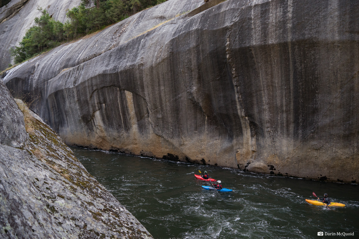
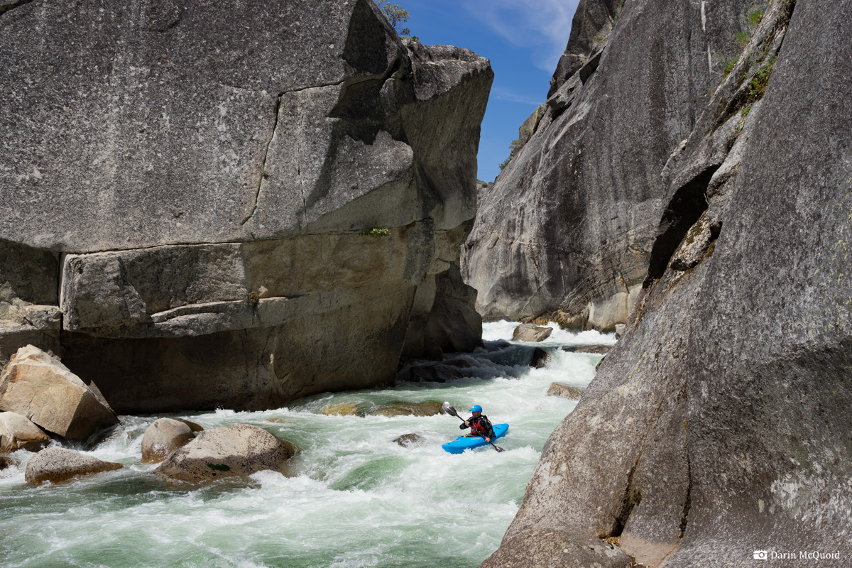
Shannon in the first rapid, 2011.
Nick Murphy, the next horizon with the pyramid rock in the center is Broken Arrow. 2014.
Ben Stookesberry on the final drop of The Crucible, 2008.
The Crucible at low water in November, 2014.
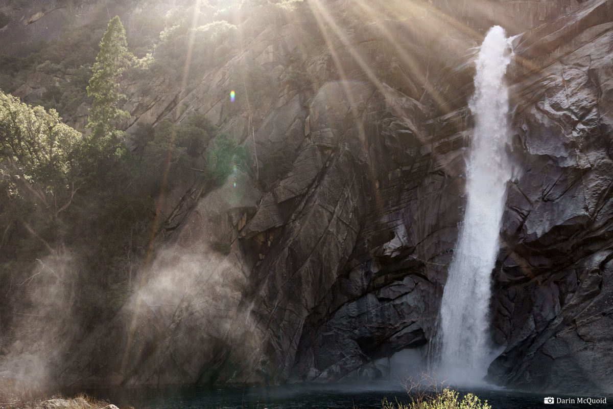
The
beautiful
Shangri-La waterfall of Granite Creek is worth spending a few minutes
at if you have the time. There is a nice campsite just downstream, with
use trail access. On the water again, take out on the right
above the next gorge. Portage through the saddle between the gorge dome
and the real canyon wall for fifteen to twenty minutes, putting into
the pool below.
Nick Murphy, Thomas Moore and Middy Tilghman with Granite Creek in the background, 2012.
David Maurier enjoying a scenic section below the portage, 2011.
Stay
on your
toes for the next horizon line below the portage. Get out early on the
right to scout, as there is a tempting eddy at the lip on the right,
but it commits you to the more dubious right line or make a portage
back upstream to get over to the better left line. The second horizon
after the portage can be portaged on the left, or run on the right. One
trip we had a terrible incident at said rapid, so treat it with
caution, the kayak was still in the same spot in November.
Scout and run one or two more rapids before making a portage or two around sieves. There is a very nice campsite hidden away on the right in here. Google Maps Marker. Below this campsite is a fantastic boof on the right, followed by some read and run out of the rapid.
So good until it's not, the San Joaquin is a river to be treated with respect.
Scout and run one or two more rapids before making a portage or two around sieves. There is a very nice campsite hidden away on the right in here. Google Maps Marker. Below this campsite is a fantastic boof on the right, followed by some read and run out of the rapid.
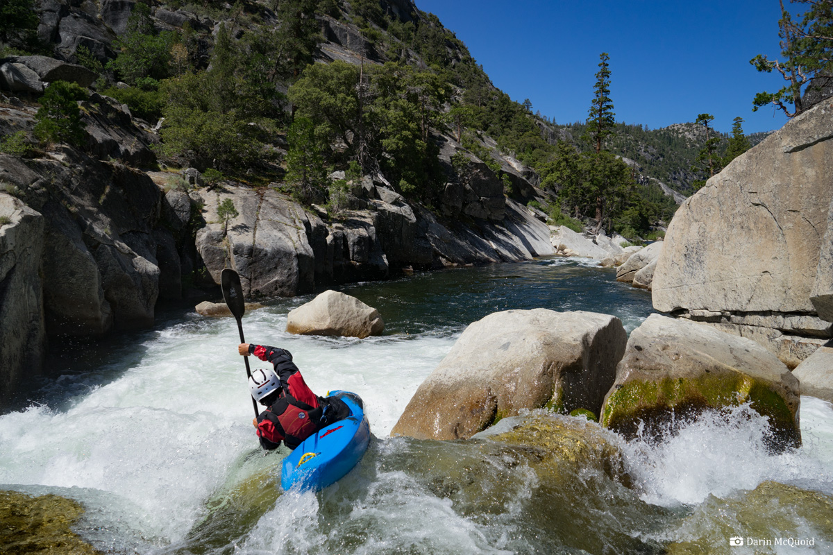
Kevin Smith enjoys a good morning boof.
Soon another portage
comes up, which can be done on the left or the right. Paddle down the
pool below the portage and get out on the left to portage again. You really earn it on these portages.
Phil Boyer, 2017.
Both of these portages are through rock piles, but the river goes underground so there is no need to scout. After the second portage seal launch into the class IV run out. Run the last rapid on the far left and enjoy the calm of the South Fork San Joaquin confluence. Below the confluence there are only three more mandatory portages, several rapids that look like they'd be portages but actually go just fine. Scout when necessary, there are some fantastic rapids in this section. The last portage ends just above the lakes high water line. Normally at least one rapid is uncovered below the high water line, beware of a sieve on the bottom right of it.
Matt Thomas, "flying squirrel", September 2008.

Phil Boyer, 2017.
Both of these portages are through rock piles, but the river goes underground so there is no need to scout. After the second portage seal launch into the class IV run out. Run the last rapid on the far left and enjoy the calm of the South Fork San Joaquin confluence. Below the confluence there are only three more mandatory portages, several rapids that look like they'd be portages but actually go just fine. Scout when necessary, there are some fantastic rapids in this section. The last portage ends just above the lakes high water line. Normally at least one rapid is uncovered below the high water line, beware of a sieve on the bottom right of it.
Ben Stookesberry "flying squirrel", July 2008.
Matt Thomas, "flying squirrel", September 2008.
Kevin Smith riding the Bucking Bronco II.
Chris Madden, Tom Janney, Jim Janney in 2014
Unrelenting gorges, 2014.
Hope that the lake is full, if not the river contiues at an unrelenting pace. Tom Janney, 2014.
Take out is at
Mammoth Pool Reservoir. The best way to get there from Oakhurst:
Highway 41 North. Right on Bass Lake Road. Left on Road 07/Beasore
Road. Stay on Beasore Road until you see Jone's Store on the left. It's
the only building for miles. If you need food get some here, the owners
are awesome. Just past Jone's Store make the next available right turn
on a paved road. Follow this road (staying to the right on the paved
road) until it T's into Minarets Road. Turn left on Minarets Road, and
in a few minutes take a right on Mammoth Pool Road. Stay left at the Y
and you'll end up at the boat ramp.
Some maps show a dirt road to a campground further up the reservoir. It doesn't exist, so ignore it.
Put-in: Retrace your steps to Highway 41. Turn right (North) and head into Yosemite. Stay North on Highway 41 until a right turn onto Highway 120 East. Follow 120 East until it T's into Highway 395. Take a right on Hwy 395 South and follow it to Mammoth Springs. Follow signs to Devil's Postpile and Reds Meadow.
Flow range is roughly 100-200 on the gauge, but a lot of tributaries come in below it. All images taken with medium flows of 160-180 on the San Joaquin at the Devil's Postpile gauge.