
| Darin McQuoid | Blog | Reviews | Tutorials | River Directory |
North
Fork of the Cosumnes - V
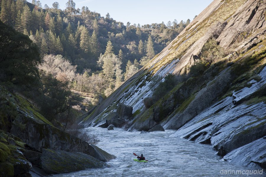
I first saw the put-in for this section while driving to the Upper Middle Cosumnes. Crossing over the river on Buck's Bar Road, the downstream gorge is alluring. A little bit of inquiry steered me away however. The put-in is also a popular climbing destination, and all reports told of sieve pile rapids in a gorge. One winter day however, I got a call from Taylor Cavin and decided it was time to talk my boat for a hike through the low Sierra. Will Pruett decided to join in the boat walking too.
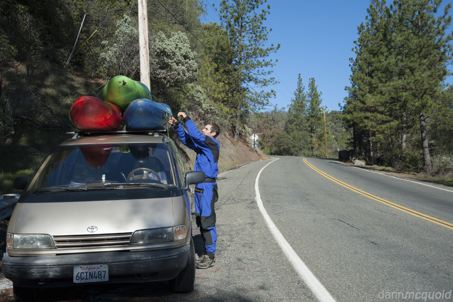
Will
Pruett unloads my grocery getter at the same parking area used to
access climbing.
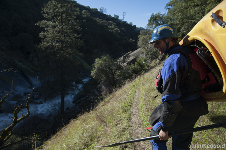
We
started by hiking down the climbers trail for a few minutes before
getting our first glimpse of the river. The view was more promising
than expected, a big rapid that looked full on but not out of question.
Adhering to prudence we set our boats down and embarked on an extended
scout. Unfortunately the good rapid ended without much of a pool, and
the next drop didn't look quite as classic.
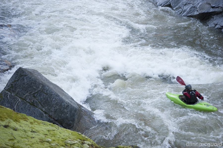
Eddying out looked like too dubious of a move for out taste, added to the fact that egressing from the gorge would take rope work. With darkness setting in just after four in the afternoon speed was of the essence, so we wasted no time in sticking to the trail and moving downstream.
With a total of fifteen minutes of hiking behind us, we officially put in below the rapid pictured above and ran a quick rapid. Only to be forced out of our boats on the next corner. Another ten to fifteen minute walk and things looked a lot better. The river opened up momentarily and gradient eased up for a quarter mile. Then once again the river delved into walls of granite and got steep.
Deep in the gorge we knew we were committed to figuring things out at river level, and after five major rapids no one was complaining when the gorge opened up. A brief flat led us to the lip of another gorge. I was starting to wonder about how we were doing on time, if the river continued at this pace we'd have no chance of escaping before dark. I noted that on the left there were ATV tracks coming down an old road near the river. At least there was some access. This gorge was considerably tighter than the last, but only contained one big rapid. A rather junky rapid, with of course the requisite sieves. It had a decent line and we all ran it together, dealing with some chaos coming through the crux move but all escaping unscathed.
In typical Cosumnes fashion, after the gorge was over the river flattened out. Thankfully it was not as willow infested as the Middle Fork of the Cosumnes is in its lower reaches and we made quick time through a mile or two of class II before the pace picked up again. Although there were no gorge walls, the river picked up into a nice mile long section of IV with one notably larger IV+ which was a nice surprise and not at all typical of the watershed. As the sunlight left the river, so did anything resembling warm air, so we put our heads down and paddled to take out.
Glad to be done with the mission in daylight, we all agreed that it was fun but certainly not classic. It's the kind of run that's worth doing once to see somewhere new.
We used the Cosumnes at Mt Aukum Gauge and had around 500cfs.
Take out: From Sacramento: 50 East to Highway 49 South. Follow Highway 49 until a hard turn left on Union Mine Road. We drove up Union Mine until we could see the river, then asked a local land owner if we could park our car on the side of the road.
Put in: Back to a right turn on Highway 49 North, follow until making a right on Pleasant Valley Road. Follow until another right turn on Buck's Bar Road. You can follow Buck's Bar Road to the river, but will need to turn around and park a few switchbacks up the hill on the North side of the river, as there is no access where the bridge crosses.
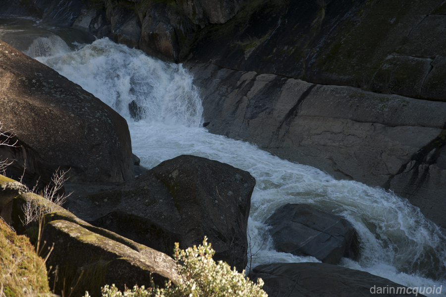
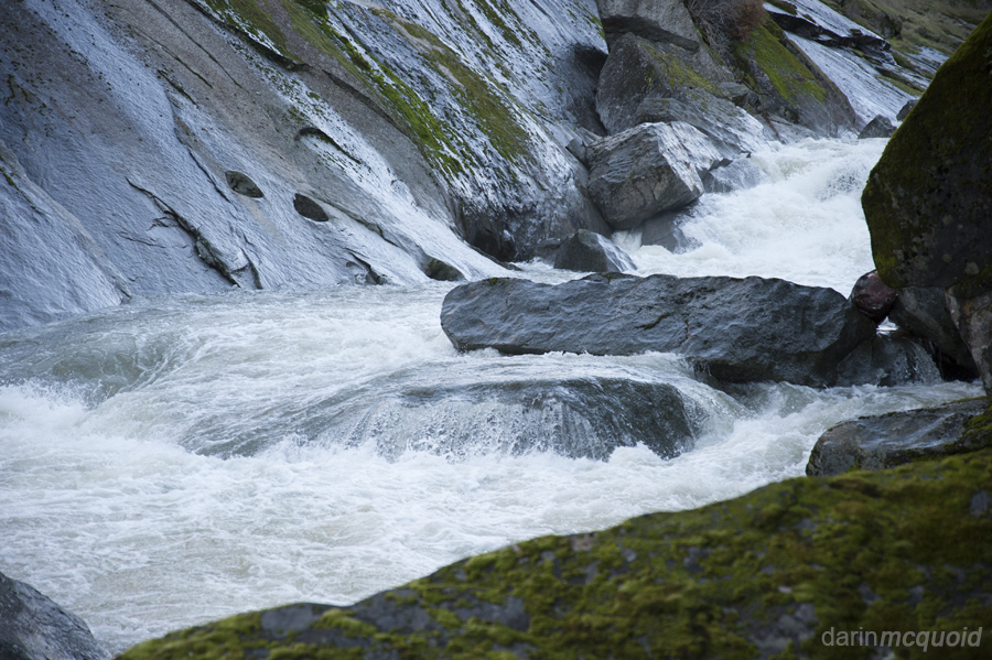
Looking
down at the first potential rapid.
Eddying out looked like too dubious of a move for out taste, added to the fact that egressing from the gorge would take rope work. With darkness setting in just after four in the afternoon speed was of the essence, so we wasted no time in sticking to the trail and moving downstream.
Taylor
Cavin

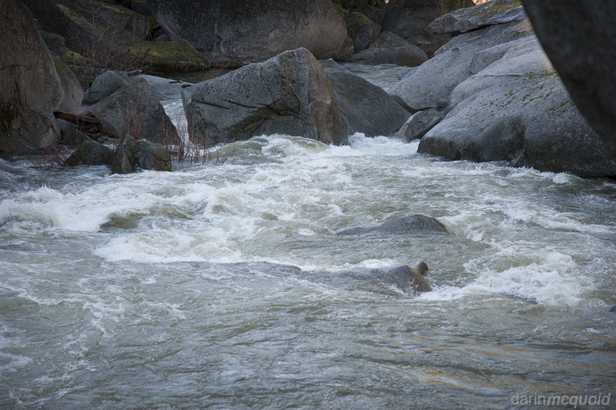
She just keeps going down there.
She just keeps going down there.
Yep
that's why we're portaging. Will with the run-out of a massive sieve in
the background.

Things don't look too much better downstream....
Things don't look too much better downstream....
With a total of fifteen minutes of hiking behind us, we officially put in below the rapid pictured above and ran a quick rapid. Only to be forced out of our boats on the next corner. Another ten to fifteen minute walk and things looked a lot better. The river opened up momentarily and gradient eased up for a quarter mile. Then once again the river delved into walls of granite and got steep.
A
long scout revealed a better looking gorge, and Taylor leads the charge.
A downstream view. Yes that's ice on the left bank, it's winter after all.
A downstream view. Yes that's ice on the left bank, it's winter after all.
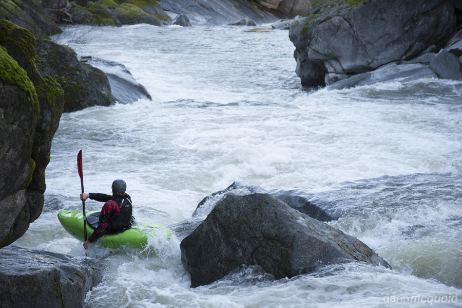
Still
lots of sieves, but some fun moves too.
The water levels seemed perfect, just enough to open up the options.
The water levels seemed perfect, just enough to open up the options.
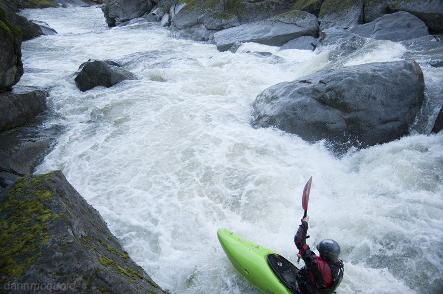
Looking
back upstream at the single largest drop we ran on the North Fork
Cosumnes.
Deep in the gorge we knew we were committed to figuring things out at river level, and after five major rapids no one was complaining when the gorge opened up. A brief flat led us to the lip of another gorge. I was starting to wonder about how we were doing on time, if the river continued at this pace we'd have no chance of escaping before dark. I noted that on the left there were ATV tracks coming down an old road near the river. At least there was some access. This gorge was considerably tighter than the last, but only contained one big rapid. A rather junky rapid, with of course the requisite sieves. It had a decent line and we all ran it together, dealing with some chaos coming through the crux move but all escaping unscathed.
In typical Cosumnes fashion, after the gorge was over the river flattened out. Thankfully it was not as willow infested as the Middle Fork of the Cosumnes is in its lower reaches and we made quick time through a mile or two of class II before the pace picked up again. Although there were no gorge walls, the river picked up into a nice mile long section of IV with one notably larger IV+ which was a nice surprise and not at all typical of the watershed. As the sunlight left the river, so did anything resembling warm air, so we put our heads down and paddled to take out.
Taylor
Cavin finishing in daylight, not bad for a little December mission!
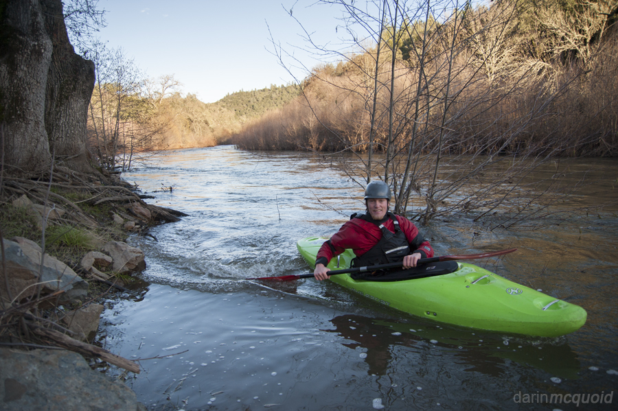
Glad to be done with the mission in daylight, we all agreed that it was fun but certainly not classic. It's the kind of run that's worth doing once to see somewhere new.
We used the Cosumnes at Mt Aukum Gauge and had around 500cfs.
Take out: From Sacramento: 50 East to Highway 49 South. Follow Highway 49 until a hard turn left on Union Mine Road. We drove up Union Mine until we could see the river, then asked a local land owner if we could park our car on the side of the road.
Put in: Back to a right turn on Highway 49 North, follow until making a right on Pleasant Valley Road. Follow until another right turn on Buck's Bar Road. You can follow Buck's Bar Road to the river, but will need to turn around and park a few switchbacks up the hill on the North side of the river, as there is no access where the bridge crosses.