
| Darin McQuoid | Blog | Reviews | Tutorials | River Directory |
South
Fork of the Salmon River
IV-V
The majority of water in the South Fork Salmon comes from a glacier high in the Trinity Alps Wilderness. The rest of the water flows out of the Russian Wilderness, guaranteeing first rate water quality on the South Fork Salmon, even when it’s flooding. Referred to as, the "Gorge Run" aka "Matthews Creek" aka "Limestone Bluffs" run of the South Fork Salmon is a classic no matter what you call it.Oregon Kayaking has a great write-up for the South Fork. Typical to the Salmon drainage, at lower flows (500-700) the run isn't as pushy but it starts to get a bit rocky with a few chunky rapids, and at ideal flows (1200-1600) it starts to get pushy with big holes, but is very padded out and surprisingly forgiving.
Initially the rapids are spaced but pick up into a quick mini gorge, with one rapid occasionally portaged. After the mini gorge rapids spread out again, until it nears “Amusement Park” a long rapid in a mini gorge that is just so much fun. Just before the wonderful "Amusement Park" is a smaller rapid of similar style.
Just a few rapids seperate the "Amusement Park" from the "Final Gorge". One of my favorites is a long, multiple move boulder garden.
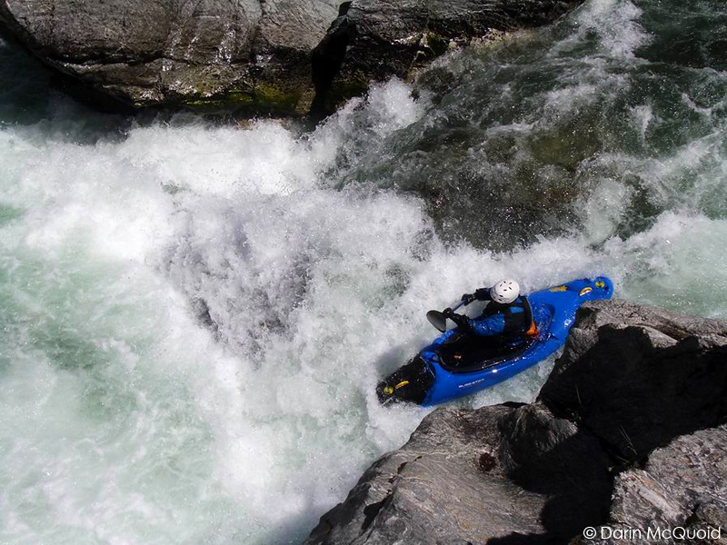
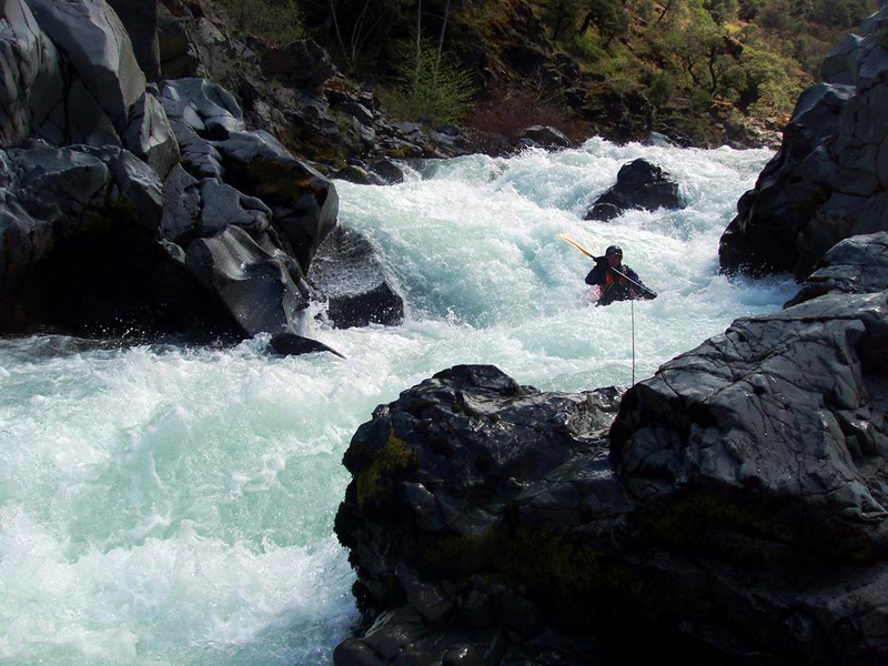
The final gorge is three decent sized rapids of different character. The first is the mankiest on the left as pictured above, but a nice right line also exists. In my opinion the hole at the bottom of the right line has gotten softer over the last few years, and the combination of newer "ride over everything" creek boats and a softer hole make the right line much more desirable.
If it is your first time on the South Fork Gorge, make sure you plan for a full day and plenty of scouts, there are several major hazards in the river that you don't want to go near. On the other hand if flows are juicy and you can find someone to route you through the rapids, the whole run can take less than an hour, resulting in some great laps.
Take out at Matthews Creek Campground or River Access, and you can either put-in on the steep trail from the pull out just upstream of the Limestone Bluffs, or drive upstream another mile to the steep dirt road access. Dreamflows has a great estimate for flows. It's easier lower and gets quite full class V at 2,000.
IV-V
Limestone
Bluffs

The majority of water in the South Fork Salmon comes from a glacier high in the Trinity Alps Wilderness. The rest of the water flows out of the Russian Wilderness, guaranteeing first rate water quality on the South Fork Salmon, even when it’s flooding. Referred to as, the "Gorge Run" aka "Matthews Creek" aka "Limestone Bluffs" run of the South Fork Salmon is a classic no matter what you call it.Oregon Kayaking has a great write-up for the South Fork. Typical to the Salmon drainage, at lower flows (500-700) the run isn't as pushy but it starts to get a bit rocky with a few chunky rapids, and at ideal flows (1200-1600) it starts to get pushy with big holes, but is very padded out and surprisingly forgiving.

Initially the rapids are spaced but pick up into a quick mini gorge, with one rapid occasionally portaged. After the mini gorge rapids spread out again, until it nears “Amusement Park” a long rapid in a mini gorge that is just so much fun. Just before the wonderful "Amusement Park" is a smaller rapid of similar style.
Matt
Thomas entering the unnamed rapid.
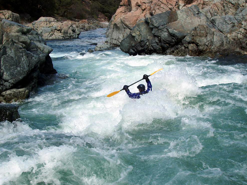
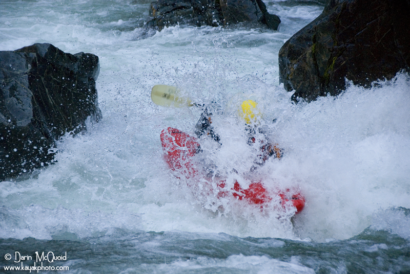
Brian
"420" finishes by punching through several holes.
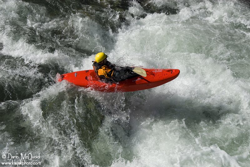
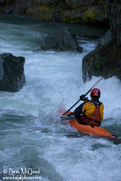
Darin
McQuoid in Amusement Park at lower flows.
About to exit the park.

About to exit the park.

Just a few rapids seperate the "Amusement Park" from the "Final Gorge". One of my favorites is a long, multiple move boulder garden.
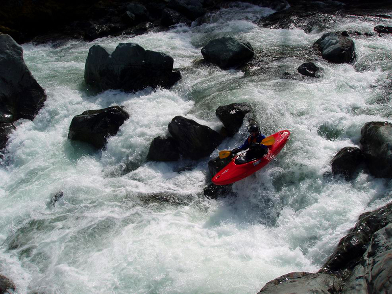
Matt
Thomas boofing his way into the boulder garden.
Brian
working his way through the moves of the sweet rapid.
Matt
taking the left door at the top.
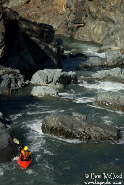
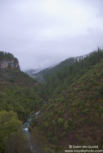
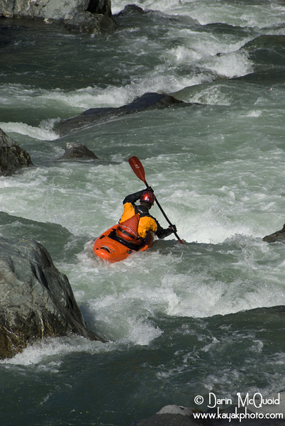
The
South Fork Salmon generally has decent pools between all the rapids.
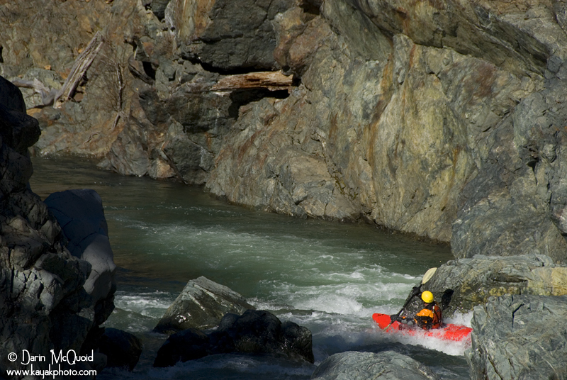
The
author dropping into the final gorge on the South Fork Salmon.

As
of 2/16/08 new wood has surfaced in the first of the three final drops.
The final gorge is three decent sized rapids of different character. The first is the mankiest on the left as pictured above, but a nice right line also exists. In my opinion the hole at the bottom of the right line has gotten softer over the last few years, and the combination of newer "ride over everything" creek boats and a softer hole make the right line much more desirable.
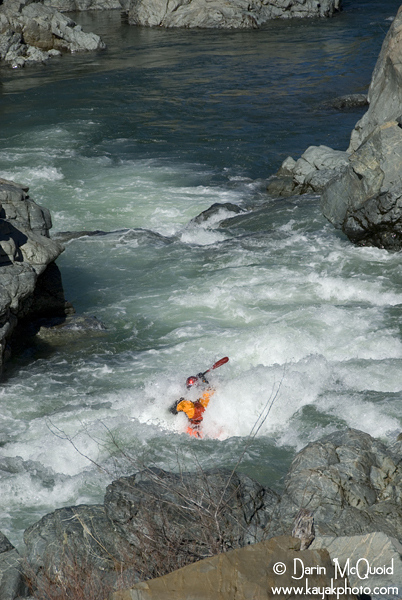
Second
in the gorge is a nice pinch rapid that's always fun. Brian
"420" on the second rapid.
Matt
Thomas on the same.
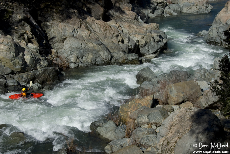
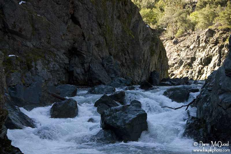
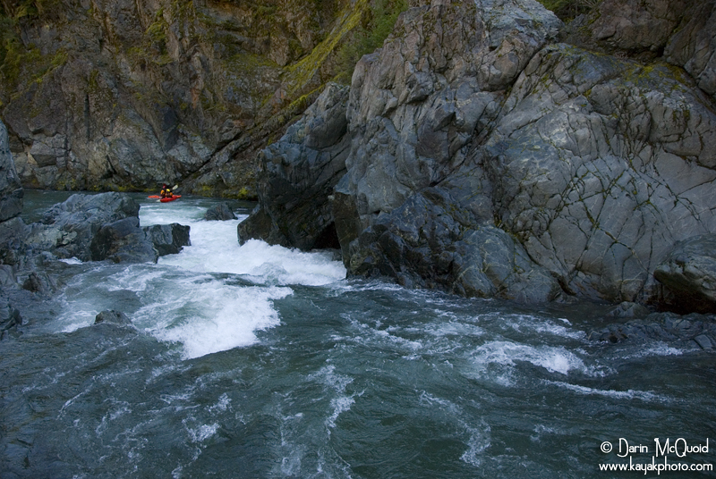
Zoomed
out view of the gorge and next to last rapid.
If it is your first time on the South Fork Gorge, make sure you plan for a full day and plenty of scouts, there are several major hazards in the river that you don't want to go near. On the other hand if flows are juicy and you can find someone to route you through the rapids, the whole run can take less than an hour, resulting in some great laps.
Take out at Matthews Creek Campground or River Access, and you can either put-in on the steep trail from the pull out just upstream of the Limestone Bluffs, or drive upstream another mile to the steep dirt road access. Dreamflows has a great estimate for flows. It's easier lower and gets quite full class V at 2,000.