| Darin McQuoid | Blog | Reviews | Tutorials | River Directory |
Thomes Creek
IV-P
Day Three - The Gorge.
IV-P
Day Three - The Gorge.
A
few rain drops patter on the rainfly in the middle of the night. Just
enough to be glad to have a tent, not enough to get anyone wet. Wind
picks up in the early hours and we awake dew free around seven, ready
to see what the last gorge has in store for us. Not many rivers have
sections simply marked "The Gorge" on maps. Always optimistic, perhaps
this last gorge will be better than all the other ones we've suffered
through so far.
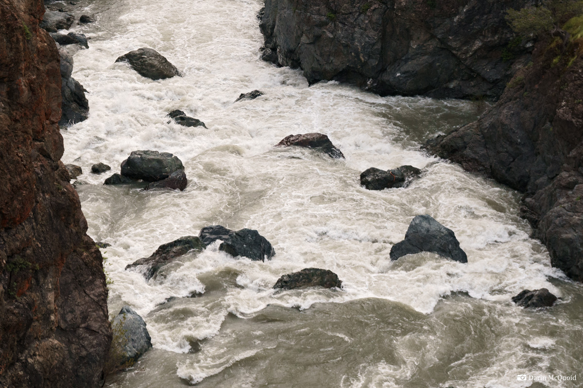
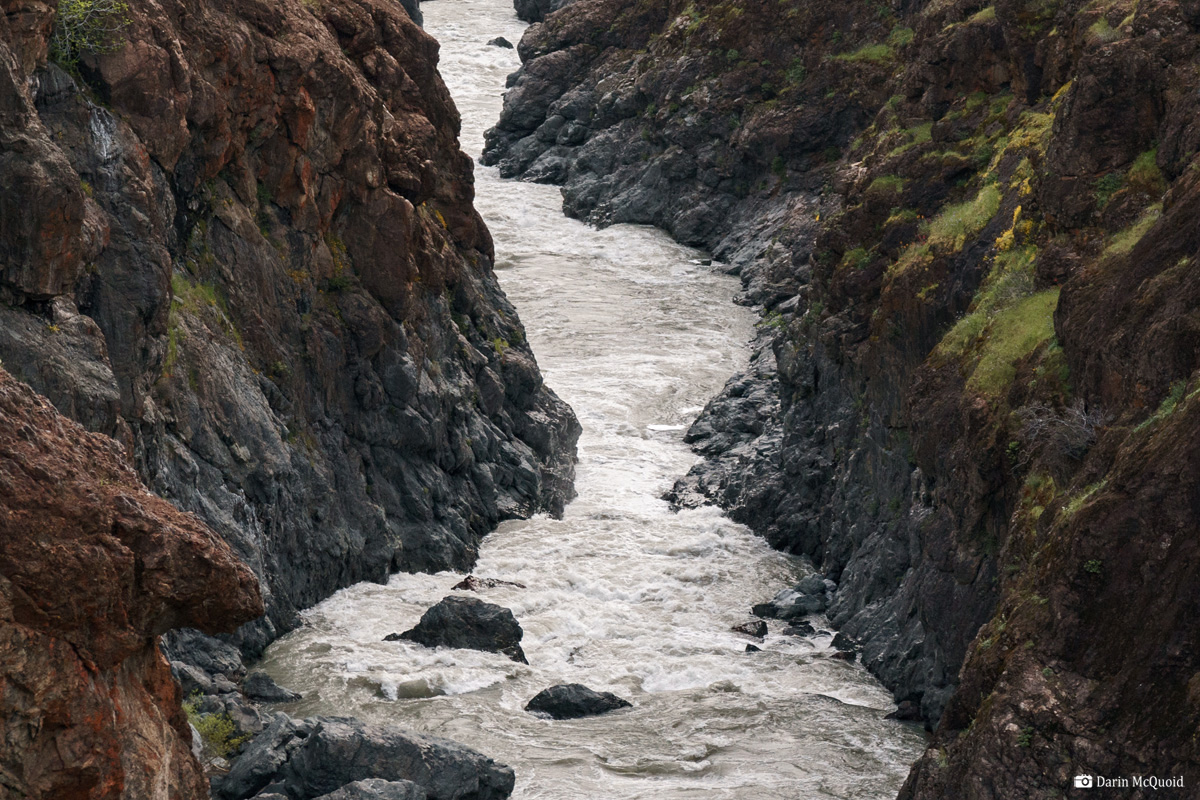
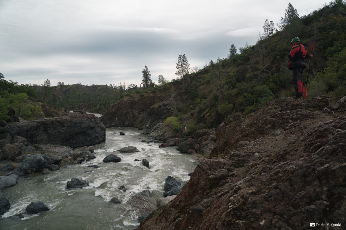
As the water surgest it's apparent this is just another boulder pile with water flowing over it. Shallow rocks and sieves abound, as well as some large hydraulics.
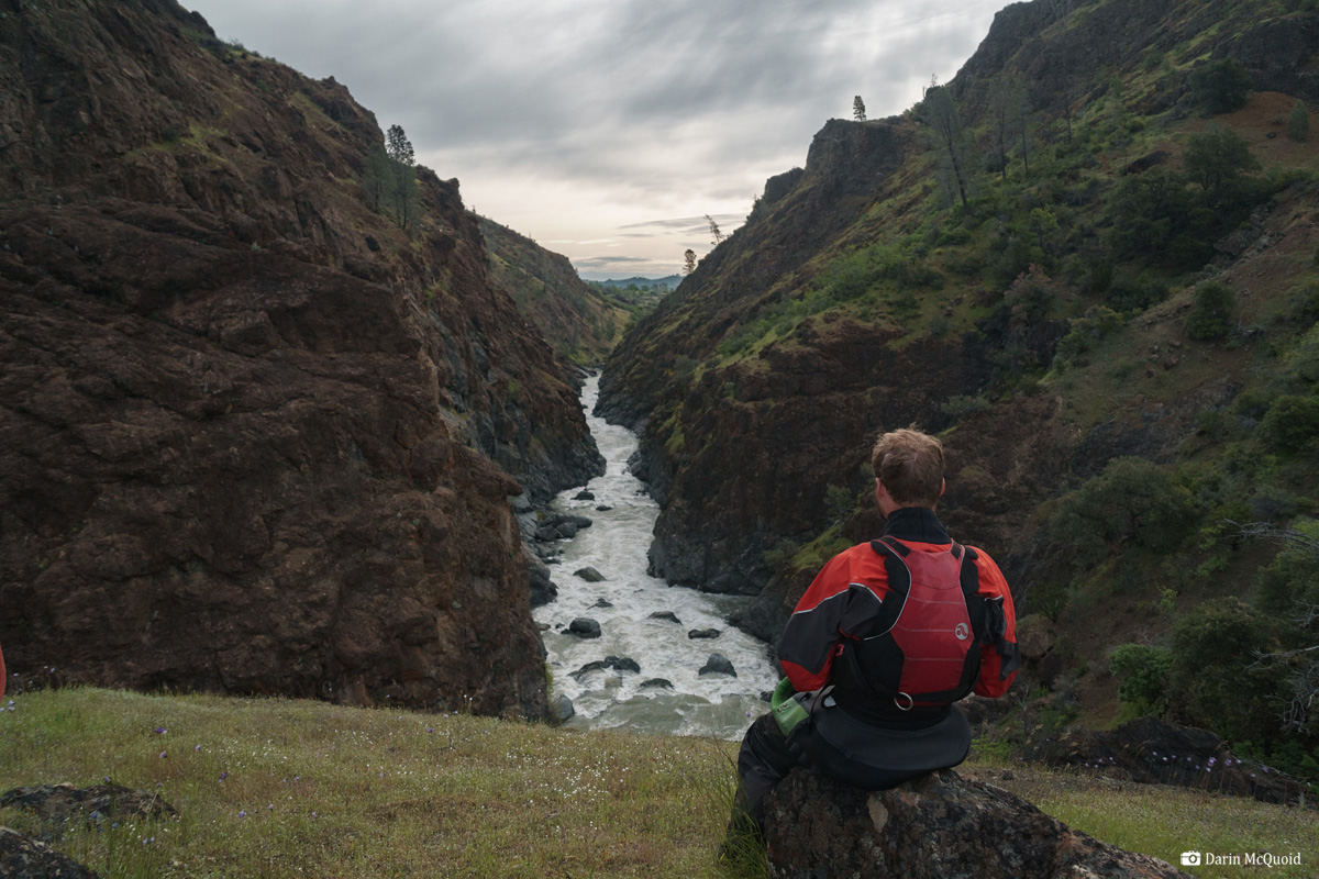
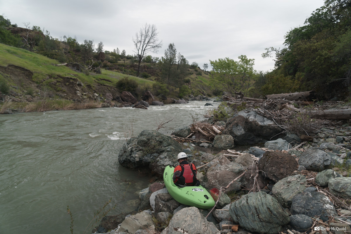
Sitting at the lookout we ponder our options. Maps show an old 4x4 road going up and around on the left. It's kind of a sure thing but long. Joseph and Luke opt to scout for a portage on the right.
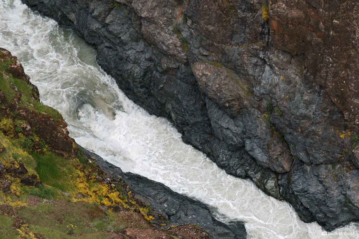
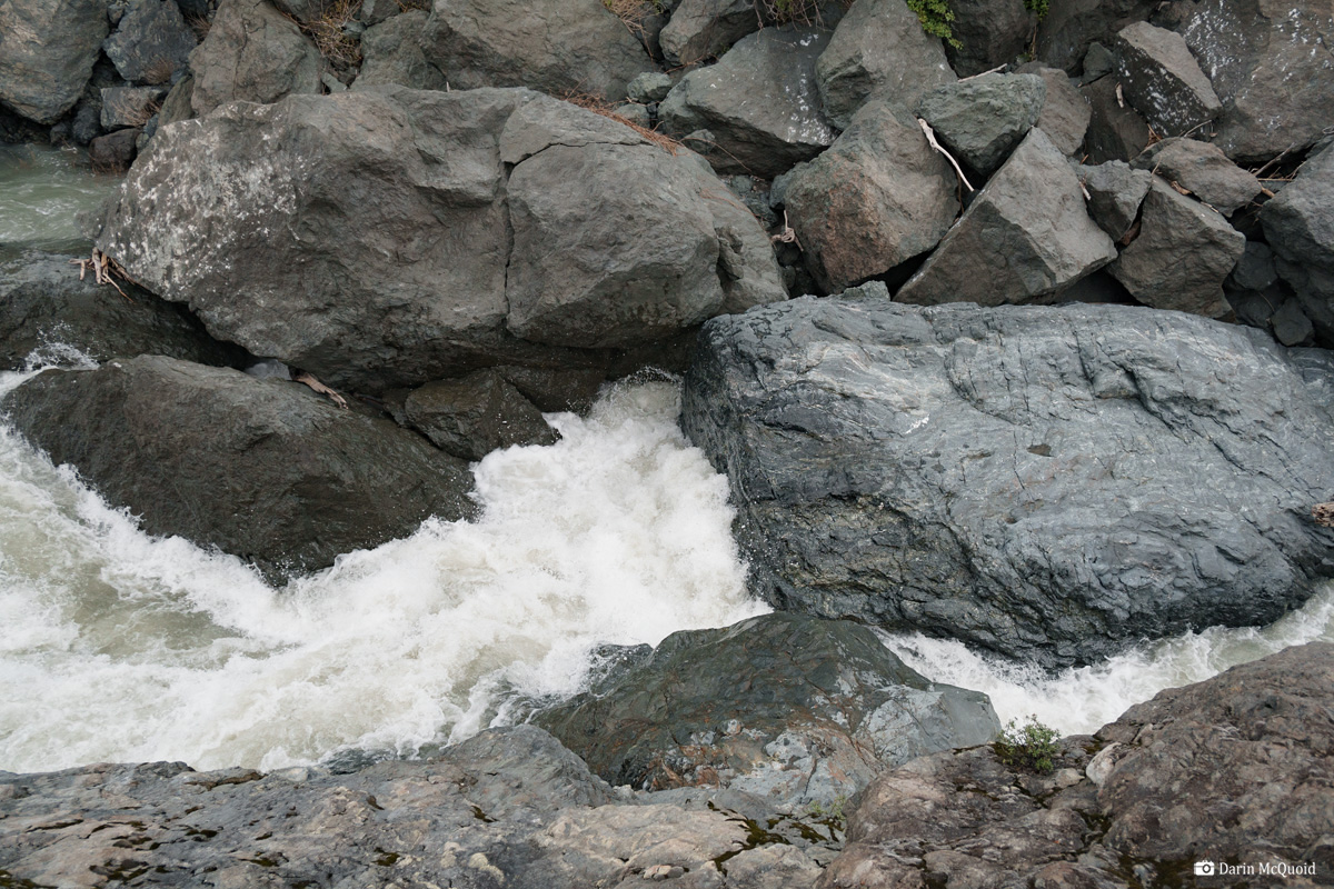
Looking down into the gorge at the horizon, a hydraulic with fifty to a hundred feet pulling back into it.
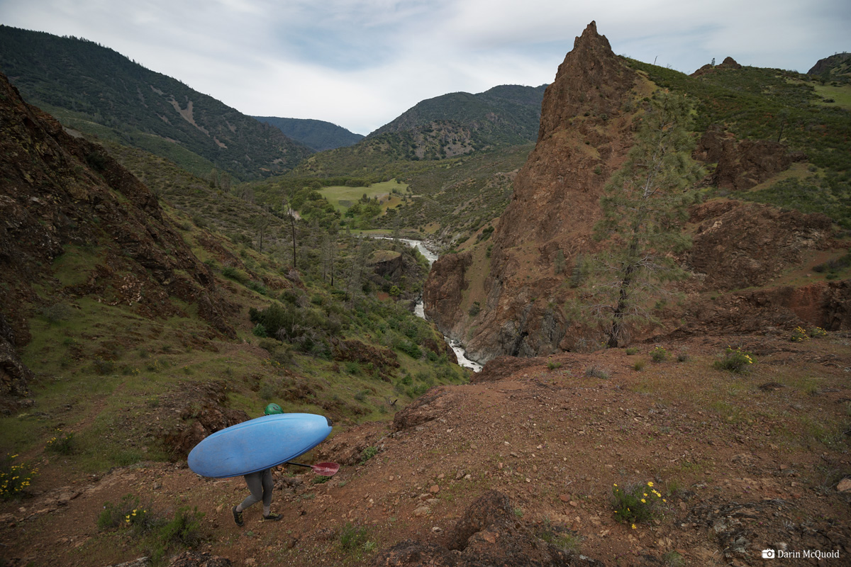
The rest of the portage is wandering through cattle grazing terrain, trying to find a brush free route to the river. Start to finish it's a two hour portage, three if you count the scouting of the route. At the water we eat a quick snack and put in above a rapid that's essentially down in the valley floor.
Joseph Hatcher looks at the run out into the valley floor.
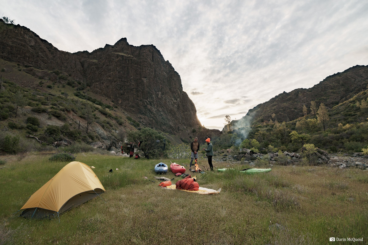
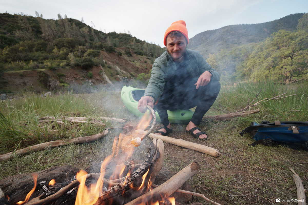
Luke Andraka roasts one last mini marshmallow.
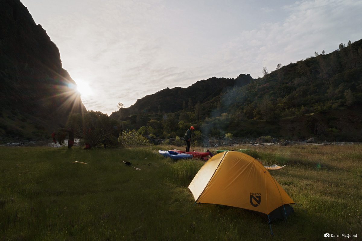
Time to pack up the sweet campsite.
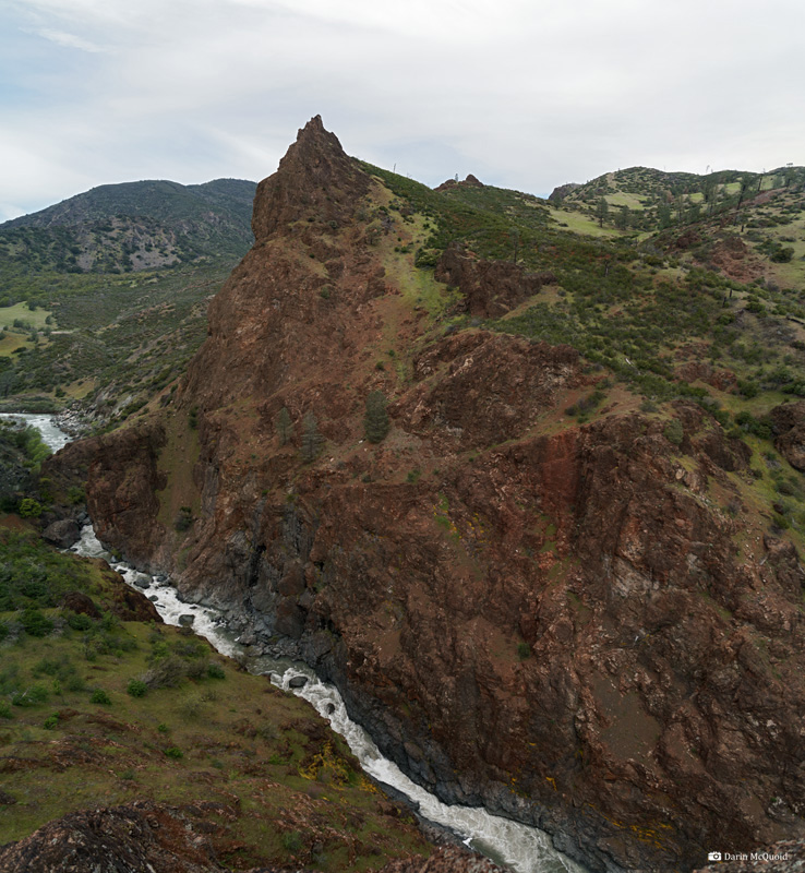
We
all agree the only smart way to proceed is to scout the gorge before
dropping in. Looking at our maps and the terrain, we decide to ferry
across and scout from the right. On a trail it's an easy walk up to a
lookout point. As we come up the rise and get our first view it's a
relief to see that it's not a boulder jumble; it should go. Then we
look a bit closer.
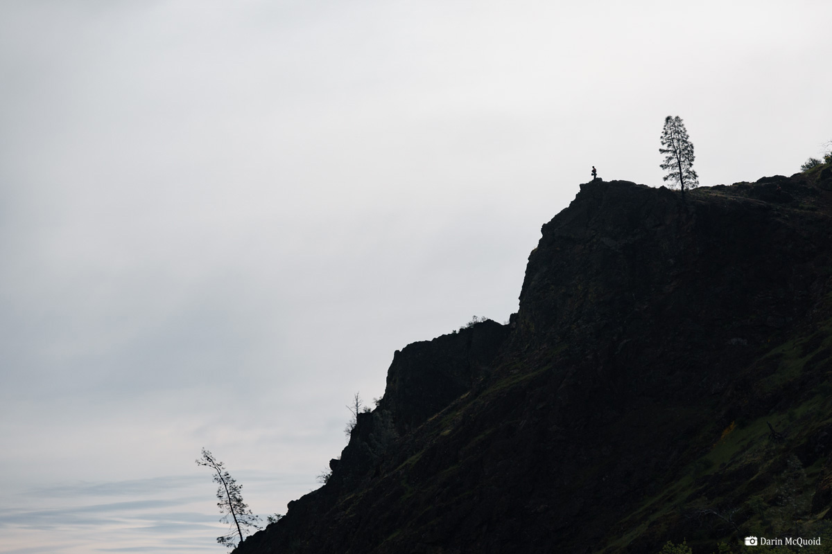
Luke Andraka overlooks The Gorge on Thomes Creek.
Luke Andraka overlooks The Gorge on Thomes Creek.
The longer we stare, the worse it looks, and we are still far away from the rapids.
As the water surgest it's apparent this is just another boulder pile with water flowing over it. Shallow rocks and sieves abound, as well as some large hydraulics.
Yet it's just a lead in for the downstream horizon as the gorge narrows and the river goes over a large drop.
Sitting at the lookout we ponder our options. Maps show an old 4x4 road going up and around on the left. It's kind of a sure thing but long. Joseph and Luke opt to scout for a portage on the right.
They
come back with a report of a nice game trail, so we take off our
drysuits and begin to carry. Joseph Hatcher about halfway through.
Looking down into the gorge at the horizon, a hydraulic with fifty to a hundred feet pulling back into it.
It's buried deep in the gorge with no chance for safety.
The rest of the portage is wandering through cattle grazing terrain, trying to find a brush free route to the river. Start to finish it's a two hour portage, three if you count the scouting of the route. At the water we eat a quick snack and put in above a rapid that's essentially down in the valley floor.
Yes, one last Thomes sieve.
Joseph Hatcher looks at the run out into the valley floor.
We
expect the final six to eight miles to be a grind, yet there are no
real flats and we make it out in no time thanks to steady current and
the odd II-III rapid. All total we spent about nine hours portaging
over three days. Typically I'd say any river is worth doing once. Not
this one due to the poison oak, dangerous portages and few stand out
rapids. It sure is a beautiful place though! We had flows around 850 on
this gauge.
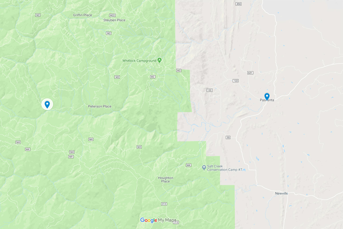
Put in and Take out on Google Maps.