
| Darin McQuoid | Blog | Reviews | Tutorials | River Directory |
Deer
Creek
IV-IV+
(Lower section)
Sacramento River Tributary

IV-IV+
(Lower section)
Sacramento River Tributary
Deer Creek is the stunningly beautiful, slightly easier sister of Mill Creek in Northern California. Deer Creek has a shorter window of good water levels, and a rougher if shorter shuttle road. The rapids are generally class III moves, yet blind and with IV - IV+ hazards, giving the run a IV+ feel on the whole, especially if none in the group know it.
The team starts at the
Ponderosa Way
bridge.
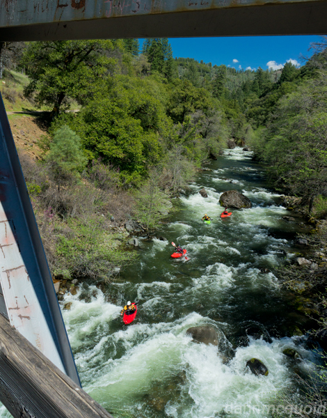
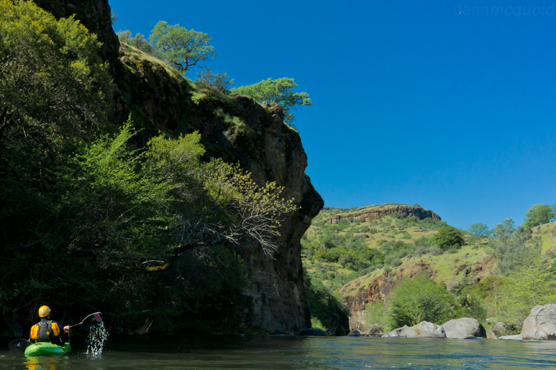
The run starts in the forest, but quickly transitions to high desert.
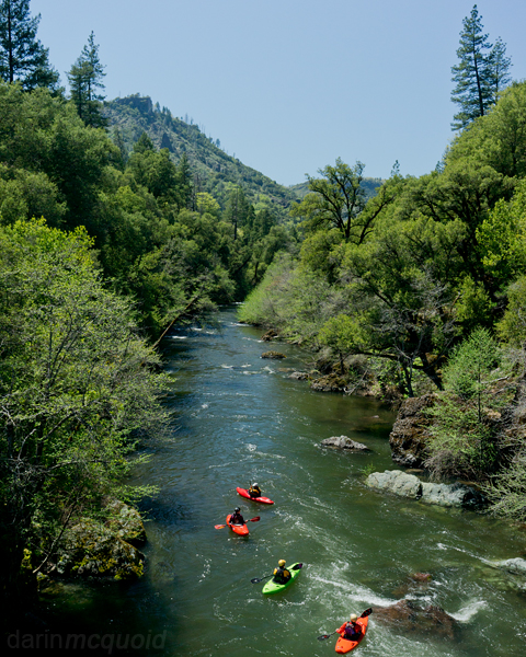
The first mile is the best of Deer Creek, full of non-stop class III action that gives it a class IV feel.
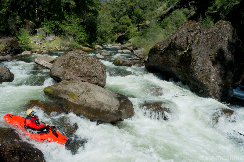
Ron Rodgers runs a typical blind but not terribly hard boulder garden. Wood is a major hazard on Deer Creek.
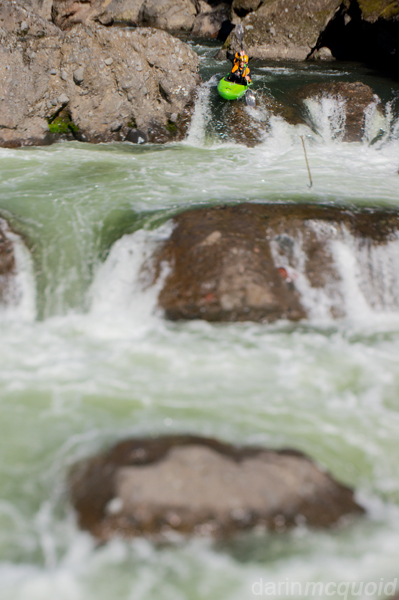
Austin Nickell runs the trademark drop of Deer Creek; Ishi Falls.
Alex Cousins boofs into Ishi Falls.
Below Ishi Falls we cruised through one more short section of good whitewater before pulling over on the right and camping above what must be "Double Drop"
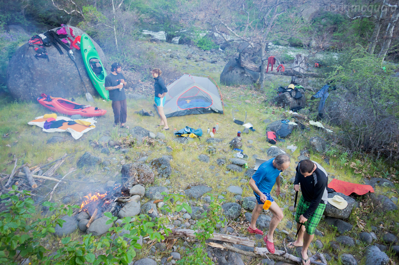
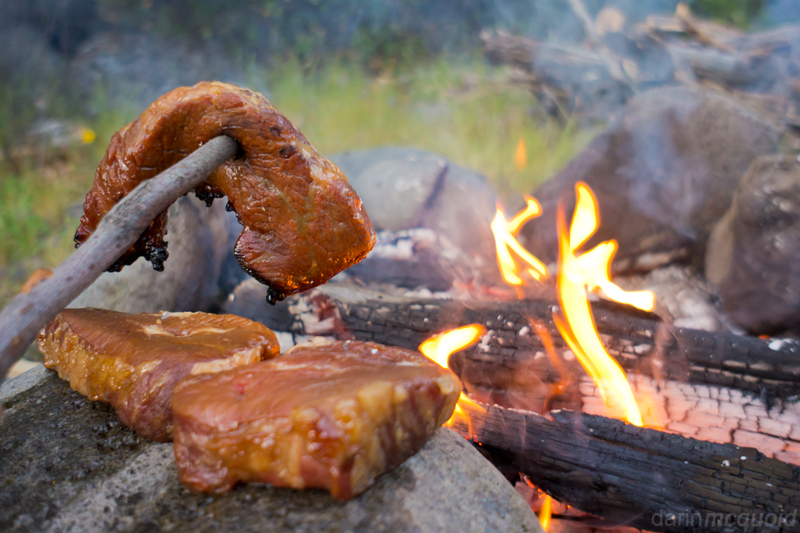
The beauty of portage free overnight trips, good food!
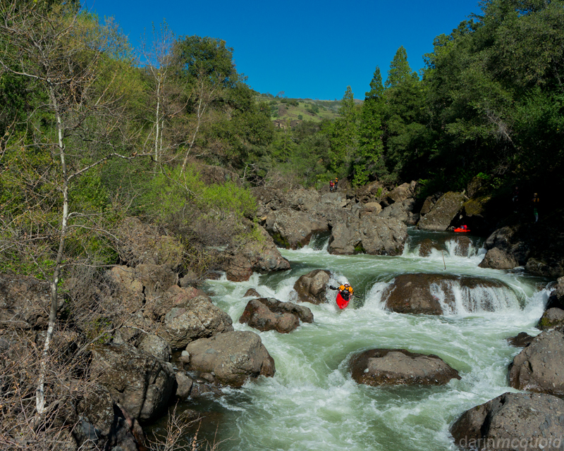
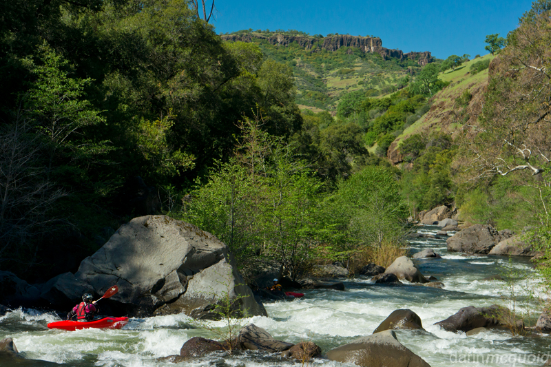
The section below our camp started off busy with Double Drop, which we snuck on the right, and was followed by several fun rapids.
Shannamar Dewey runs one with a nice view on the morning of our second day.
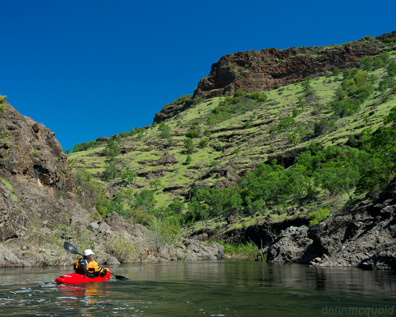
Only too soon the rapids mellow out and Deer Creek takes on more of a class II character, but the scenery is sublime.
The run starts in the forest, but quickly transitions to high desert.
The first mile is the best of Deer Creek, full of non-stop class III action that gives it a class IV feel.
Ron Rodgers runs a typical blind but not terribly hard boulder garden. Wood is a major hazard on Deer Creek.
Feeling like we'd made good
progress, we took a moment to
look at our map.
According to our best guess we were near some private land and pushed
on through Ishi Falls.
Austin Nickell runs the trademark drop of Deer Creek; Ishi Falls.
Alex Cousins boofs into Ishi Falls.
Below Ishi Falls we cruised through one more short section of good whitewater before pulling over on the right and camping above what must be "Double Drop"
Ron
and Alex cut some firewood at camp.
The beauty of portage free overnight trips, good food!
The section below our camp started off busy with Double Drop, which we snuck on the right, and was followed by several fun rapids.
Shannamar Dewey runs one with a nice view on the morning of our second day.
Only too soon the rapids mellow out and Deer Creek takes on more of a class II character, but the scenery is sublime.
Too soon the gradient and
scenery tapered off and we were in the paddle out. Putting our heads
down and paddling saw us at the Leininger Road Bridge in an hour and a
half, where our vehicles were parked that day thanks to Steve McCabe, a
great shuttle driver: 530-519-1040. The shuttle is very worthwhile both
to alleviate driving time, and because vandalism is a common problem
for cars left at the bridge overnight. We had 600cfs on the
gauge, and I'd consider
500-1,000 to be ideal, with the river very
possible but harder at higher flows.
Take out: From Chico, head North on Highway 99 to a right turn onto Vina Road. Follow Vina until a left onto Leininger Road and follow to the bridge over Deer Creek. To be absolutely legal, park past the faded spray painted line 200' away from the bridge.
Put-in: Return to Highway 99 and make a left, heading South to a left turn onto Keefer Road, following that until a left onto Cohasset Road. Follow Cohasset Road for a long time and through some rough terrain (High Clearance needed). Eventually make an unmarked right turn downhill onto Ponderosa Way. There is a spray painted rock that says Deer Creek but no sign for Ponderosa Way. Follow Ponderosa Way to the River.
Other resources:
A Wet State
Oregon Kayaking
California Creeks