
| Darin McQuoid | Blog | Reviews | Tutorials | River Directory |
Mill
Creek, Upper
IV-V
We'd pushed through thirty miles on lower Mill Creek, returning to the put-in at 11pm for a buggy nights sleep, Jon and I decided to attempt running the 17 mile two day stretch of upper Mill Creek in the morning. Mostly because the horrible shuttle on the dirt road; we were already at the take out for upper Mill. The drive to the put-in went by pretty fast, and we found flows to be low but substantial enough to float.
Upper Mill Creek starts off just outside the town of Mill Creek and is up in the forest, quite different from the high desert of the previous day. The first four or five miles flew by with one two log portages and lots of class II/III gravel bar/boulder garden action,. Many logs were ducked and I managed to drop my paddle several times in the process, but we made good downstream progress.
Suddenly the pace picked up from II/III into consistent IV-V, eventually into consistent V, much larger than lower Mill. We were able to boat scout most everything, and ducked a lot of logs and ran lines close to a lot of sketchy logs. It's no surprise that this run is still full of wood as reported in Holbeck & Stanley, but at 450cfs most of it is avoidable. We portaged once for a rapid, a long boulder garden that dropped about 30' overall and ended with a huge undercut rock in the middle and a hole that fed under it. If the rock wasn't there, there would be an awesome 12' waterfall on the river right side, but the shallow landing of the waterfall went directly under the rock.
Here
is the entrance of the rapid.
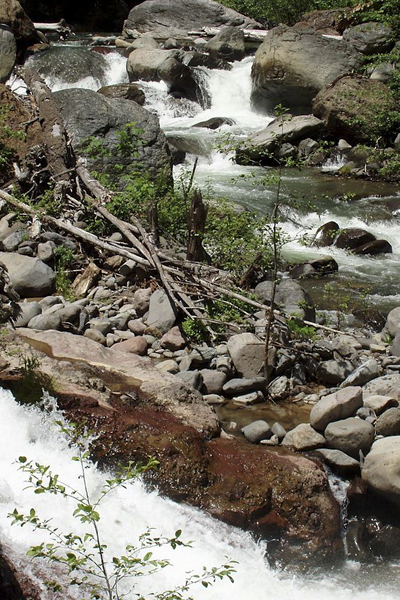
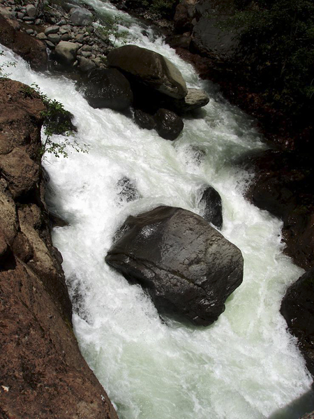
This is the large rock in the middle, quite undercut, and the hole on river left of it was much larger than appears in the picture. The slide on river right landed moving straight into the rock creating the pillow on it.
What
a shame.
We
ended up with a 15'
seal
launch from
the
portage on river right, only to find if you follow the cliff down
another 10 yards it drops down to river level, although it doesn't
appear that it drops from on top. After the portage many boat scout
able Vs continue for miles, with us eventually scouting a 8' ledge on
river right that had a two tiered boof on the center.
The river mellowed back down to class IV with Vs thrown in for several miles. Jon and I were hoping to see Black Rock Mountain soon, but it eluded us for many miles. We were able to run the portage listed in Holbek & Stanley, as the terminal hole was not at all terminal at low flows. The final hole in the last set of ledge drops near black rock mountain, just yards above the take-out.
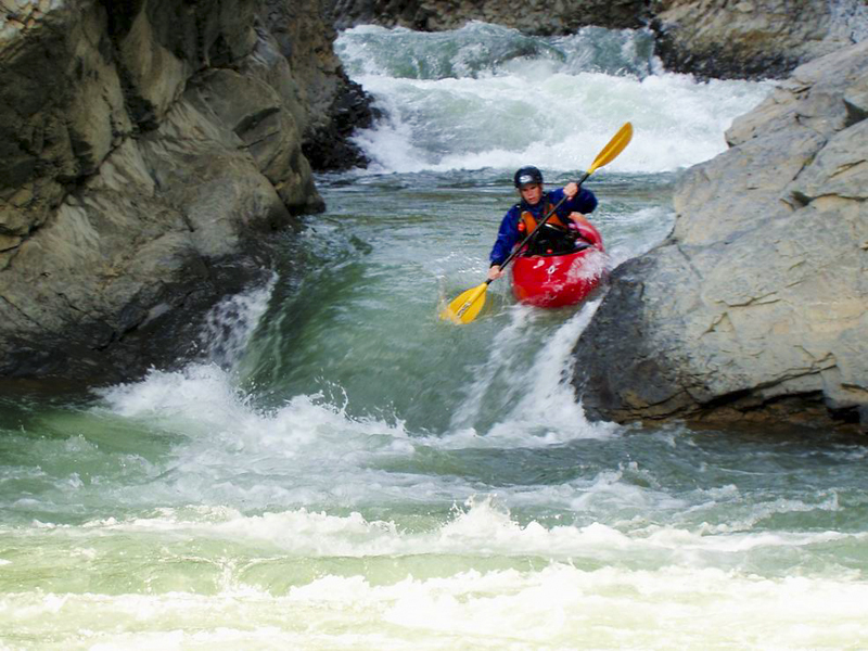
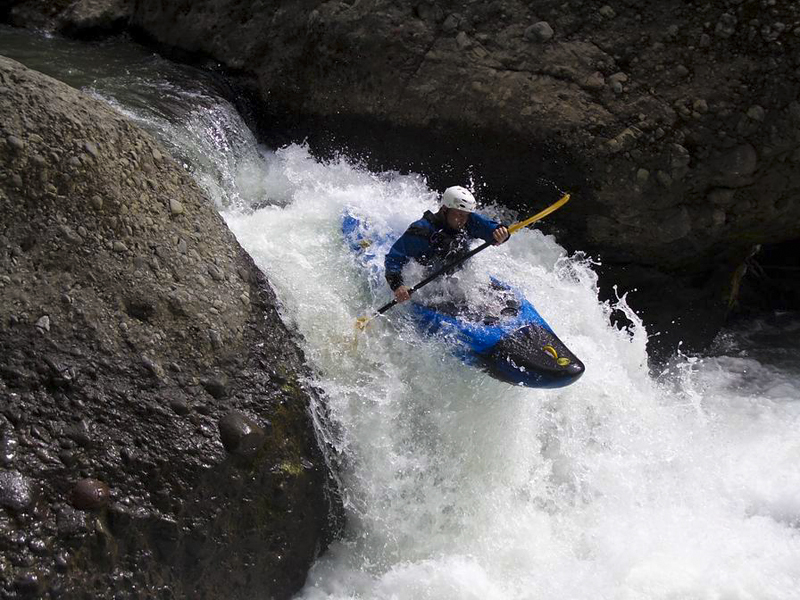
Jon
runs the boof, I took the falls.
The river mellowed back down to class IV with Vs thrown in for several miles. Jon and I were hoping to see Black Rock Mountain soon, but it eluded us for many miles. We were able to run the portage listed in Holbek & Stanley, as the terminal hole was not at all terminal at low flows. The final hole in the last set of ledge drops near black rock mountain, just yards above the take-out.
Two
days and 47 miles, it all blurs together, other than upper
Mill is much harder and has a lot of wood. If you don't mind dodging
logs (ten or so in 17 miles, I portaged two, Jon portaged one) give
this run a go.
2018 Update
Over the years I'd forgotten just how beautiful the canyon was, or perhaps as a new paddler, was too scared to notice. Joseph Hatcher.
We only walked one rapid last time, and hoped it would look better thirteen years later. The rapid did, but the wood situation was catastrophic for the rapid.
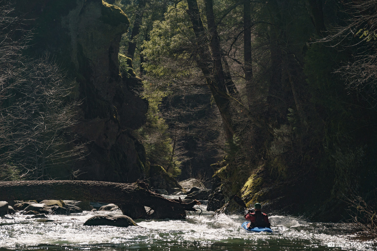
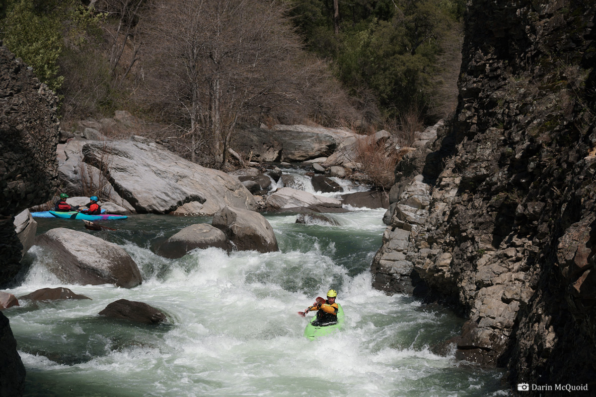
Tom Janney eddies out above some typical Mill Creek action.
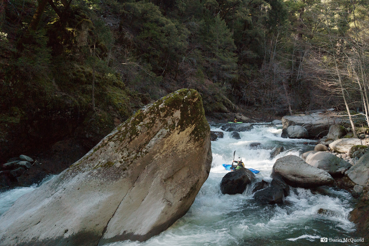
Tight, technical lines are the norm. Dave Farkas moves across the river.
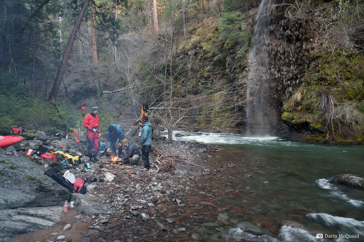
Our campsite was a bit brushy yet beautiful.
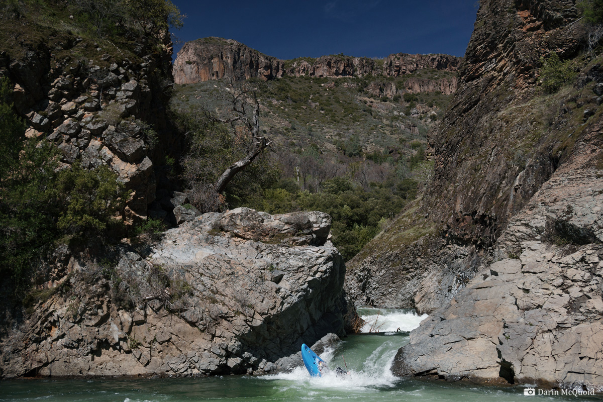
At the end, character changes dramatically as Mill Creek cuts through the base of Black Rock.
The final hole looked like nothing from the scout, yet gave us a little surprise as it was more powerful than anticipated, giving several tail stands.
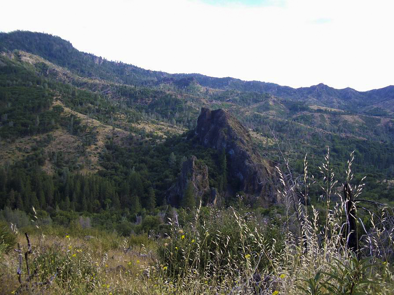
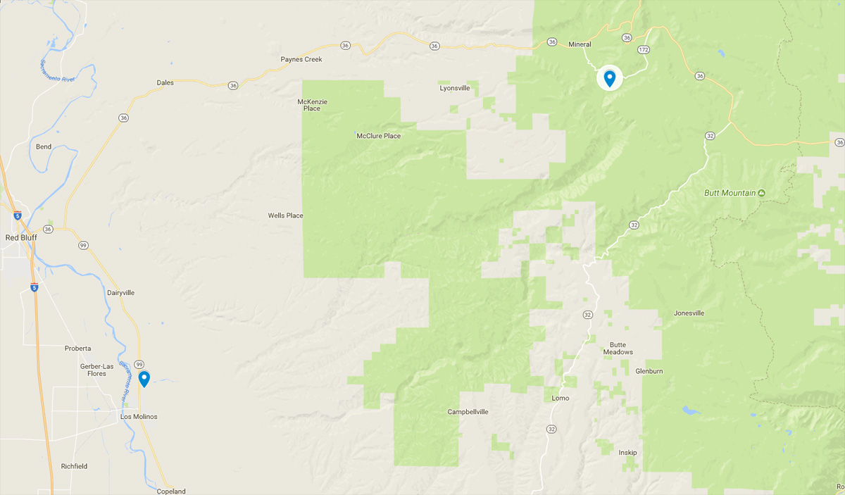
Black
Rock Mountain, the put-in for Lower Mill and takeout for Upper Mill
2018 Update
Upper Mill Creek does not get run very often. Between the original write-up in 2005 and 2018 I'd heard of of three
groups doing the run, one hiking out due to high water and an injury.
Yet it's been on my list as something to see again, and the opportunity
came as a group from Colorado came into town, flows and weather
aligned. Plus take out is now forty five minutes from our house instead
of eight hours thanks to relocating in the fall. Of the group, Tom
Janney had even done the run before in 2011. The road to hole in the
ground campground was still closed due to snow, so we put in about
three miles upstream.
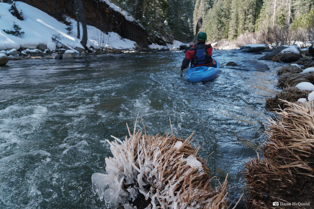
Not your typical California weather with ice lining the banks.
Much as remembered, the first miles were fast and easy, mostly spent dodging plentiful rocks and the occasional log jam. We made one portage for wood on the paddle in.
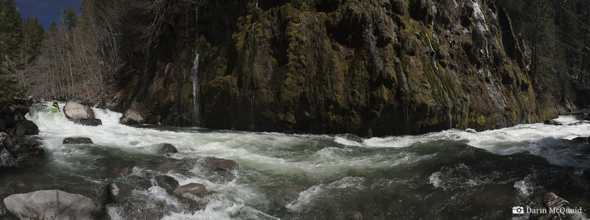
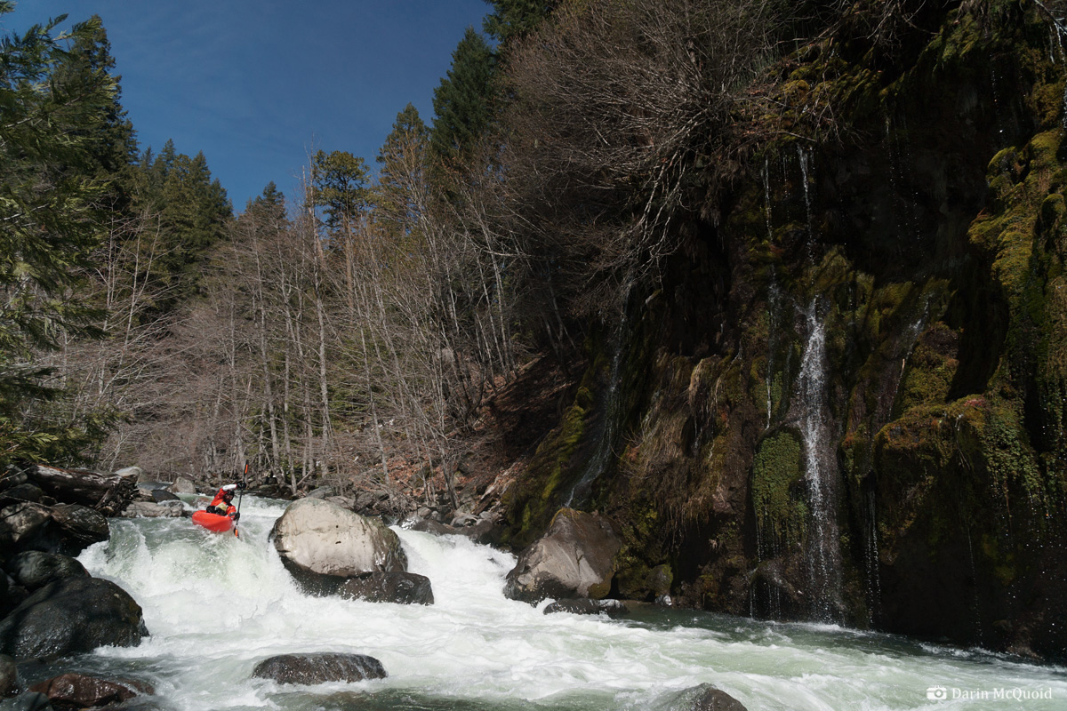
Eric Parker on a nice boof as water cascades down thanks to melting snow.
Tom Janney on the same.
I was hoping to be out of the snow for lunch, but it's sticking around longer than we expected.
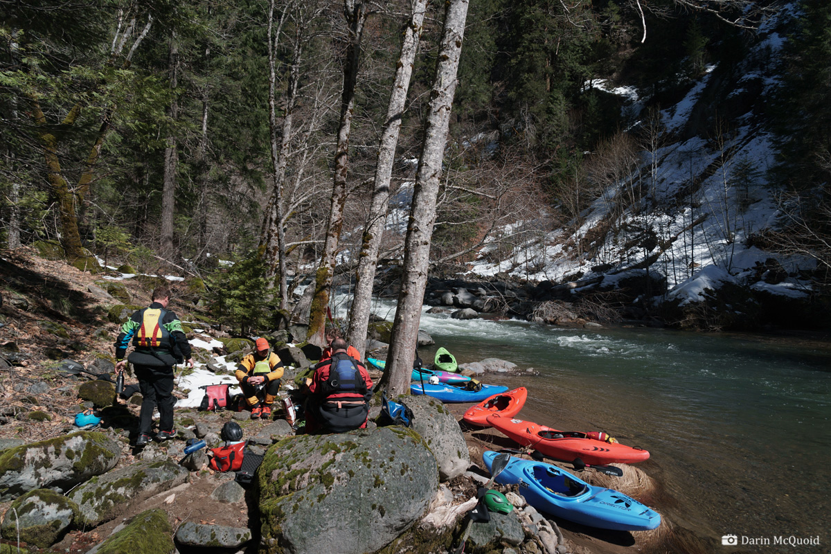
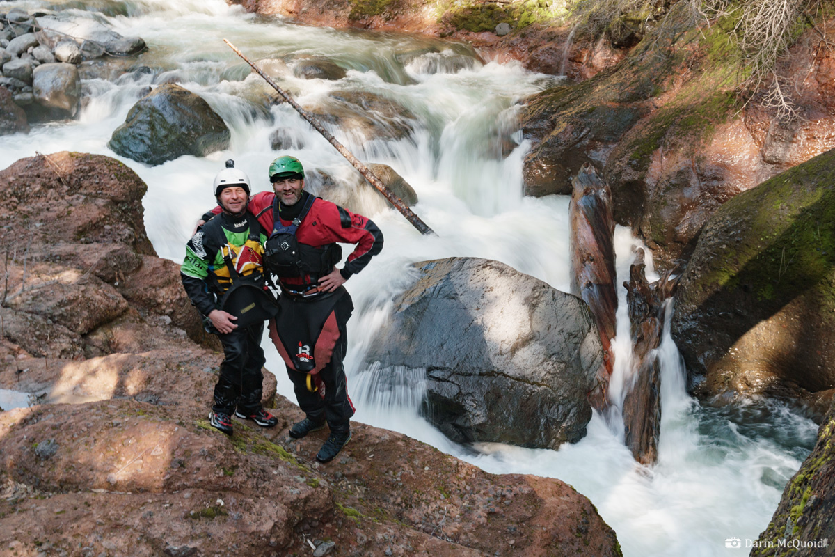
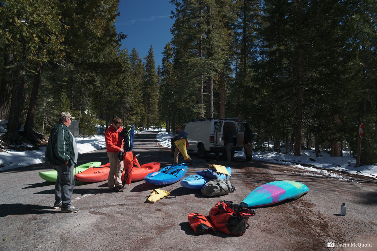
Tom Janney, Eric Parker, Dave Farkas, Joseph Hatcher, Adam "Frey Ball" and I gear up at put-in.
Not your typical California weather with ice lining the banks.
Much as remembered, the first miles were fast and easy, mostly spent dodging plentiful rocks and the occasional log jam. We made one portage for wood on the paddle in.
Eric Parker on a nice boof as water cascades down thanks to melting snow.
Tom Janney on the same.
I was hoping to be out of the snow for lunch, but it's sticking around longer than we expected.
Over the years I'd forgotten just how beautiful the canyon was, or perhaps as a new paddler, was too scared to notice. Joseph Hatcher.
We only walked one rapid last time, and hoped it would look better thirteen years later. The rapid did, but the wood situation was catastrophic for the rapid.
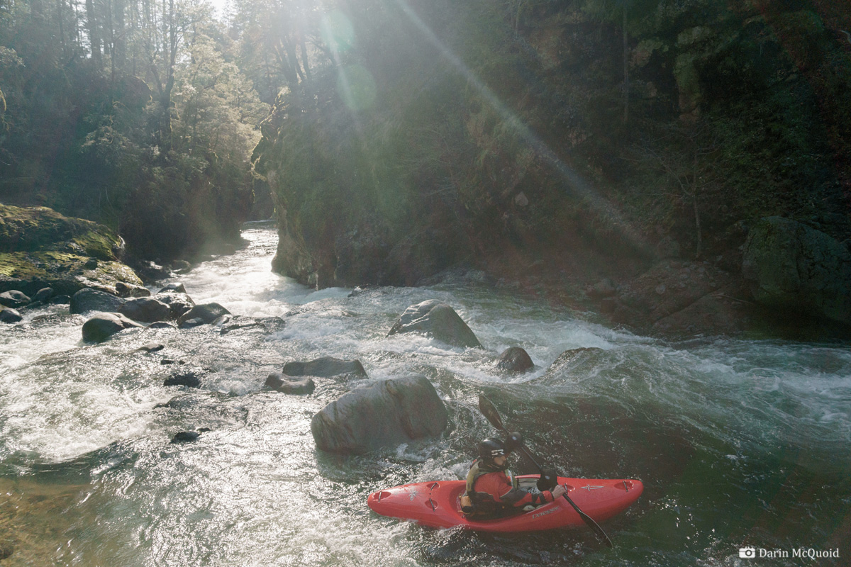
Tom Janney eddies out above some typical Mill Creek action.
Tight, technical lines are the norm. Dave Farkas moves across the river.
Our campsite was a bit brushy yet beautiful.
At the end, character changes dramatically as Mill Creek cuts through the base of Black Rock.
The final hole looked like nothing from the scout, yet gave us a little surprise as it was more powerful than anticipated, giving several tail stands.
We continued down through Lower Mill
Creek, camping for another night before finishing by Highway 99 for a
total of fifty miles of glorious scenery and wilderness paddling. It's
an incredible journey from the forest to the valley floor. We had three
log portages on Upper Mill, none were hard. We ducked or went around
five or six other logs. While the whitewater isn't classic, we all
agreed it is good and the adventure is worth doing. Flows can be a
tricky thing for Upper Mill, more water gets pushy quickly, especially
with the log jams. On the other hand we hit more rocks than we liked.
Our flow was 450-600 depending on the day. 700-800 would probably have
been ideal, yet it's a tough call as where the water comes from will
vary depending on the time of year. For us, a lot was coming in down
low, while later in the year it will all be coming from up top.
HTML
Comment Box is loading comments...