
| Darin McQuoid | Blog | Reviews | Tutorials | River Directory |
South
Fork of the
San Joaquin "Lower" V-V+
Day Four
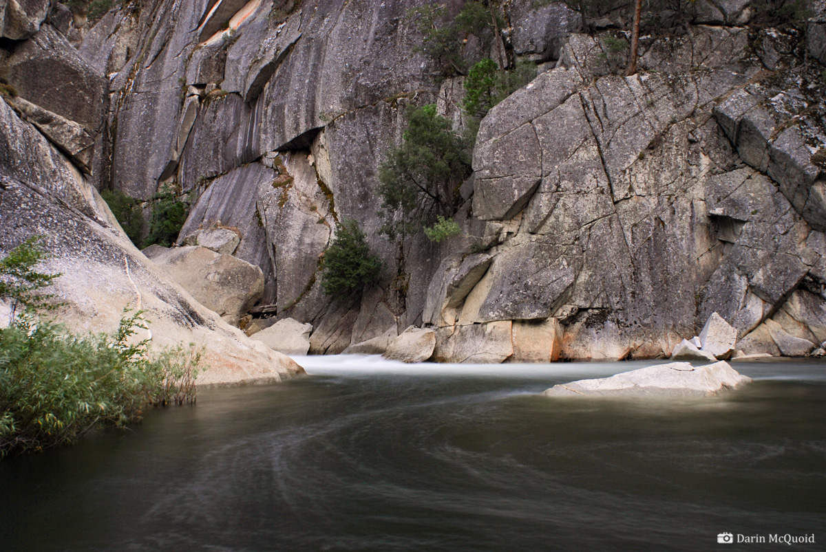
This is the rapid that forced us back out of the gorge. It looks a lot better in picture than in person, both sieves are out of view, but note how thin flows are in the center.

Photo: Kevin Smith
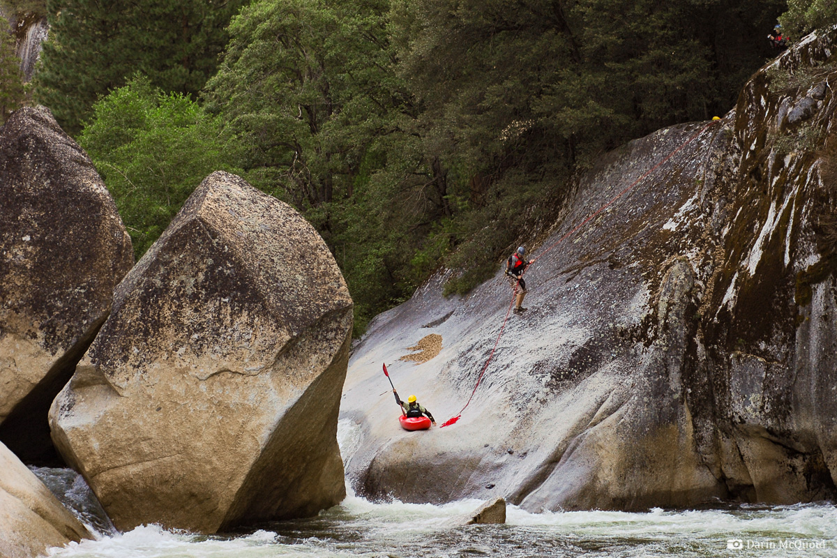
The gradient looks good as we round the corner out of camp, but the first drop is highly suspect. We scout high on the left and deem it in our best interest to make a quick portage, the crack is just too tight to be sure of fitting through. At least we can make use of the seventy meter rope Ben has been hauling down the river.
Matt
Thomas seal launches in while
Kevin Smith rappels.
After the portage we run a boulder garden or two before coming to something none of us are expecting; bedrock. Every rapid we have run so far has been composed of boulders or at best, a minuscule amount of bedrock. I don't’ get out of my boat, the horizon line looks clean. Ben gives hand signals and is ready to film, so I peel out and paddle hard right down a nice slide to slide combo that is clean as a whistle.
Matt Thomas, Sunrise Slide.

Kevin Smith relieved to be running a clean rapid.

At
this point in the trip we are all exhausted, yet Kevin Smith proves
just how motivated he is by hiking up and running the slide again.

Looking dowstream from the slide, we are almost to the confluence. Looks can be deceiving. Exiting the
slide, the
character of
the river makes a severe turn for the worse, and becomes filled with
boulders, not of a friendly nature. Our portage ratio ticks
up dramatically, yet we are still picking off a few good ones.
Kevin
Smith runs a good one in bad
lighting.

Once
again another downstream view,
the confluence is above the tight
gorge.
Photo: Kevin Smith
Photo: Kevin Smith
The
last good rapid we run for a
while. Matt Thomas.
Photo: Kevin Smith
Photo: Kevin Smith
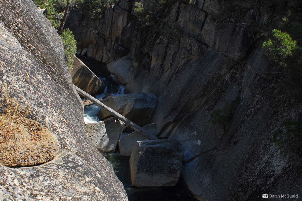
It turns into complete hell. This is the steepest section of the river, and we have been expecting the gradient, but the whole thing is a big sieve pile, and the portages are terrible. The portage we are making was like a gigantic Crucible entrance portage, and if you have done those you know. Giant boulders, right up against the gorge wall, lots of boat raising and lowering. It makes for a tediously slow pace.
Yeah, good times coming up.
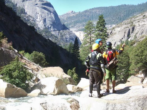
Photo: Kevin Smith
Photo: Kevin Smith
If there was no suffering, would it be the San Joaquin?
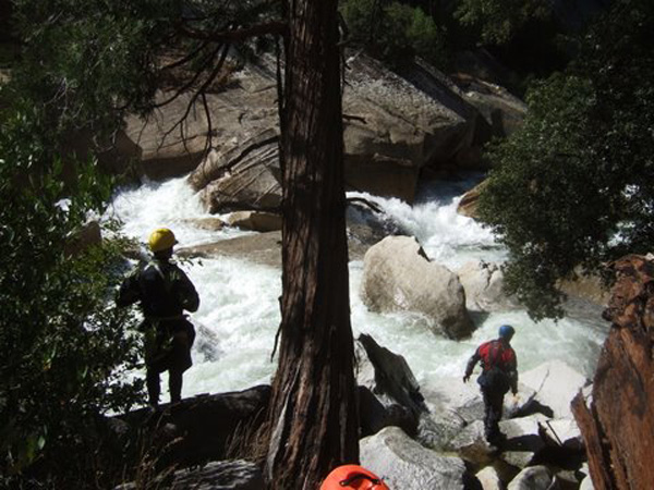
Photo: Kevin Smith
No clean lines.
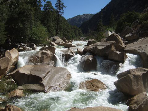
Photo: Kevin Smith
Photo: Kevin Smith
No clean lines.
Photo: Kevin Smith
As the gradient tapers off the river give us one last fun rapid that is relatively clean, and we are floating through some pleasant class II riffles; suddenly Balloon Dome comes into view. Truly a sight to behold from any angle, the granite monolith which divides the Middle and South Fork San Joaquin.
Kevin
Smith and Balloon Dome.

It seems like it should be easy run out to the Middle Fork now, but when Ben scouts the rapid below the pool, yet another gigantic sieve, locked deep in a gorge. Amazingly we have to attain back up to the beach in the above photo, and portage up and over the whole final gorge.
The South Fork San Joaquin not playing nice.
Once
on top we decide to check if it is worth rappelling in, since we are so deep into the run anyways. It isn’t…more
sieves…
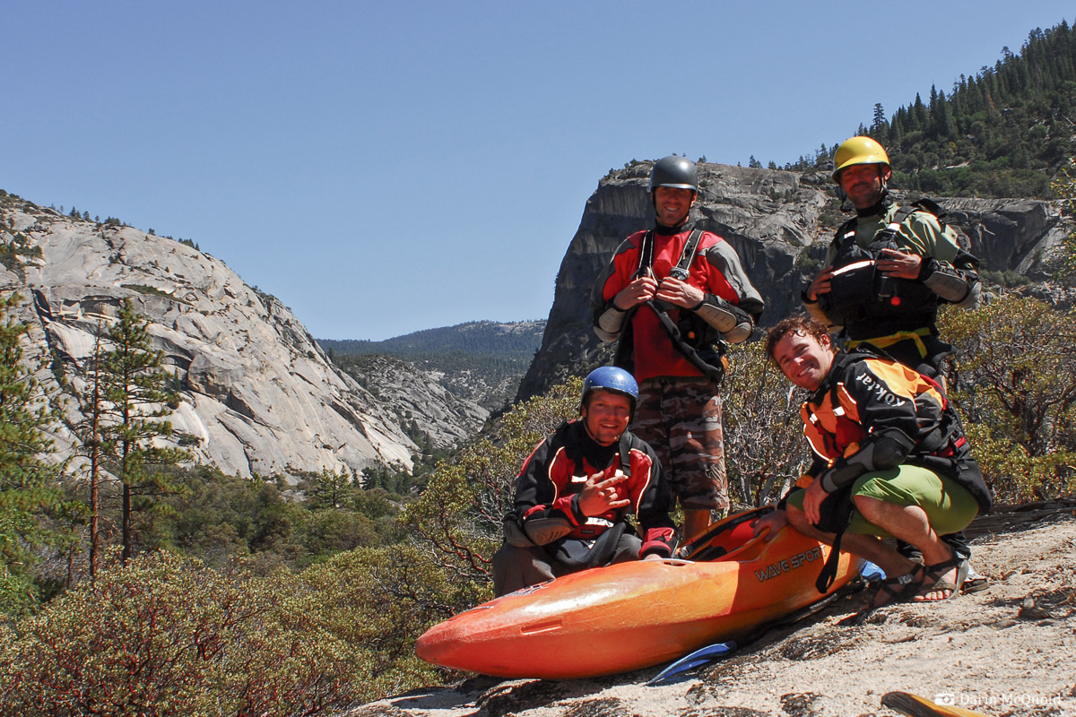
From
left to right, top to bottom,
Kevin Smith, Matt Thomas, Ben
Stookesberry and Darin McQuoid.
Below the gorge it's easy class II to the confluence, where the Middle Fork contributes only a paltry amount of the flow. Before putting on we debated if five to six hundred cfs would be enough for the Middle Fork, and to our relief it is perfect. Ben, Kevin and I had done the Middle Fork earlier in the year, so we make quick time down this section of river. It's much better at medium flows than the high flows of spring. There are still the typical big San Joaquin portages, and we feel immense relief as the lake comes into view.
In July the lake was full, yet we had to paddle all the way out due to a surprising lack of motor boaters on the lake. We figure this time it's Labor Day weekend, so we're sure to get a ride out.
When
we reach the bath tub line it is apparent the lake is really
low, and we continue to portage and paddle for at least two more miles
before finally finding the lake.

Photo: Kevin Smith
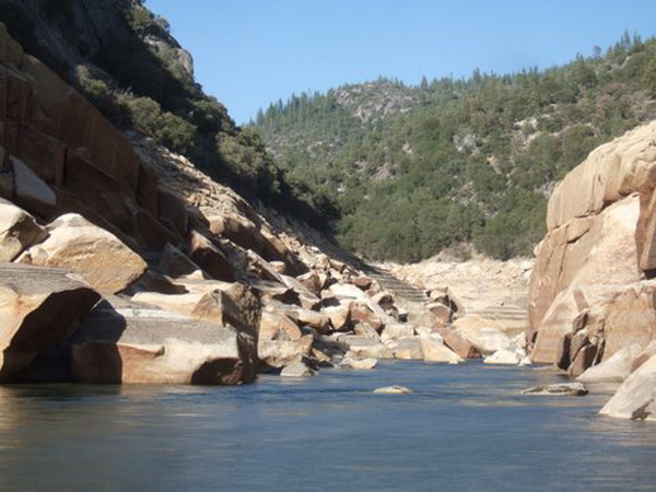
Photo: Kevin Smith
Photo: Kevin Smith
Photo: Kevin Smith
It's Labor Day, why are there no fishermen on the lake? Our mistake becomes apparent as we paddle into the boat ramp, or lack thereof. Mammoth Pool is so low that boats can’t launch.
Off the water logistics are still daunting, a four hour shuttle followed by twelve hour drive back to Mt Shasta. Truly, this one was a mission. Thanks to Kevin, Matt and Ben for rallying like true pioneers.
In retrospect 500cfs was the perfect flow. Somehow I thought the run would be 24 miles long and be possible in three days. Start to finish it was 40 miles, a bit much to cover in three days on a first descent. I’d imagine in the spring, flows would be low at the start, and way too high at the confluence, mandating a strenuous hike out. Will Southern California Edison ever willingly release water down the South Fork San Joaquin? That is highly unlikely and we can only hope a freak occurrence like this will happen again.
Thanks again to Paul Martzen for sharing flow information with the kayaking community at large, and to Kurt Sable for notifying me about the flows.