
| Darin McQuoid | Blog | Reviews | Tutorials | River Directory |
Grand
Canyon of
the Tuolumne V-V+
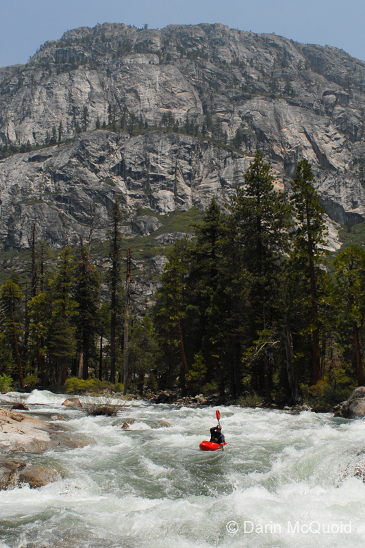
The Tuolumne River originates from two major tributaries high in Yosemite National Park. One starts on Mount Lyell at 13,114’, and the other on Mount Dana at 13,061’. When both meet in Tuolumne Meadows, the Tuolumne River begins at an approximate elevation of 8619’ near the road, making the put-in for the Grand Canyon of the Tuolumne the highest put-in of all the classic High Sierra multi-day runs.
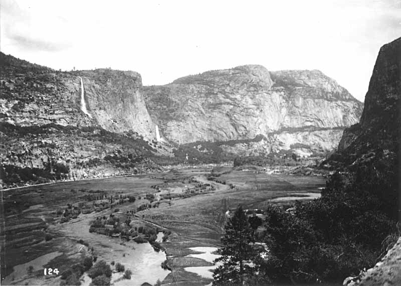
Since 1915 it has submerged a valley loved by John Muir as second only to Yosemite Valley in unique scenery, and richer in history. Because of the high water quality in the Tuolumne River, the water doesn’t need treatment before being piped to San Francisco, so there is a ban on swimming and boating in the reservoir.
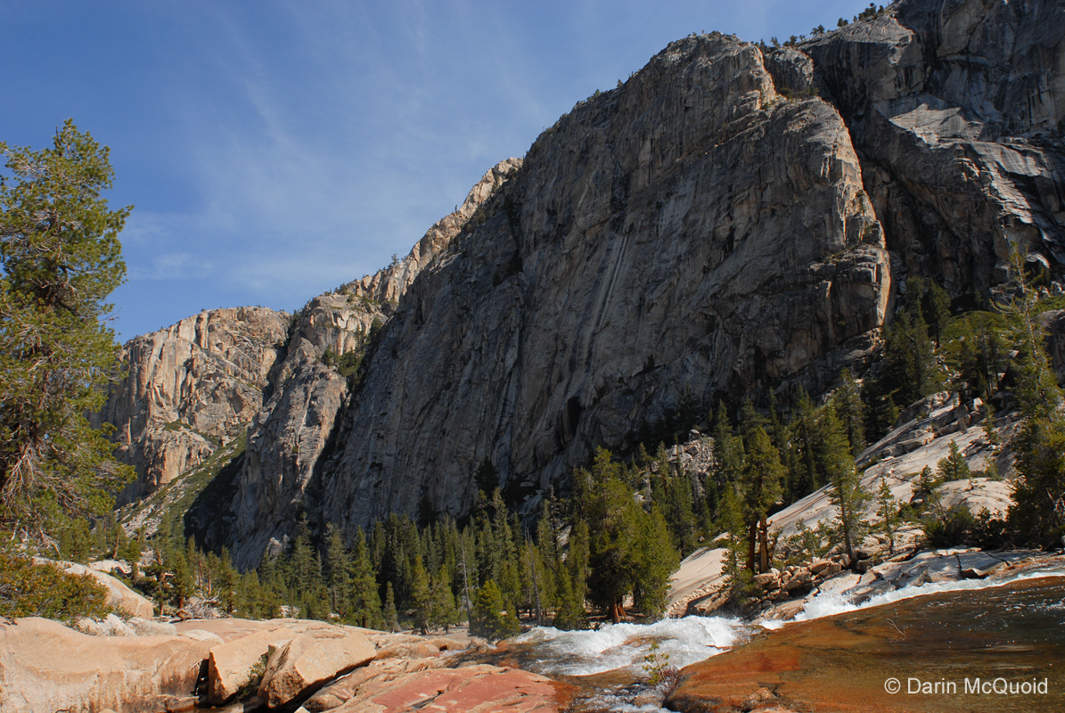
Hetch
Hetchy valley before the
reservoir.
First descended by Robbins, Montgomery, Lake, Stanley and Holbeck in 1983, the Grand Canyon of the Tuolumne quickly gained a reputation as a section of river better accessed by a backpack than kayak. “All in all we ran seven good rapids, hiked about as many miles with our boats and all swore that we would never go back. The consensus was that the guidebook is right, a backpack is the best way to see the Grand Canyon of the Tuolumne.” – Seven Rivers Expedition. Combine this reputation with questionable legality, and this section of river has not seen too many descents.
During our West Cherry trip, Ben Stookesberry inquired about the Grand Canyon of the T to veteran Dustin Knapp, who remarked that it was a run he would do again, and thought the ideal flow was around 1,200 cfs, over double what the Seven Rivers crew had.
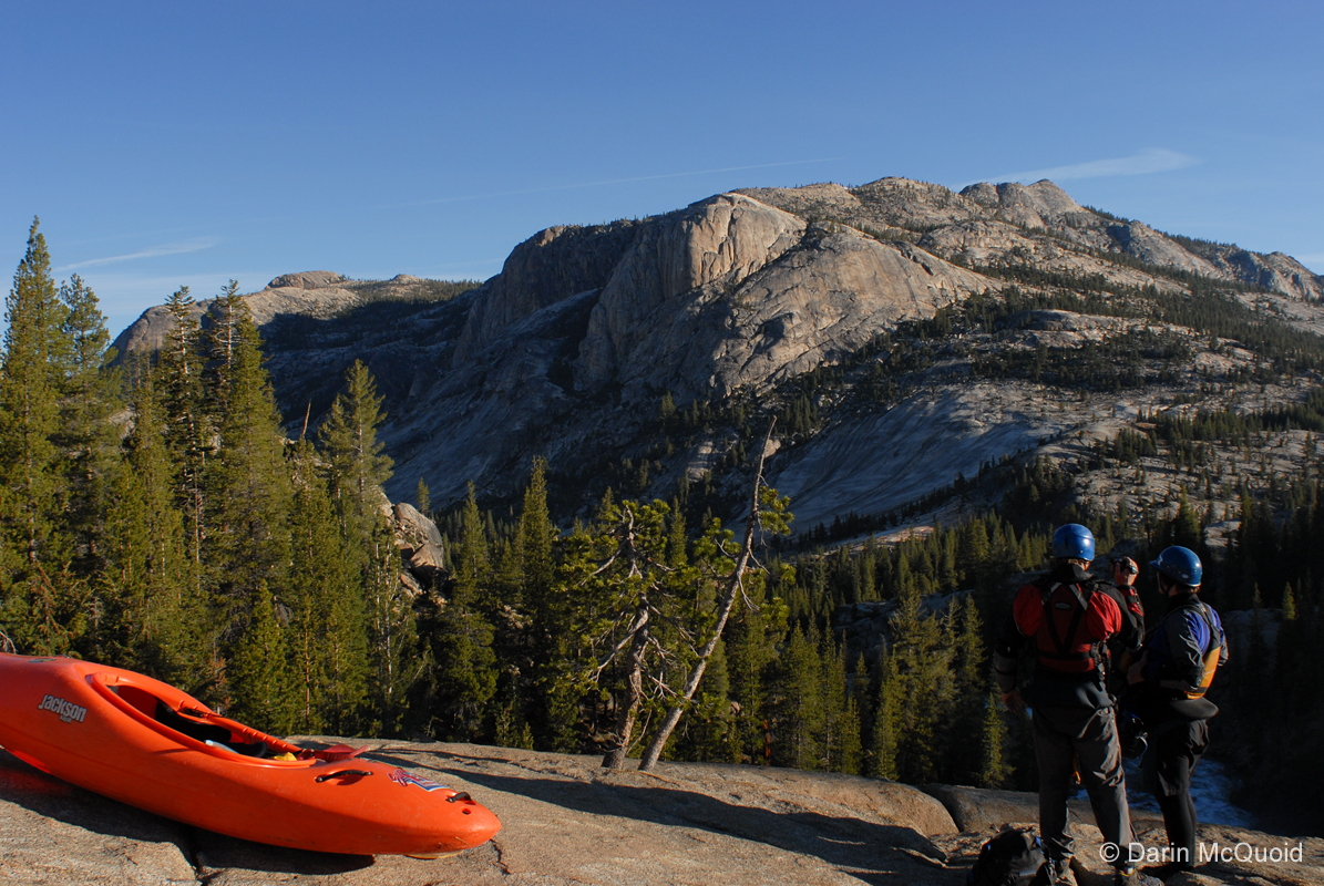
We had an incredible mix of beta on top of all this information. Reports of “clean fifty footers” and “all the best whitewater is in the first four miles” among many “don’t bother, it’s not worth it” recommendations. The best beta we received was that it was of considerable import for us to pass by Glen Aulin before eight in the morning. A run of this magnitude and logistical complexities requires far more planning than your average weekend trip, and we sorted out details the week before when not diverting ourselves with the South Fork Tuolumne. Flows were looking perfect, we had a shuttle driver set up, plenty of food and full moon. With many things lining up, people still backed out, dropping the our group to a small team, fellow paddlers Ben Stookesberry, Chris Korbulic and myself were the only ones still willing to risk it. Most groups put on at four or five in the morning to escape notice.
It was apparent that we had plenty of water, perhaps more than plenty, and in two hours we had floated down at least four miles to the first major slide, and opted to camp rather than try to deal with rapids in the dark. While still in our boats we were surprised to find ourselves wishing for pogies, and once out of the water it became even more plain how cold it was, however due to the cold weather and good gear we were relieved to find all our base layers dry, and quickly slipped into our summer sleeping bags and curled up for a few hours of sleep.
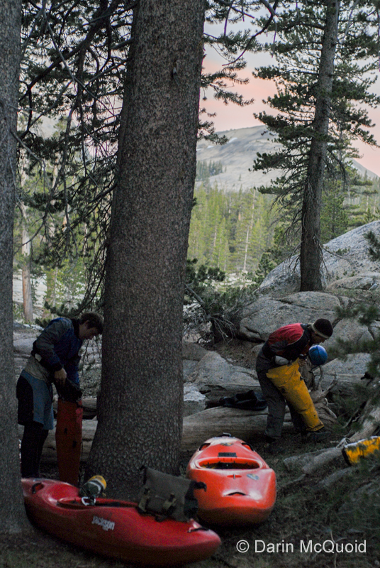
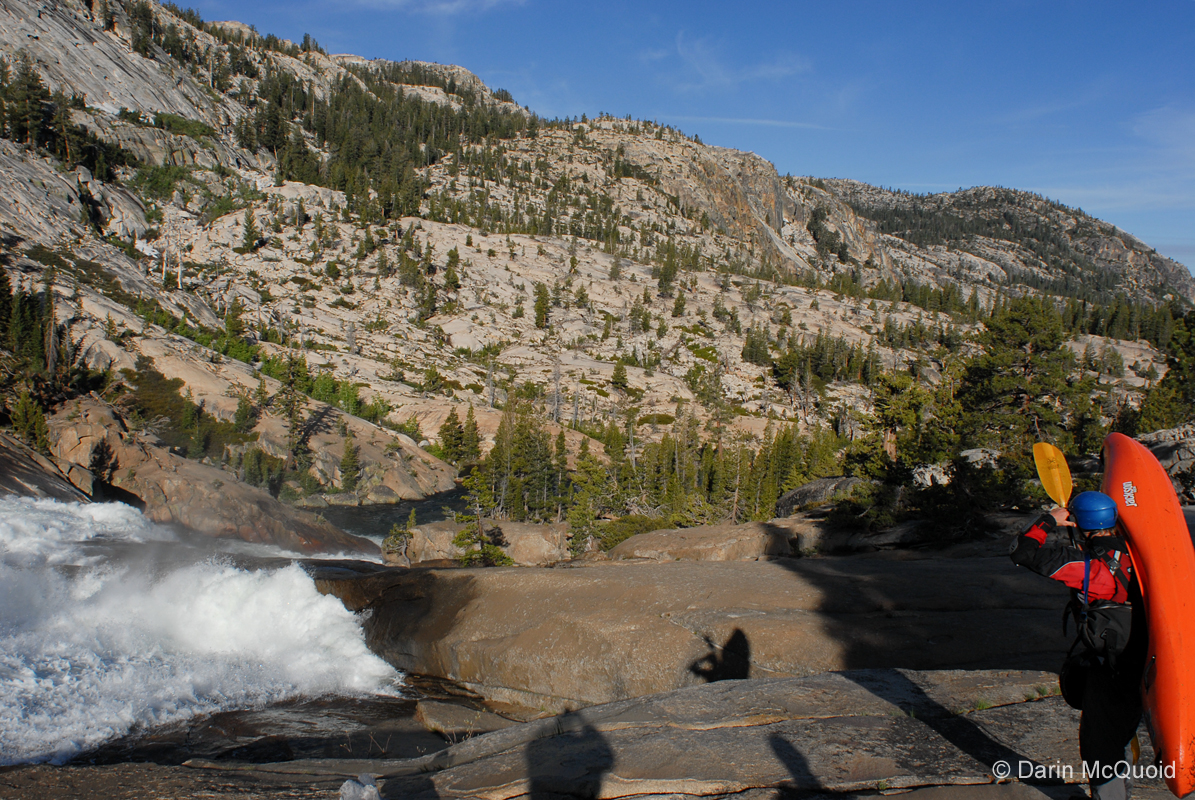
A
cold, early morning start for Ben and Chris on
our first true day of the GC of the T.
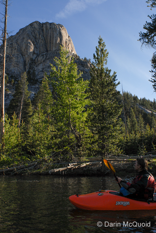
I awoke at first light, gazed over at Chris and Ben and strongly desired to return to slumbering. Any other run and I gladly would have, even with a long day ahead, but motivated to escape possible confrontation and fines, we knew an early start was necessary, so we all geared up after only two hours of sleep and portaged the first rapid because it simply looked too cold for this time of day. Cruising through the meadow after the rapid, frosted grass confirmed our suspicions about temperatures.
“It’s
way too early and
cold to deal with margarine
on my paddle”
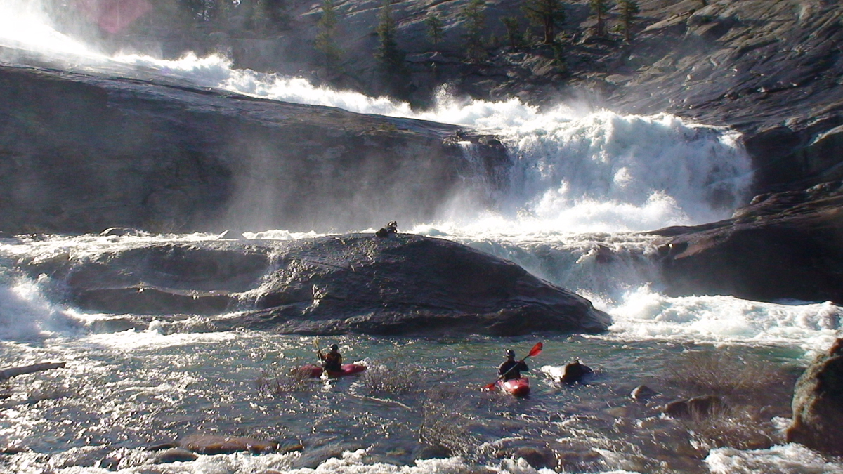
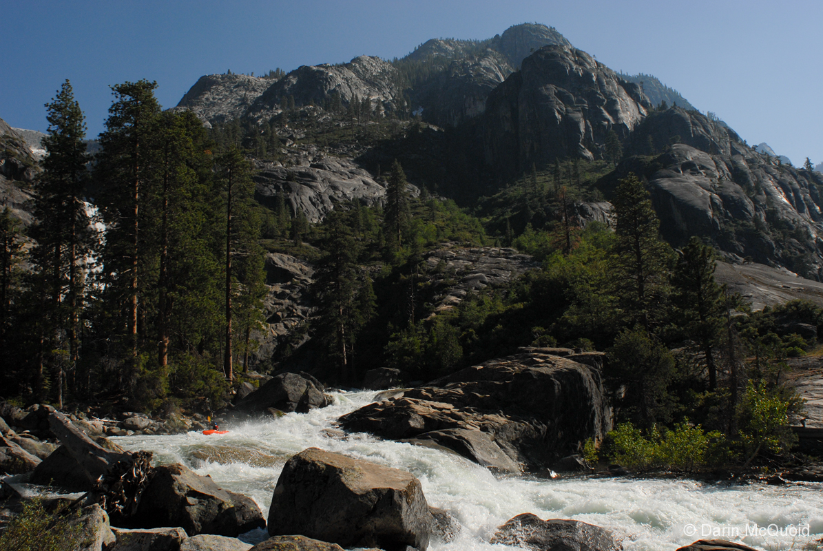
The sun had still not risen when we approached the first of a series of wide, long, low angled slides. Motivated simply by desire to make time Ben would give them a quick scout and route us through while he took some quick video and stills.
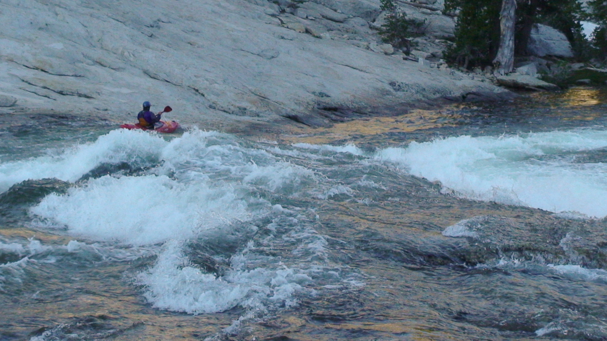
The
slides were all long and fun, but
we were pretty focused on
avoiding any large holes and staying warm. Chris Korbulic in a wake up
slide.
Four or five slides into it, and feeling good about the river, we came to the first large cataract, Tuolumne Falls. One quick look at the size of both the horizon line and rocks in the landing had us take a few quick scenery shots and portaging on the left.
Ben
Stookesberry and Chris Korbulic
enjoying the view and sharing
feelings at Tuolumne Falls.
Tuolumne Falls.
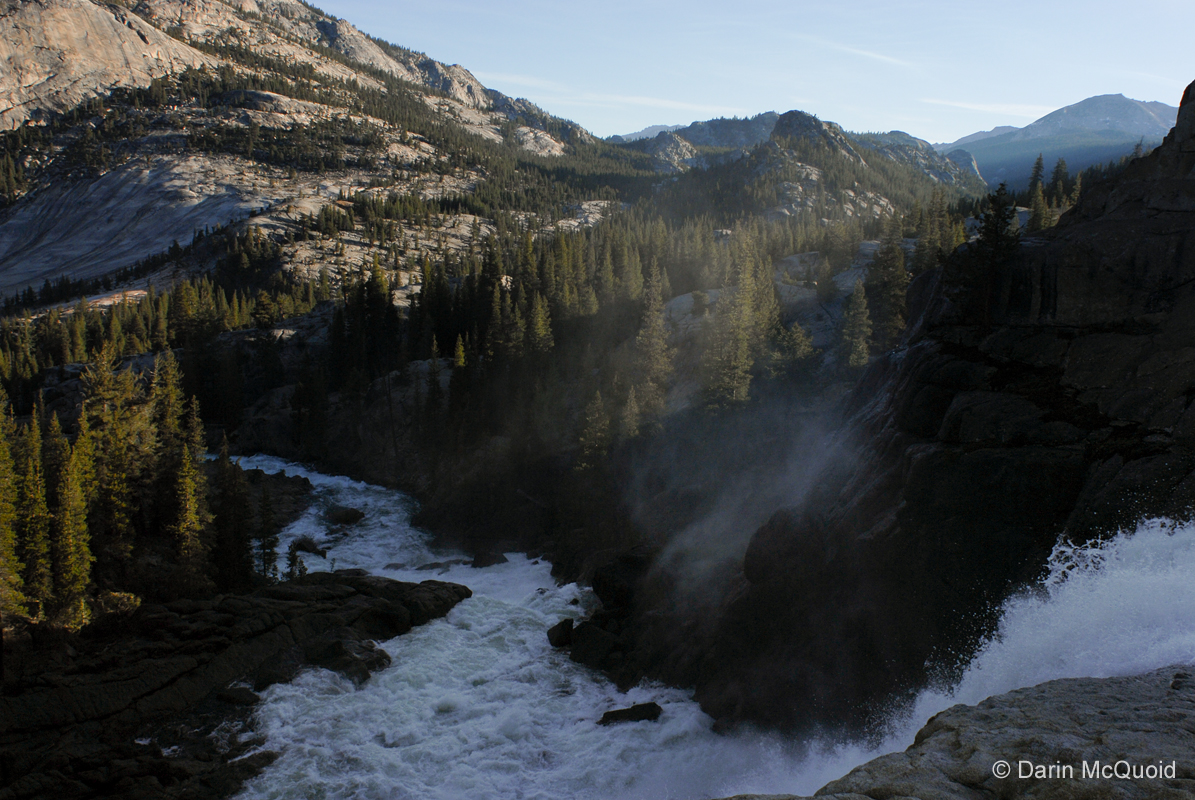
Tuolumne Falls.
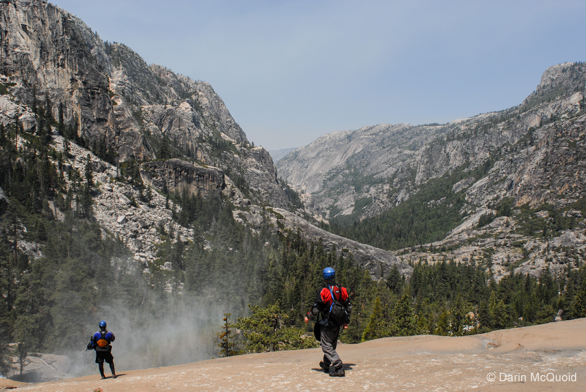
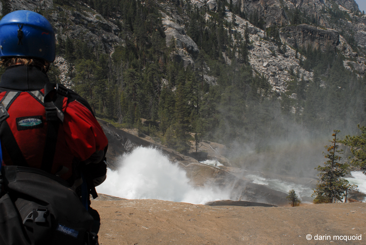
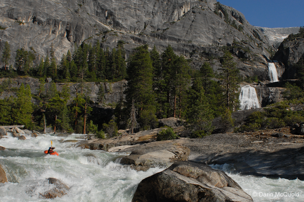
Tuolumne Falls led into a few more class IV drops until, as the map and our knowledge predicted, we were at the brink of White Cascade and just above Glen Aulin. Our internet scouting had made White Cascade look like one of the possibly navigable drops based off this less than tenable source. Upon arrival, the combination of the sheer size of the falls and lack of time to properly scout had already ruled it out, let alone the impossible shallow landing.
Enjoying
the scenery.
During our portage we nearly ran into an occupied campsite, and quickly worked our way around trying to make as little noise as possible. We knew we were right above Glen Aulin and wanted to avoid all people. We only got on the river for a short amount of time before paddling up to the bridge at Glen Aulin, happy to note it was only seven in the morning. Wanting to move past as quickly as possible we didn’t give the Glen Aulin slide any kind of a look before making another quick portage down the left, happy to be past the Ranger station and awed by more superb meadow scenery.
Ben
Stookesberry in the Glen Aulin
meadow.
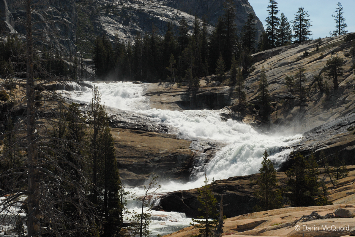
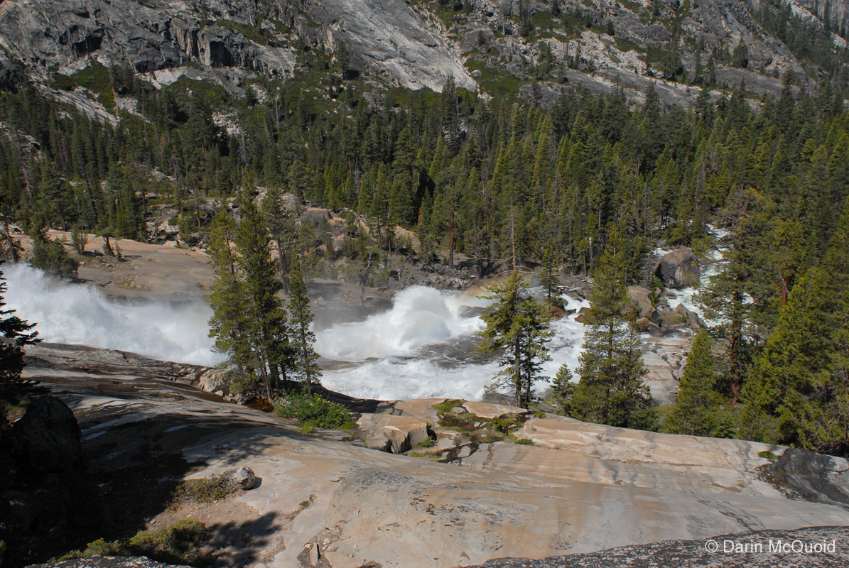
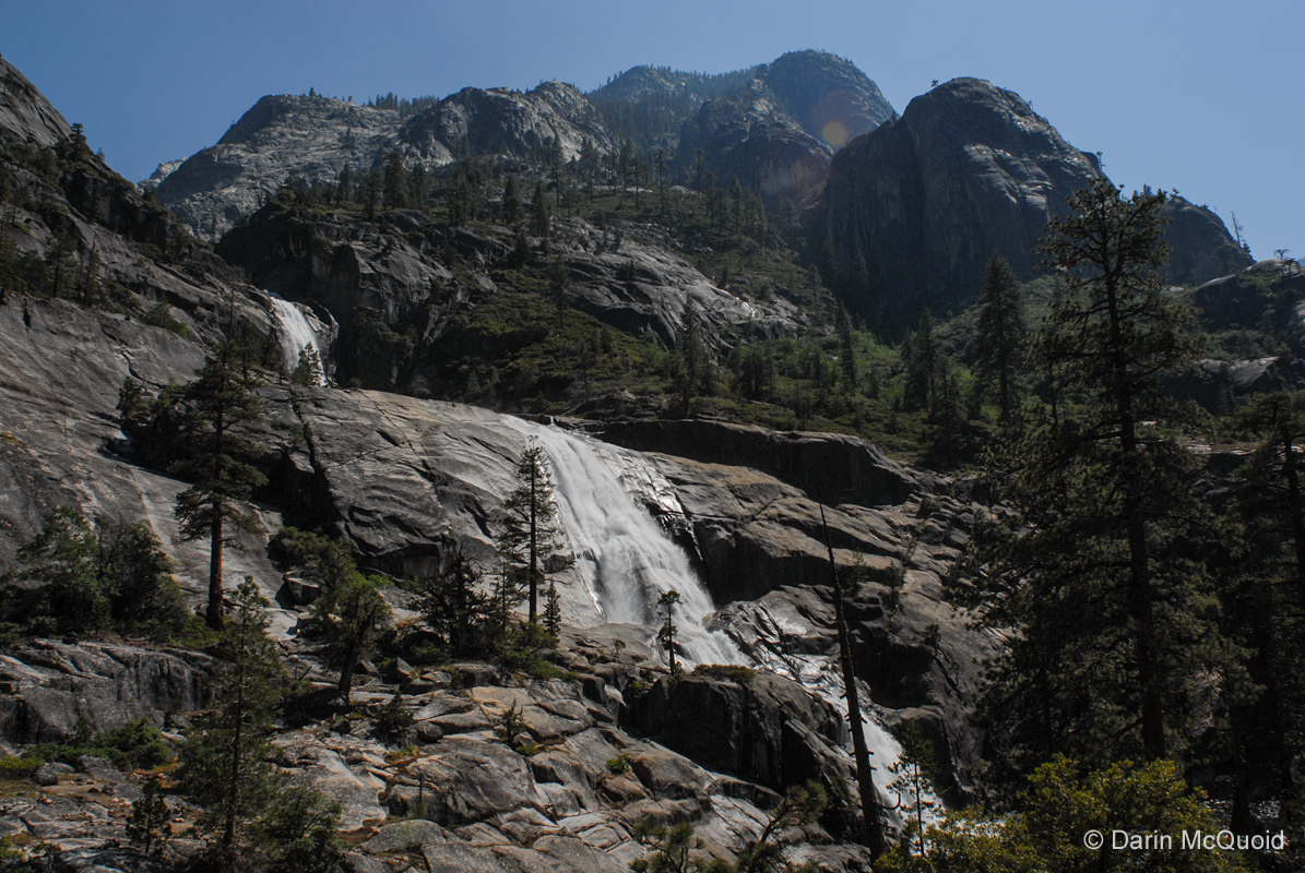
It’s common knowledge that below Glen Aulin are several large “waterfalls” on the Tuolumne River, although they are actually gigantic slides. The first of these is California Falls, another that we assumed might be possible via the ever dubious internet scout. Coming through the meadow in tight knit formation, the impressive horizon line had us scouting in no time, and portaging almost as quickly.
Ben
Stookesberry taking in California
Falls.
All of the large slides and falls in the Grand Canyon of the Tuolumne are larger than pictures would lead you to believe. The size of the Grand Canyon is so impressive that the drops don’t appear so big, but they all lose a minimum of one hundred feet, and most considerably more. Granite slabs made portaging easy, and at the bottom of California Falls we ferried to the left side of the river where we could put our boats out of view and enjoy some much needed breakfast and sleep.
Chris
Korbulic and the author ferry
across below California Falls.
California falls as viewed from near our breakfast camp.
California falls as viewed from near our breakfast camp.
Downstream
views are equally
impressive.
While digesting we walked down to check the slide shown above, and found another large slide that contained a sketchy pothole and gigantic hole at the bottom, so after our nap we made another quick portage. Once again we drifted through fantastic meadow scenery, only too soon to be at another large horizon line where Chris saw someone fishing.
Chris signaled us into an eddy on the left where we were out of view, and once assembled in the eddy we discussed our options. We still wanted to avoid any contact with people, but the trail and fisherman were on river right, and from where we were the left side looked like an undesirable portage. Facing that fact that we would run into at least a few people, we paddled down and started a friendly conversation with two hikers. Both were quite friendly and we talked about the hike and scenery, wished them a good day with a parting word to please not mention us to anyone they saw, and they were kind enough to share that an hour or two ago they had passed two rangers heading down river.
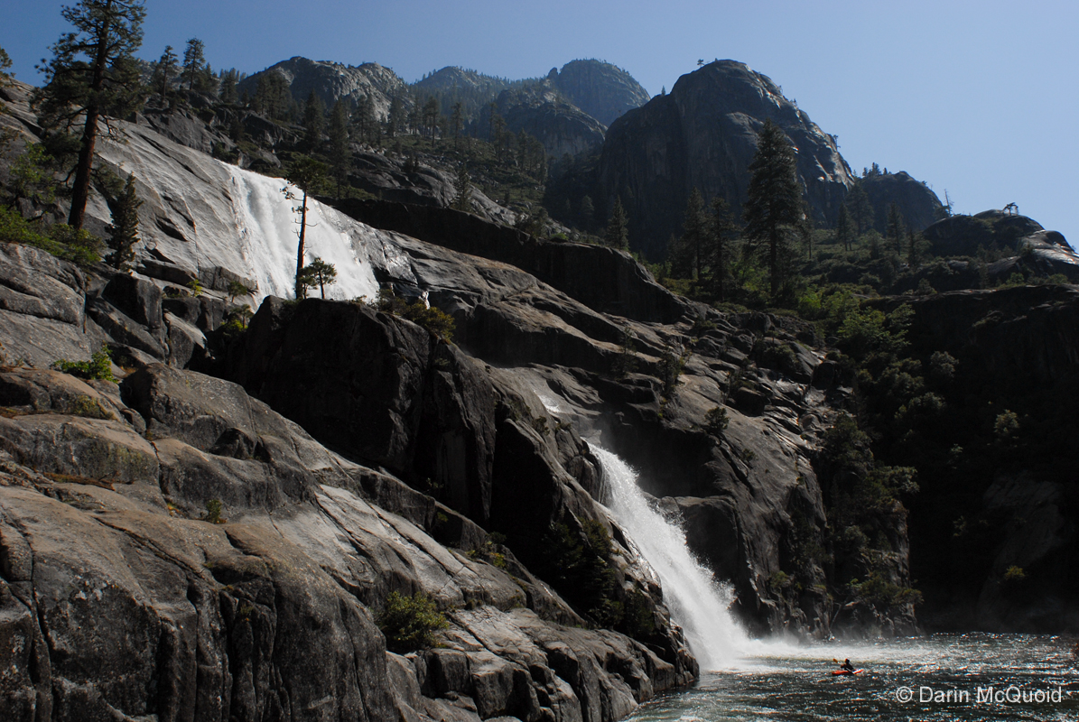
Le Conte Falls.
Taking this into consideration we portaged around
what we
knew to be Le
Conte Falls, one of the most unique slides I have ever seen. Both Le
Conte and Waterwheel Falls feature the phenomenon known as
“water wheeling” where on impact the water deflects
so hard that with any breeze it is blown back up to the pool above the
falls. These rooster tails have to be seen to be believed, this one at
Le Conte was thirty to forty feet high.
The
largest rooster tail I have ever
seen.
We used the trail to portage, put in at a gorgeous camp site located in a meadow between Le Conte and Waterwheel, and soon enough were at the equally impressive Waterwheel Falls.
Ben
Stookesberry and Chris Korbulic
with Waterwheel Falls in good form.
Looking
over Ben Stookesberry’s
shoulder into Waterwheel
Falls, it also falls into a thin crack and makes two ninety degree
turns, very unusual.
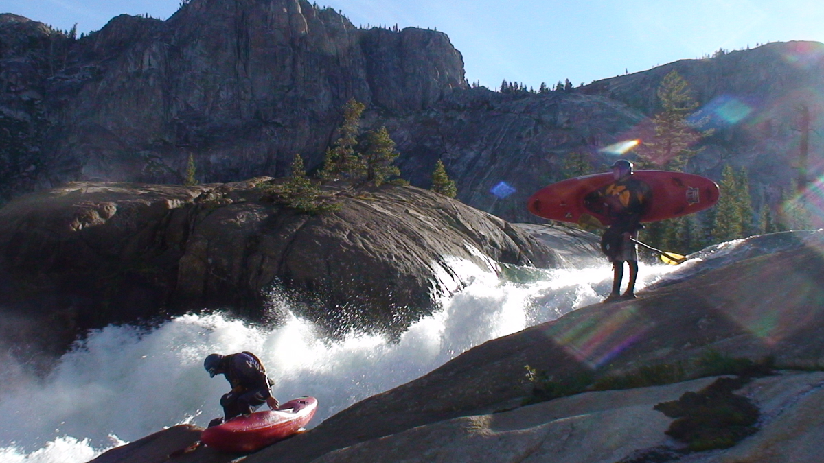
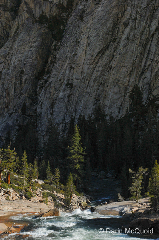
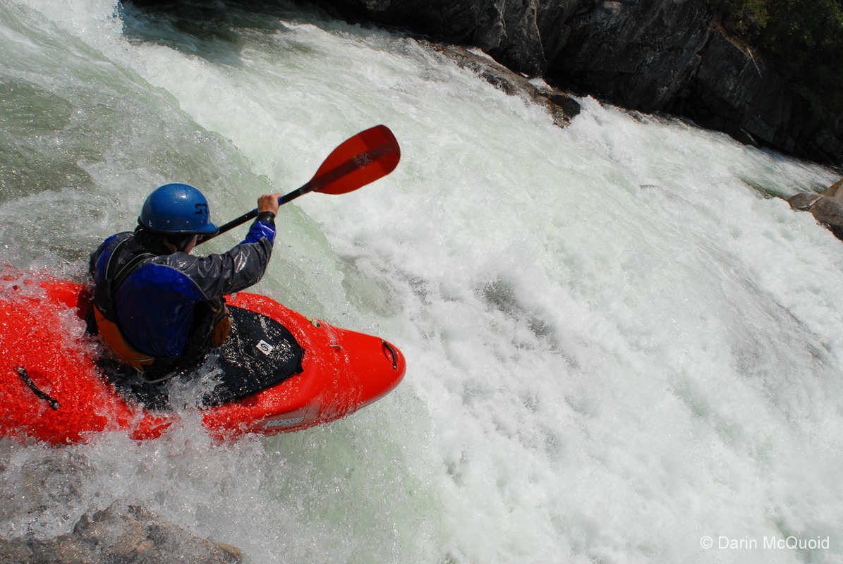
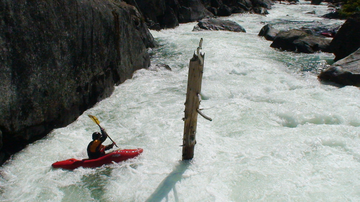
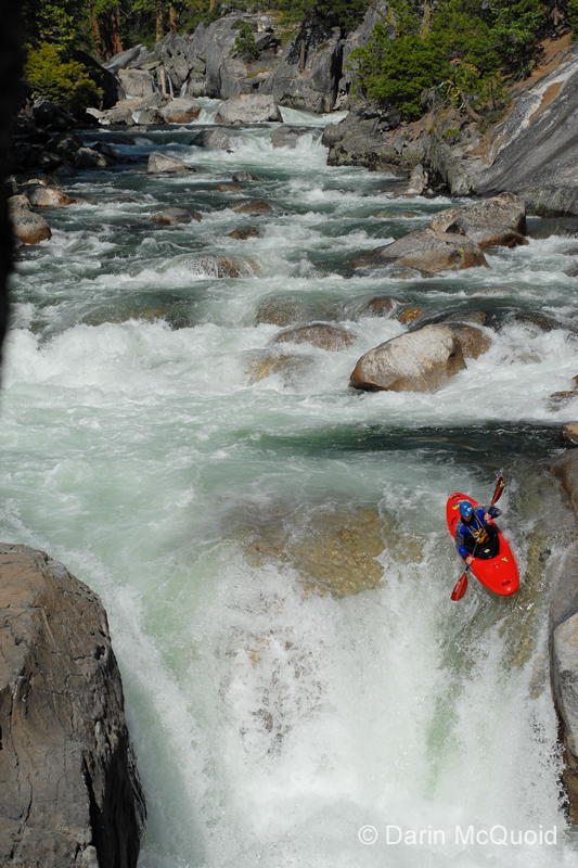
High gradient continued on for half a mile below Waterwheel Falls, until the confluence of Return Creek, where we were able to put back on and run one larger boulder garden into our first true class V of the trip, a series of sticky ledge drops. We were surprised by the continuous nature of the Tuolumne, and after some short boogie water were at another quick scout, and checking the time deemed it appropriate for a lunch break. Taking time to relax in the sun and soak up the scenery, we knew we had been making good time and the river looked manageable below, so we took one more quick nap to make up for the nights lack of sleep.
All along we had hoped to push to the top of Muir Gorge on the first day, and although we had already put in a lot of work, we still had a long ways to go, so we didn’t nap too long, and refreshed by sleep and food we slid back into the riverbed and started making our way downstream through some fantastic rapids.
Chris
Korbulic on the lead in to a
larger drop.
Chris
Korbulic boofing one of many
holes.
Chris surfing the final hole in the rapid.
Chris surfing the final hole in the rapid.
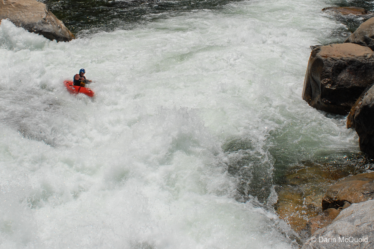
Only too soon the read and run starting getting marginal, our aggressive boat scouting with the occasional scout was now too dicey, between the sieves rearing up and increased gradient.
Ben
Stookesberry running one more
rapid.
Optimistic that we would be in the river again soon, we started portaging at river level, but after a hundred yards it was apparent that portaging over the large rocks was dangerous due to heavy leaf cover on top of loose rock, and the gradient was steep for a considerable amount of river, so we had to risk it and hit the convenient yet painfully obvious trail.
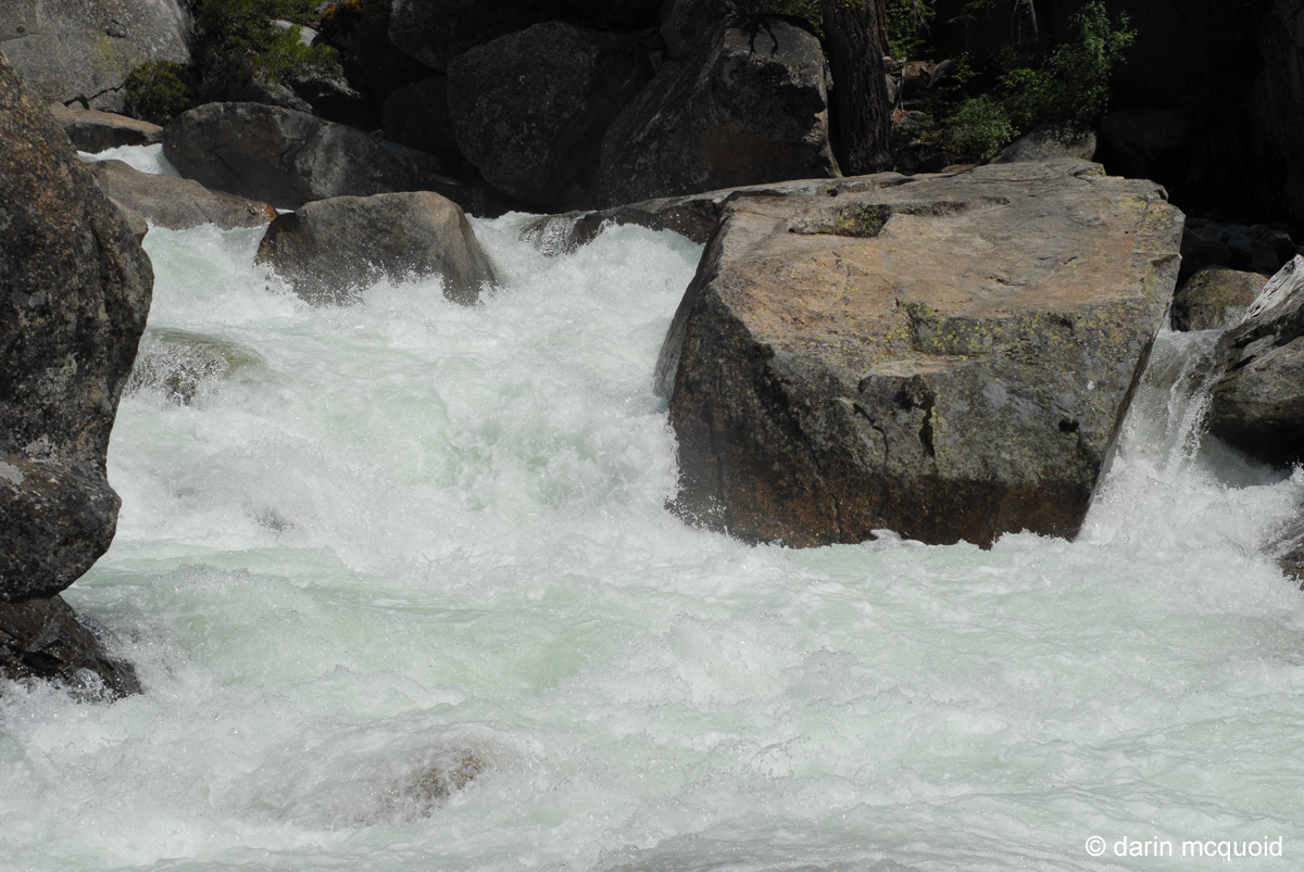
A view of what we portaged, one half mile long sieve strewn affair with plenty of big holes, which at lower flows is supposed to be manky and occasionally underground, so we weren’t missing anything here.
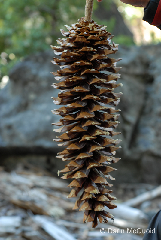
Perhaps
the realized perfection of a
Sugar Pine Cone.
Ben Stookesberry and Chris Korbulic speculate on our location and how much longer before we should drop back down to river level.
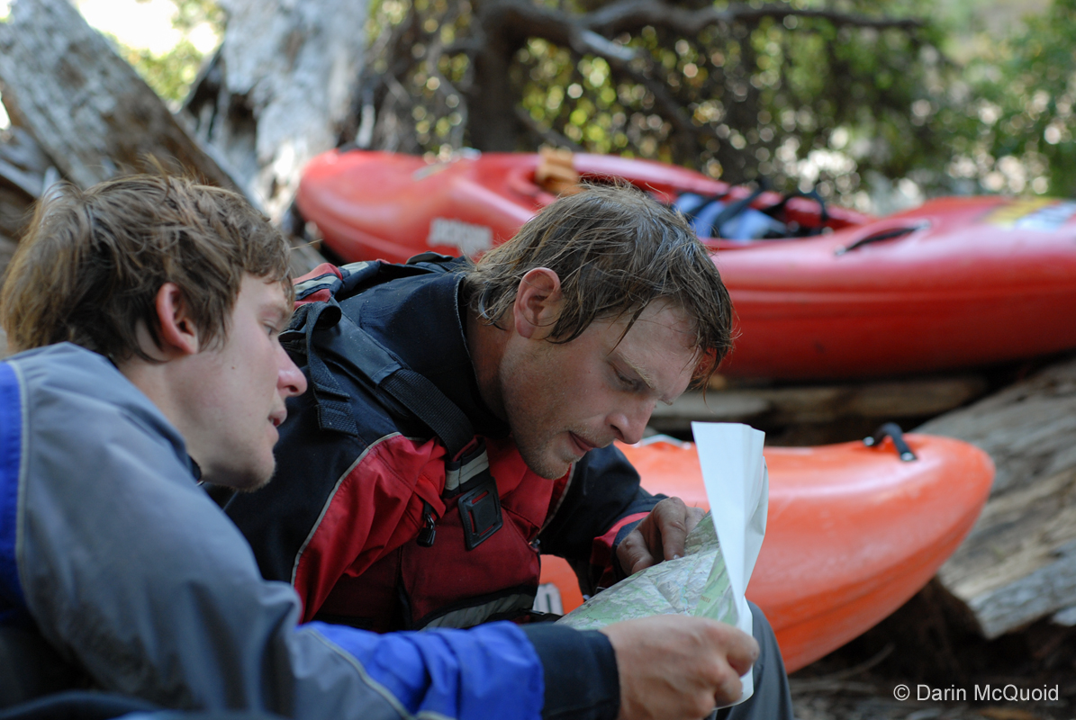
Ben Stookesberry and Chris Korbulic speculate on our location and how much longer before we should drop back down to river level.
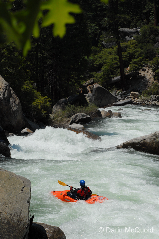
Hot and tired from the hike we chose to return to the river a little too early, and ended up running and portaging a few marginal rapids.
The
author somewhere in the marginal
mix of rapids.
To our gratitude the river eased up after a
handful of
marginal rapids,
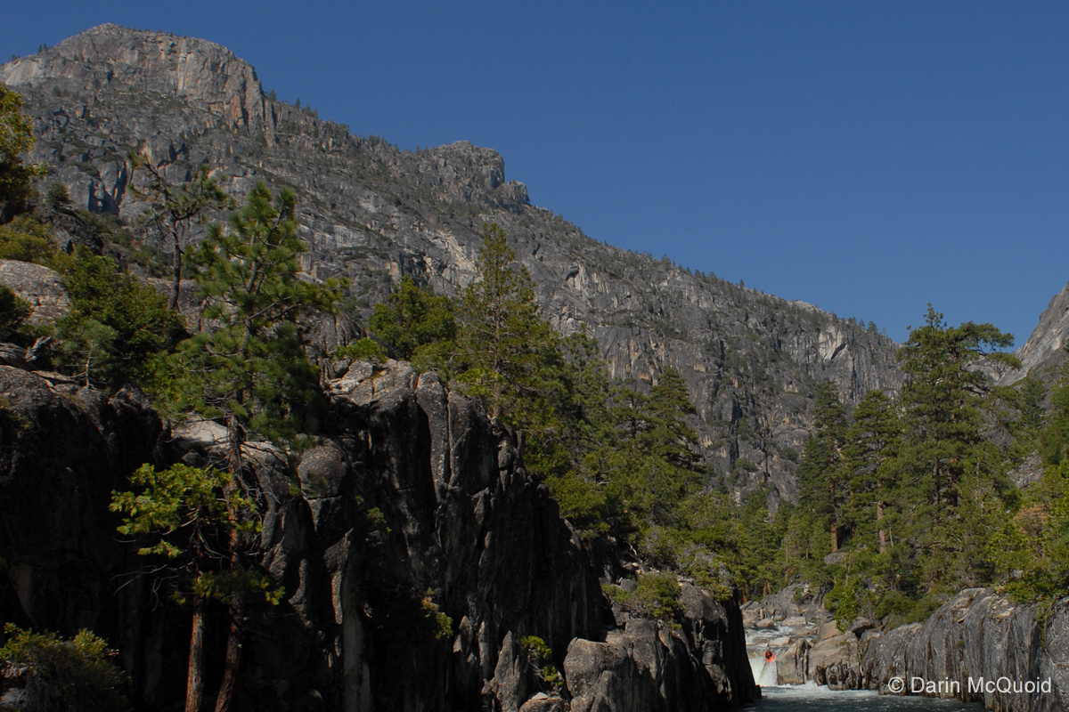
and we ran more high quality class IV down to an extended scout. Location confirmed.
One long rapid and small, but high volume waterfall led to the confluence with Cathedral Creek, one of the most beautiful tributaries I have had the pleasure to watch fall into any river. Exhausted, we considered camping across from Cathedral Creek, but our desire to finish the day with a few good rapids joined with our initial goal of Muir Gorge had us opt to push through a little further.
Chris
Korbulic running the beautiful
tributary waterfall.
Ben on the same.
Ben on the same.
Ben
Stookesberry at the base of
Cathedral Creek, this just shows the
bottom two of four large waterfalls on Cathedral Creek.
The confluence marks the start of one of the largest rapids we ran on the trip. Starting off with a boulder garden that would be IV+ on its own, and class V on many rivers, the water then enters directly into a long hole-studded slide, before turning ninety degrees into a large boulder garden. The key moves would be staying upright while making a strong right to left squeeze between a large lateral wave-hole backed up by an undercut rock, moving to the left channel on the slide, only to move back to an eddy on the right at the bottom. I think at any less flow and the river would have gone underground at the boulder garden, as even at high flows it was apparent that underwater sieves were abundant.
I planned to run the entrance and slide, exiting on the left of the large hole at the bottom of the slide, but not so far left as to get blown down the boulder garden. It was apparent the boulder garden went, and was simply a rapid that would have to be dealt with as there was no perfect line through the convoluted mess. Entering the top boulder garden I quickly realized that the whole thing was a lot larger and more powerful than it had looked like from shore. The top section was very fast, and thankfully I had no problems with the top over head height lateral wave-hole. With time to collect my thoughts in the brief slack water above the slide, I started trying to gain momentum back to the right so that when I punched the bottom hole of the slide I would resurface moving towards the eddy. The second I hit the slide I was again taken aback by just how strong the current was, as my attempt to drive more to the right availed me of nothing, I straightened out for a small rooster tail at the bottom and skipped through the hole, now with no other option I dropped into the boulder garden, which was filled with large but thankfully soft holes that let me through to scramble out on river right and give a thumbs up, and get ready for Ben to come through.
Ben
Stookesberry, below the Cathedral
Creek slide and entering the
boulder garden.
With Cathedral Creek in the background, Ben finishes up the run out to the large rapid, under half of the gradient/rapid is pictured here.
With Cathedral Creek in the background, Ben finishes up the run out to the large rapid, under half of the gradient/rapid is pictured here.
To our relief we entered a short meadow below the Cathedral Creek rapid, meandered through its beauty, and at the bottom a small rapid led into what we could see was serious drop in elevation, a turn of the corner and a serious gorge. We were assuaged when we realized that this was the infamous Muir Gorge and that our long first day was over. Not willing to take the risk of pushing downstream to find a suitable campsite, we backtracked several hundred yards to safety on an island in the middle of the river, made a quick dinner and were already asleep long before the sun was down. We were all glad to have made it so far and planned to expend our extra time fully scouting Muir Gorge the next morning.